Motorway 8 (Switzerland)
| Autobahn 8 in Switzerland | |||||||||||||||||||||||||||||||||||||||||||||||||||||||||||||||||||||||||||||||||||||||||||||||||||||||||||||||||||||||||||||||||||||||||||||||||||||||||||||||||||||||||||||||||||||||||||||||||||||||||||||

|
|||||||||||||||||||||||||||||||||||||||||||||||||||||||||||||||||||||||||||||||||||||||||||||||||||||||||||||||||||||||||||||||||||||||||||||||||||||||||||||||||||||||||||||||||||||||||||||||||||||||||||||
| map | |||||||||||||||||||||||||||||||||||||||||||||||||||||||||||||||||||||||||||||||||||||||||||||||||||||||||||||||||||||||||||||||||||||||||||||||||||||||||||||||||||||||||||||||||||||||||||||||||||||||||||||
| Basic data | |||||||||||||||||||||||||||||||||||||||||||||||||||||||||||||||||||||||||||||||||||||||||||||||||||||||||||||||||||||||||||||||||||||||||||||||||||||||||||||||||||||||||||||||||||||||||||||||||||||||||||||
| Operator: | Federal Roads Office | ||||||||||||||||||||||||||||||||||||||||||||||||||||||||||||||||||||||||||||||||||||||||||||||||||||||||||||||||||||||||||||||||||||||||||||||||||||||||||||||||||||||||||||||||||||||||||||||||||||||||||||
| Start of the street: |
Spiez ( 46 ° 42 ′ N , 7 ° 39 ′ E ) |
||||||||||||||||||||||||||||||||||||||||||||||||||||||||||||||||||||||||||||||||||||||||||||||||||||||||||||||||||||||||||||||||||||||||||||||||||||||||||||||||||||||||||||||||||||||||||||||||||||||||||||
| End of the road: |
Hergiswil NW ( 46 ° 59 ′ N , 8 ° 18 ′ E ) |
||||||||||||||||||||||||||||||||||||||||||||||||||||||||||||||||||||||||||||||||||||||||||||||||||||||||||||||||||||||||||||||||||||||||||||||||||||||||||||||||||||||||||||||||||||||||||||||||||||||||||||
| Overall length: | approx. 94 km | ||||||||||||||||||||||||||||||||||||||||||||||||||||||||||||||||||||||||||||||||||||||||||||||||||||||||||||||||||||||||||||||||||||||||||||||||||||||||||||||||||||||||||||||||||||||||||||||||||||||||||||
|
Canton : |
|||||||||||||||||||||||||||||||||||||||||||||||||||||||||||||||||||||||||||||||||||||||||||||||||||||||||||||||||||||||||||||||||||||||||||||||||||||||||||||||||||||||||||||||||||||||||||||||||||||||||||||
|
Course of the road
|
|||||||||||||||||||||||||||||||||||||||||||||||||||||||||||||||||||||||||||||||||||||||||||||||||||||||||||||||||||||||||||||||||||||||||||||||||||||||||||||||||||||||||||||||||||||||||||||||||||||||||||||
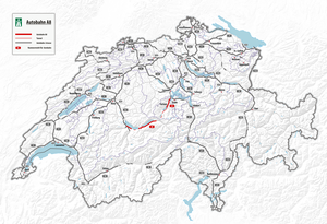
The Swiss autostrasse 8 and autobahn 8 is an important cross-connection between the Bernese Oberland and central Switzerland , which has been developed as a car route over long distances ; it is part of the national road 8. It is the lifeline for the canton of Obwalden and allows industrial companies to settle in this region, which through the A8 have quick connections to the major economic centers in the Central Plateau and the north-south transit axis A2 . In terms of tourism, it opens up the large ski areas in the Bernese Oberland and the Meiringen-Hasliberg and Interlaken tourist regions in the opposite direction .
situation
The A8 starts at the Lattigen junction near Spiez . Then it leads, partly as a highway, partly as a highway, partly interrupted as a main road 6 and 11 to the Lake Thun along to Interlaken, past the Jungfrau Park and on the southern shore of Lake Brienz to Brienz . From there to Giswil the road is interrupted, with the exception of the 3.5 km long Lungern bypass tunnel : On the winding pass road up to the Brünig Pass and with further curves on the north side of the pass and down the Lungerersee towards Giswil, the road is the main road 4 described. The Giswil bypass tunnel , from where the road is continuous again, relieves the town of through traffic and saves travelers from having to cross the Brünig Railway . After crossing the 400 m long Zollhaus tunnel , you then come to the portal of the Sachseln bypass tunnel . This runs under Sachseln and, with its length of over five kilometers, is the sixth longest road tunnel in Switzerland . After the tunnel you are on the outskirts of Sarnen , where the road has been expanded to four lanes for a few kilometers. Via the straight road that was formerly used as a military makeshift airfield (including a bridge) you reach Alpnach , while the Pilatus rises straight ahead . Along the Alpnachersee it goes to the Loppertunnel , at the end of which the A8 joins the A2 .
traffic
The A8 is the only east-west connection in a wide area and is therefore very busy. Except in the Interlaken area, where it has four lanes, it is a car road, and on the Brünig Pass it is a main road . The 2.1 km long Kaiserstuhl tunnel , which will bypass the hamlet of Kaiserstuhl and avoid the tight curves in the north of the village on the slope of the Kaiserstuhl, is currently in the planning stage . Construction is scheduled to run from 2019 to 2032.
According to the Federal Roads Office FEDRO, a peak tunnel under the Brünig Pass, which was planned at times, is not justifiable for economic reasons until around 2050.
Important engineering structures
Lungern bypass tunnel - Giswil bypass tunnel - Zollhaus tunnel - Sachseln bypass tunnel - Lopper tunnel
Military use
Autostrasse 8 was one of the Swiss national roads with military importance . It was intended as an emergency landing site for military aircraft south of Alpnach. For safety reasons, however, only take-offs were carried out, in the 1970s with Hunter fighter aircraft and in the 1980s with Tiger F-5E ; the landings were made on the normal runway.
Web links
- National road A8 , website of the canton of Obwalden
- Bernese Oberland tunnel safety and renewal of the A8
- Photo series A8 on Autobahnen.ch
Individual evidence
- ↑ Lungern North - Giswil South with the Kaiserstuhl tunnel , accessed on July 26, 2018
- ↑ Obwalden: Green light for the Kaiserstuhl tunnel. In: Obwaldner Zeitung, July 26, 2018
- ↑ Brünigtunnel safely off the table for 30 years In: Luzerner Zeitung of February 17, 2017
- ↑ Uno Zero Zero - A Century of the Swiss Air Force. Aeropublications, Teufen / ZH 2013, ISBN 978-3-9524239-0-5 , p. 230

