
Berger back
| Berger back | ||
|---|---|---|
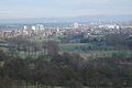
 Fields and orchards on the Berger ridge |
||
| height | 212.6 m above sea level NHN | |
| location | Hesse | |
| Dominance | 11.45 km → Köhlerberg | |
| Notch height | 100 m ↓ Niddatal near Harheim | |
| Coordinates | 50 ° 9 '35 " N , 8 ° 44' 18" E | |
|
||
| Type | Ridges | |
| rock | Marl , silt | |
| Age of the rock | Pleistocene | |
| particularities | Highest elevation in the urban area of Frankfurt am Main | |

The Berger Ridge is a geological formation in the northeast of Frankfurt am Main between the valleys of the Main and Nidder / Nidda . It connects the Frankfurt districts of Berkersheim , Seckbach and Bergen and extends in the east to Maintal - Bischofsheim . Parts of the Berger Ridge belong to the Frankfurt Green Belt Landscape Protection Area and the Quellenwanderweg in the Frankfurt Green Belt .
The southern slope of the Berger Ridge east of Bergen is known as the Berger Hang . It is one of the Frankfurt nature reserves ; The Lohrberger Hang is the only remaining vineyard in the Frankfurt city area. The Heiligenstock, characterized by orchards and fertile loess areas , extends on the flatter northern slope . The Berger Warte stands on the highest point of the Berger Ridge .
Location and history
Along with its eastern extension, the High Street , the Berger back is the 81.14 km² large natural spatial unit 234.4 Bergener back (High Street) , the main unit for Wetterau belongs.
The Berger Ridge was created during the Pleistocene , when the Main dug itself into several river terraces in calcareous layers from the Tertiary period and formed a steeply sloping slope to the south . To the southwest, the Berger Ridge falls over the 185 meter high Lohrberg and the Huthpark to the Friedberger Warte and ends in the Bornheimer Hang and the Röderberg . Relics from this time form the Enkheimer Ried , the Riederbruch and the Seckbacher Ried at the foot of the Berger Ridge.
In what is now downtown Frankfurt, the Main created a breakthrough that separated the foothills of the Berger Ridge from the Sachsenhausen mountain . The limestone barrier in the river bed formed a ford that could be passed by carts , which gave the settlement built here its name and importance as a traffic junction in the early Middle Ages.
To the north, the Berger Ridge slopes gently towards the valleys of the Nidder and Nidda. In the east it passes over into the Ronneburg hill country at Bruchköbel . The geological subsurface of massive limestone was created in the Oligocene when the area was part of an estuary. The soils on the south slope consist of medium-sized rendzines and parabroun earths , on the north slope towards the Wetterau fertile loess soils predominate . In some places there is basalt in the subsoil, which comes from the Vogelsberg volcanism of the Miocene . Occasionally small tertiary brown coal seams can be found underground, for example near Seckbach and Roßdorf , which were temporarily exploited in the 19th century.
The highest elevation of the Berger Ridge is the waiting field at the early modern watch tower Berger Warte on Seckbacher district at 212.6 m above sea level. NHN . A little further to the northeast is the Gisisberg at 202 meters above sea level, the second highest point on the Berger Ridge.
Monuments, a Roman sanctuary, a Roman estate, Roman roads, a giant Jupiter column near Seckbach and the Anthracotherium seckbachense , a primeval hoofed animal the size of a hippopotamus , have been excavated on the mountain ridge .
Berger waiting
|
FFH area Berger Warte
|
|
 Berger Warte at the highest point of the Berger Ridge |
|
| surface | 29.81 hectares |
| Identifier | 5818-302 |
| WDPA ID | 555521137 |
| Natura 2000 ID | DE5818302 |
| particularities | Orchard meadow complex with extensive grasslands and extensive grassland |
The listed Berger Warte stands at the highest point of the Berger Ridge, the Wartfeld , in the Seckbach district . The round, approximately 12 meter high watchtower was built in the middle of the 16th century from red Main sandstone . The field name Am Galgen is reminiscent of the former high court , which was located north of the control room from 1484 to 1835. Today, this is the entrance to the Tennet TSO's Frankfurt-Nord substation , which supplies large parts of Frankfurt with electricity. The Bergen II Jewish Cemetery, laid out in 1925, is located near the control room .
North slope
Since 2004, part of the site northeast of the Berger Warte has been registered as a fauna and flora habitat (FFH). It extends along the northern slope of the Berger Ridge on the city limits to Bad Vilbel to the north and covers 29.81 hectares.
On the northern slope of the Berger Ridge there are numerous rough meadows and orchards. The fertile loess soils are used for agriculture . Because of the many small parcels, there are many hedges and hardly any public roads. In spring it smells intensely of wild garlic ( Allium ursinum ). In some places terraces with old vines have been preserved. Wine was grown here on a large scale until the 20th century. Chaffinch ( Fringilla coelebs ), Corn Bunting ( Emberiza calandra ), cuckoo ( Cuculus canorus ), Little Owl ( Athene noctua ), Nightingale ( Luscinia megarhynchos ), red-backed shrike ( Lanius collurio ) and numerous species of insects are found here.
The 1.5 hectare Baumlohhohl on the Berger ridge is one of the natural monuments in Frankfurt . The field trees with oak ( Quercus ), spruce ( Picea ), hornbeam ( Carpinus betulus ), willow ( Salix ), elderberry ( Sambucus ), sloe ( Prunus spinosa ), birch ( Betula ) and hazel ( Corylus ) came along from an earlier ravine Hedges on both sides. It offers wild animals , birds and small mammals a protected shelter.
Berger slope
|
FFH area Am Berger Hang
|
|
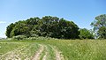
 Orchard meadow on the Berger slope |
|
| surface | 10.79 hectares |
| Identifier | 5818-301 |
| WDPA ID | 555521136 |
| Natura 2000 ID | DE5818301 |
The steep southern slope of the Berger Ridge, the Berger Hang , has been a 10 hectare nature reserve since 1954 and has been designated as an FFH area on the Berger Hang since 2000 . It extends to the city limits of Bischofsheim. Flowers rich fat meadows with rare strictly protected plants such as the Military Orchid ( Orchis militaris ), a sea of primroses ( Primula ) and old fruit trees have adapted to it and coming together to largest contiguous orchards area of Hesse . In between there are meadows with orchid species ( Orchidaceae ), for example Handelwurzen ( Gymnadenia ), which come into their own in summer.
The Untermain ornithological observation station of the Federal Environment and Nature Conservation Germany (BUND) is located on the site .
Many springs arise on the Berger ridge, the spring hiking trail in Frankfurt's green belt connects them. Its formation can be traced back to a layered structure of gravel , sand and clays from deposits left by oxbow lakes of the Main . The Enkheimer Mühlbach has dug a 5 to 8 meter deep valley into the southern slope of the Berger Ridge, which is particularly steep here. The 3.28 hectare Mühlbachtal, which has been designated as a nature reserve since 1968 , contains the giant horsetail ( Equisetum telmateia ), a relic of a former stream floodplain forest . It is the only occurrence in the entire Rhine-Main area . Wine was grown on the slopes of the Mühlbachtal in the 18th and 19th centuries, after which there was a switch to fruit.
Lohrberg and Lohrpark

The Lohrberg, 185 m above sea level, above Seckbach, drops steeply to the south and south-west. Because of its view over large parts of the city, it is considered the local mountain of Frankfurt. The Frankfurt horticultural director Max Bromme laid out Lohrpark here from 1924 . Part of this 18 hectare Volkspark is the only Frankfurt vineyard on the Lohrberger slope . The 1.3 hectare vineyard , planted exclusively with Riesling, is part of the Rheingau wine-growing region .
Heiligenstock

The area north of Friedberger Landstrasse is named Heiligenstock after a small medieval wayside shrine next to the Altes Zollhaus inn on Landstrasse. At 182 m above sea level, the Heiligenstock is the third highest point in Frankfurt. The landscape is characterized by grasslands and old orchards with old pear, apple, cherry and mirabelle trees. The Heiligenstock transmitter was located here from 1924 to 1967 , and the German news agency operated the DENA transmitter further north . Remnants of the old concrete foundations are still visible in the nature reserve.
In the early 1990s, the city of Frankfurt laid out the Heiligenstock Park Cemetery here . Opposite is the larch meadow, a completely unusual sight in Frankfurt. The larches ( Larix ), actually native to the Alps , turn their needles golden yellow in autumn before shedding them, unlike other conifer species.
Around 1960, at about the same time as the construction of the north-west town , considerations began to build the residential town of Heiligenstock , a satellite town for 75,000 inhabitants on the Heiligenstock between Seckbach, Preungesheim, Bad Vilbel and Berkersheim . Planning began in 1965/66 and lasted about 10 years. In 1971 the city presented a planning study; the construction costs were estimated at 5 billion DM. Concerns about land use and the impact on the urban climate, but also economic considerations, delayed planning. From 1974 only partial construction measures were examined. In 1986 the city issued the development plan 446 Seckbach-Nord with the aim of opening up the entire area between Huthpark, Friedberger Landstrasse and Lohrberg for residential development. In 1991 the city council decided to include the entire area in the Frankfurt green belt, but it was not until 2016 that a new development plan 812 Seckbach-Nord green belt park was passed. Existing agricultural areas and leisure gardens are to be integrated into the green belt park.
Attractions

The Lohrberg offers an unobstructed panoramic view of the Main valley and the city of Frankfurt. The goals of a walk or a hike can, for example, be the Lohrberger Hang vineyard (1924), the Lohrbergschänke garden restaurant (1933) with integrated Lohrhaus (1763), the ÄppelBistro of the MainÄppelHaus or the water play pool in the children's recreation garden (1929) on the Lohrberg, the historical Berger Warte (1340/1557) with the neighboring Leopold Column (1790) and the adjoining scene of the Battle of Bergen , the Berger Hang nature reserve, the Mühlbachtal nature reserve, the Seckbacher Ried and Enkheimer Ried nature reserves , the Huthpark or the area at Heiligenstock.
Some bicycle and hiking trails in the Frankfurt Green Belt lead over the Berger Ridge. In addition to the Quellenwanderweg, the Berger ridge is also accessed through the Vulkan-Steig (Vater-Bender-Weg) of the Vogelsberger Höhen-Club . The Vulkan-Steig is marked by path markings, which consist of a rectangle that is horizontally divided into a red top and white bottom. Organized hikes over the Berger ridge were carried out by the Palatinate Forest Association and the hiking department of the Seckbach gymnastics club in 1875 .
Transport links
The Friedberger Landstrasse runs over the Berger Ridge between the Friedberger Warte and Bad Vilbel as part of the Bundesstrasse 521 . At the city limits, the B 521 branches off to the south onto Vilbeler Landstrasse . South of Berger Warte, the B 521 branches off to the east and runs north around Bergen to the intersection with Erlenseer Straße on the eastern edge of Bergen. From here the B 521 runs in the direction of Niederdorfelden , where it leaves the Berger ridge and reaches the Niddertal.
The Berger Ridge can be explored on foot or by bike from various points, for example from Seckbach over the Lohrberg , from Bergen and Bad Vilbel over the Vilbeler Landstrasse . With each variant, there are sometimes considerable inclines to overcome. The RMV bus line 551, Berger Warte stop , serves as a feeder for local public transport . From there, access is relatively at ground level. Further options are the RMV bus line 43 to the Budge-Heim / Lohrberg stop or the 30 or 69 bus lines to the Heiligenstock / Lohrberg stop .
gallery
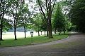
Huthpark as the westernmost point of the Berger Ridge
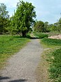
The donkey path on the Heiligenstock site

Spring blossom on the Lohrberg

Panoramaweg in Lohrpark on the Lohrberg
View from Friedberger Landstrasse to Lohrberg
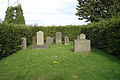
Bergen II old Jewish cemetery

View from the Berger slope to the Enkheimer Ried
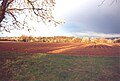
View from Berger Hang to Maintal - Bischofsheim

Bird protection tree Baumlohhohl
Bird protection tree at the Berger Warte


literature
- Urban waters. Rivers, streams, oxbow lakes. Published by the Environment Agency Frankfurt am Main.
- Folker Rochelmeyer: Seckbach and its surroundings. Frankfurter Sparkasse from 1822 - Polytechnische Gesellschaft (Ed.), 1972.
- Folker Rochelmayer (chronicle): Festschrift 1100 years Seckbach, 880-1980. Festival committee 1100 years of Seckbach e. V. (Ed.), 1980.
- Martin Heinzberger, Petra Meyer, Thomas Meyer (arr.): Development of gardens and green areas in Frankfurt am Main. (= Small writings. Volume 38). Historical Museum Frankfurt am Main (Ed.), 1988.
- The Lohrpark in Frankfurt am Main - fire protection and urban green. City of Frankfurt am Main, Garden and Cemetery Office, Department for Environment (Ed.), 1989.
- H.-J. Dechent, H. Kramer, M. Peukert, H. Redeker, A. Böffinger: Floristic observations from the city of Frankfurt am Main. In: Botany and nature conservation in Hessen. 5, 1991.
- H. Kramer, M. Peukert: Nature and nature protection. In: Tom Koenigs (Ed.): Vision of open green spaces - green belt Frankfurt. Campus Verlag, Frankfurt am Main 1991, ISBN 3-593-34515-3 .
- Walter Sauer: Seckbacher Geschichte (n), Ein Heimatbuch, Kultur- und Geschichtsverein Seckbach e. V. (Ed.), 2000.
- The Quellenwanderweg in Frankfurt's Green Belt. 2nd Edition. Green Belt Project Group, City of Frankfurt am Main, Environment Agency (Ed.), 2002.
- Roland Bolliger: Viticulture in Seckbach. Culture and History Association 1954 Frankfurt am Main.-Seckbach e. V. (Ed.), 2005.
- Rainer Vollweiter: Fresh air for the economic miracle capital. and the dawn of Frankfurt green planning in the 1950s. In: Stadt und Grün / Das Gartenamt. Vol. 50, No. 6, 2008, p. 847, ISSN 0948-9770 .
- The Green Belt Leisure Card - with the RheinMain Regional Park. 6th edition. City of Frankfurt am Main, Umweltamt, Stadtvermessungsamt (Ed.), 2007.
Web links
- Berger back on the website of the City of Frankfurt am Main, accessed on Feb. 25, 2020
- Nature conservation group Seckbach im BUND, Frankfurt am Main
- Website of the culture and history association 1954 Frankfurt am Main.-Seckbach e. V.
Individual references and sources
- ↑ a b Management plan for the FFH area Berger Hang , Darmstadt Regional Council , 2011
- ↑ a b Otto Klausing, The Natural Spaces of Hesse , Wiesbaden 1988. Available online in the HLNUG's Environmental Atlas Hessen
- ^ Berger Warte, City of Frankfurt am Main, accessed on Feb. 25, 2020
- ^ Jewish cemetery Bergen II, City of Frankfurt am Main , accessed on February 25, 2020
- ↑ Annexes to the ordinance of the Darmstadt Regional Council
- ↑ FFH area Berger Warte, City of Frankfurt am Main, accessed on February 25, 2020
- ↑ Baumlohhohl am Berger Rück, City of Frankfurt am Main, accessed on February 25, 2020
- ↑ a b Berger Hang nature reserve, City of Frankfurt am Main, accessed on Feb. 25, 2020
- ↑ Management plan for the FFH area 5818-301 “Am Berger Hang”, Darmstadt regional council, January 21, 2011
- ↑ Bernd Günther, Blossom splendor for the eye and apples for the press , Frankfurter Allgemeine Zeitung , May 4, 2006
- ^ City of Frankfurt am Main, Environment Agency (ed.): The green belt leisure map . 7th edition, 2011
- ↑ Mühlbachtal nature reserve, City of Frankfurt am Main, accessed on February 25, 2020
- ↑ Heiligenstock at par.frankfurt.de , the former website of the city of Frankfurt am Main
- ^ Frolinde Balser : From rubble to a European center: History of the city of Frankfurt am Main 1945–1989 . Ed .: Frankfurter Historical Commission (= publications of the Frankfurter Historical Commission . Volume XX ). Jan Thorbecke, Sigmaringen 1995, ISBN 3-7995-1210-1 , p. 236 .
- ↑ a b Chronicle of Berkersheim on the website of the city of Frankfurt
- ↑ Green belt park Seckbach-Nord
- ^ Lohrpark and Lohrberg, City of Frankfurt am Main, accessed on February 25, 2020
- ↑ MainÄppelHaus, City of Frankfurt am Main, accessed on February 25, 2020
- ^ Huthpark, City of Frankfurt am Main, accessed on February 25, 2020
