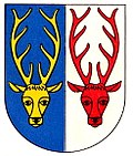
Bleiken TG
| TG is the abbreviation for the canton of Thurgau in Switzerland and is used to avoid confusion with other entries of the name Bleiken . |
| Bleiken | ||
|---|---|---|
| State : |
|
|
| Canton : |
|
|
| District : | Weinfelden | |
| Political community : | Sulgen | |
| Postal code : | 8583 | |
| former BFS no. : | 4506 | |
| Coordinates : | 732 289 / 266 288 | |
| Height : | 472 m above sea level M. | |
| Area : | 1.12 km² | |
| Residents: | 342 (1962) | |
| Population density : | 305 inhabitants per km² | |
|
Bleiken TG |
||
| map | ||
|
|
||
Bleiken is a settlement in the municipality of Sulgen in the Weinfelden district of the Swiss canton of Thurgau . From 1812 to 1963 Bleiken formed a local community of the former municipality of Sulgen.
geography
The farming village of Bleiken is located away from the traffic routes above the country road and the Sulgen – Gossau railway line . The hamlet of Befang, which also belongs to the former municipality, is on the other hand directly on the main road between Sulgen and Kradolf .
history
Bleiken was first mentioned in 869 under the name Pleichun . Most important feudal lords were from the 13th century, the Abbey of St. Gallen , the Canons Regular of St. Pelagius in Bischofszell, the House of the Brotherhood of Munster chaplains in Konstanz and the church Wil . Bleiken belonged to the Bürglen rule in 1293 . Later it formed with the so-called Helmsdorf'schen part of Buhwil and smaller localities the lower court Bleiken, which in 1608 came from Hans Heinrich von Helmsdorf to Junker Lorenz Kunkler of St. Gallen and in 1647 to the city of St. Gallen and thus again to the rule Bürglen where it remained until 1798. The single farm Befang belonged to the Lower Court of Oetlishausen .
Bleiken was always parish after Sulgen. From the Reformation until 1799, only the Reformed denomination was represented.
It was cultivation of corn in three Zelgen and viticulture as well as isolated in the 18th century strikes operated. In the 19th century the transition to cattle and dairy farming and fruit growing marked the agricultural structure and development. After the opening of the Sulgen – Gossau railway line in 1876, the number of embroidery companies built up until 1910 grew considerably.
On 1 January 1964, the formerly independent municipality in the local church Sulgen was integrated .
population
| Population development of the local community | ||||||||
|---|---|---|---|---|---|---|---|---|
| year | 1634 | 1640 | 1670 | 1799 | 1870 | 1900 | 1910 | 1960 |
| Residents | 41 | 22nd | 95 | 62 | 71 | 112 | 204 | 342 |
The Bleiken settlement had 41 inhabitants in 2018.
literature
- André Salathé: Bleiken. In: Historical Lexicon of Switzerland .
This article is largely based on the entry in the Historisches Lexikon der Schweiz (HLS), which, according to the HLS's usage information, is licensed under the Creative Commons - Attribution - Distribution under the same conditions 4.0 International (CC BY-SA 4.0) license .
Individual evidence
- ↑ Swiss land use statistics. Completed on July 1, 1912. Published by the Federal Statistical Bureau. ( Memento from April 12, 2016 in the Internet Archive )
- ^ André Salathé: Bleiken. In: Historical Lexicon of Switzerland .
- ↑ Population development of the municipalities. Canton of Thurgau, 1850-2000. On the website of the Statistical Office of the Canton of Thurgau (Excel table; 0.1 MB), accessed on April 28, 2020.
- ↑ List of settlements. Canton of Thurgau, edition 2019 . On the website of the Statistical Office of the Canton of Thurgau (Excel table; 0.2 MB), accessed on May 10, 2020.


