Cernay-lès-Reims
| Cernay-lès-Reims | ||
|---|---|---|

|
|
|
| region | Grand Est | |
| Department | Marne | |
| Arrondissement | Reims | |
| Canton | Reims-8 | |
| Community association | Grand Reims | |
| Coordinates | 49 ° 16 ′ N , 4 ° 6 ′ E | |
| height | 96-217 m | |
| surface | 16.49 km 2 | |
| Residents | 1,426 (January 1, 2017) | |
| Population density | 86 inhabitants / km 2 | |
| Post Code | 51420 | |
| INSEE code | 51105 | |
| Website | http://www.cernay-les-reims.fr/ | |
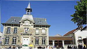
 Town hall (Mairie) of Cernay-lès-Reims |
||
Cernay-lès-Reims is a French commune with 1,426 inhabitants (as of January 1, 2017) in the Marne department in the Grand Est region (before 2016: Champagne-Ardenne ). The municipality belongs to the arrondissement of Reims and the canton of Reims-8 (until 2015: canton sein-Nauroy ). The inhabitants are called Sarnaisiens .
geography
Cernay-lès-Reims is about five kilometers east of the city center of Reims . Cernay-lès-Reims is surrounded by the neighboring communities of Witry-lès-Reims in the north, Berru in the east and northeast, Nogent-l'Abbesse in the east and southeast, Puisieulx in the south and southeast, Saint-Léonard in the south and Reims in the west.
The A34 autoroute runs through the municipality.
Population development
| year | 1962 | 1968 | 1975 | 1982 | 1990 | 1999 | 2006 | 2016 |
| Residents | 684 | 947 | 1002 | 1160 | 1152 | 1210 | 1307 | 1426 |
| Sources: Cassini and INSEE | ||||||||
Attractions
- Saint-Martin church from the 12th / 13th centuries Century, largely destroyed in the First World War, rebuilt in 1957
- Town hall from 1881
Parish partnership
Since 1981 there has been a partnership with the German town of Gauangelloch (part of the city of Leimen in Baden-Württemberg).

