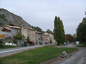
Lettret
| Lettret | ||
|---|---|---|

|
|
|
| region | Provence-Alpes-Cote d'Azur | |
| Department | Hautes-Alpes | |
| Arrondissement | Gap | |
| Canton | Tallard | |
| Community association | Gap-Tallard-Durance | |
| Coordinates | 44 ° 28 ′ N , 6 ° 4 ′ E | |
| height | 591-960 m | |
| surface | 4.2 km 2 | |
| Residents | 182 (January 1, 2017) | |
| Population density | 43 inhabitants / km 2 | |
| Post Code | 05130 | |
| INSEE code | 05074 | |
 Lettret |
||
Lettret is a French commune in the Hautes-Alpes in the region of Provence-Alpes-Cote d'Azur . It belongs to the canton of Tallard in the Gap arrondissement .
geography
The Durance flows south along the border with Tallard and Venterol . The other neighboring communities are Gap in the north, Jarjayes in the east and Châteauvieux in the west. Lettret is connected to the national trunk road network by the D942 département road. The village is at around 600 m .
Population development
| year | 1962 | 1968 | 1975 | 1982 | 1990 | 1999 | 2008 | 2012 |
|---|---|---|---|---|---|---|---|---|
| Residents | 73 | 61 | 55 | 81 | 92 | 109 | 165 | 176 |
Web links
Commons : Lettret - collection of images, videos and audio files
