
Rabou
| Rabou | ||
|---|---|---|
|
||
| region | Provence-Alpes-Cote d'Azur | |
| Department | Hautes-Alpes | |
| Arrondissement | Gap | |
| Canton | Veynes | |
| Community association | Buëch-Dévoluy | |
| Coordinates | 44 ° 36 ′ N , 6 ° 0 ′ E | |
| height | 1,020-2,280 m | |
| surface | 26.56 km 2 | |
| Residents | 79 (January 1, 2017) | |
| Population density | 3 inhabitants / km 2 | |
| Post Code | 05400 | |
| INSEE code | 05112 | |
 Rabou |
||

Rabou is a French commune in the Hautes-Alpes in the region of Provence-Alpes-Cote d'Azur . It belongs to the arrondissement of Gap and the canton of Veynes .
geography
Rabou is located in the French Alps , in the southeast of the mountain massif Massif du Dévoluy. The white water river Petit Buëch comes from the north and goes to La Roche-des-Arnauds at the lowest point of the municipality marker at 1020 m . Among the streams that it takes in are the Ruisseau de Conode and the Torrent de l'Escout. The neighboring communities are Gap in the north, east and south-east, La Roche-des-Arnauds in the south-west and west and Dévoluy in the north-west.
The municipality of Rabou was incorporated into the municipality of La Roche-des-Arnauds between January 1, 1973 and February 13, 1983.
Population development
| year | 1962 | 1968 | 1975 | 1982 | 1990 | 1999 | 2006 | 2008 | 2011 | 2013 | 2016 |
|---|---|---|---|---|---|---|---|---|---|---|---|
| Residents | 35 | 34 | 33 | 31 | 46 | 67 | 76 | 77 | 77 | 78 | 76 |

Petit Buëch mountain river
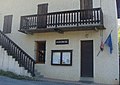
Mairie Rabou


