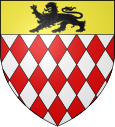
Montclus (Hautes-Alpes)
| Montclus | ||
|---|---|---|

|
|
|
| region | Provence-Alpes-Cote d'Azur | |
| Department | Hautes-Alpes | |
| Arrondissement | Gap | |
| Canton | Serres | |
| Community association | Sisteronais-Buëch | |
| Coordinates | 44 ° 25 ′ N , 5 ° 41 ′ E | |
| height | 680-1,546 m | |
| surface | 21.25 km 2 | |
| Residents | 57 (January 1, 2017) | |
| Population density | 3 inhabitants / km 2 | |
| Post Code | 05700 | |
| INSEE code | 05081 | |
 Flock of sheep on their arrival in Montclus |
||
Montclus is a French commune in the Hautes-Alpes in the region of Provence-Alpes-Cote d'Azur . It belongs to the canton of Serres in the Gap arrondissement .
geography
Montclus is located in the Maritime Alps and borders on Sigottier in the north, Serres and Méreuil in the east, Chanousse in the south, Montjay in the southwest and L'Épine in the west . The hamlet of Champ du Meunier also belongs to Montclus . On January 7, 1994, nine households were counted there.
Population development
| year | 1962 | 1968 | 1975 | 1982 | 1990 | 1999 | 2008 | 2012 |
|---|---|---|---|---|---|---|---|---|
| Residents | 72 | 47 | 40 | 46 | 45 | 48 | 50 | 57 |
Web links
Commons : Montclus - collection of images, videos and audio files

