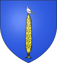
Furmeyer
| Furmeyer | ||
|---|---|---|

|
|
|
| region | Provence-Alpes-Cote d'Azur | |
| Department | Hautes-Alpes | |
| Arrondissement | Gap | |
| Canton | Veynes | |
| Community association | Buëch-Dévoluy | |
| Coordinates | 44 ° 32 ' N , 5 ° 52' E | |
| height | 817-1,653 m | |
| surface | 14.27 km 2 | |
| Residents | 163 (January 1, 2017) | |
| Population density | 11 inhabitants / km 2 | |
| Post Code | 05400 | |
| INSEE code | 05060 | |
Furmeyer is a commune with 163 inhabitants (as of January 1 2017) in the Hautes-Alpes in the region of Provence-Alpes-Cote d'Azur . It belongs to the Gap arrondissement and the Buëch-Dévoluy municipal association .
geography
Furmeyer is located in the foothills of the Alps, about 23 kilometers west of Gap . The neighboring communities of Furmeyer are Montmaur in the north and east, Châteauneuf-d'Oze in the south and Veynes in the west and northwest. The village of Furmeyer is located on a high plateau at 1019 m, the districts of Les Savoyons and Châteluce in the valley of the Petit Buëch. Among the highest elevations of the almost completely wooded area of the municipality, apart from a few clearing islands, are:
- Pic de la Fayolle du le Cuchon 1226 m
- Le Fays 1249 m
- Serre la Croix 1326 m
- Le Mias 1612 m
The highest (nameless) elevation is reached at 1653 m in the extreme southeastern tip of the municipality.
Population development
| year | 1962 | 1968 | 1975 | 1982 | 1990 | 1999 | 2006 | 2016 |
|---|---|---|---|---|---|---|---|---|
| Residents | 102 | 110 | 110 | 125 | 140 | 154 | 148 | 153 |
| Sources: Cassini and INSEE | ||||||||
Attractions
- Village church of Saint-Grégoire-le-Thaumaturge
- Chapel in the Les Savoyons district
Economy and Infrastructure
There are seven farms in the community of Furmeyer (grain cultivation, orchards, sheep and goat farming).
The D 94 / D 944 trunk road from Gap to Nyons runs through the municipality of Furmeyer . Starting from Furmeyer, the main road D 20 runs over the Col des Guérins pass to Vitrolles in the Durancetal . The nearest train station is in Veynes, three kilometers away, on the railway line to Gap.
