
Moydans
| Moydans | ||
|---|---|---|
|
||
| region | Provence-Alpes-Cote d'Azur | |
| Department | Hautes-Alpes | |
| Arrondissement | Gap | |
| Canton | Serres | |
| Community association | Sisteronais-Buëch | |
| Coordinates | 44 ° 24 ' N , 5 ° 30' E | |
| height | 633-1,494 m | |
| surface | 10.51 km 2 | |
| Residents | 44 (January 1, 2017) | |
| Population density | 4 inhabitants / km 2 | |
| Post Code | 05150 | |
| INSEE code | 05091 | |
 Mont Risou near Moydans |
||

Moydans is a French commune in the Hautes-Alpes in the region of Provence-Alpes-Cote d'Azur . It belongs to the canton of Serres in the Gap arrondissement . It is bordered by Pommerol to the northwest , Bruis to the north, Montmorin to the northeast, Ribeyret to the east, Saint-André-de-Rosans to the south and Rosans to the west .
Population development
| year | 1962 | 1968 | 1975 | 1982 | 1990 | 1999 | 2006 | 2012 |
|---|---|---|---|---|---|---|---|---|
| Residents | 59 | 70 | 75 | 63 | 58 | 53 | 48 | 61 |

Mairie Moydans
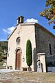
Assumption Church

Fallen memorial


Web links
Commons : Moydans - collection of images, videos and audio files