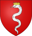
Montrond (Hautes-Alpes)
| Montrond | ||
|---|---|---|

|
|
|
| region | Provence-Alpes-Cote d'Azur | |
| Department | Hautes-Alpes | |
| Arrondissement | Gap | |
| Canton | Serres | |
| Community association | Sisteronais-Buëch | |
| Coordinates | 44 ° 23 ' N , 5 ° 44' E | |
| height | 605-822 m | |
| surface | 4.46 km 2 | |
| Residents | 74 (January 1, 2017) | |
| Population density | 17 inhabitants / km 2 | |
| Post Code | 05700 | |
| INSEE code | 05089 | |
Montrond is a French commune in the Hautes-Alpes in the region of Provence-Alpes-Cote d'Azur . It belongs to the arrondissement of Gap and the canton of Serres .
The neighboring towns are Le Bersac in the north, Saint-Genis in the east and Lagrand in the south. The latter two were merged at the beginning of 2016 to form the Commune nouvelle Garde-Colombe .
Population development
| year | 1962 | 1968 | 1975 | 1982 | 1990 | 1999 | 2008 | 2012 |
|---|---|---|---|---|---|---|---|---|
| Residents | 44 | 49 | 52 | 47 | 53 | 39 | 51 | 61 |
Web links
Commons : Montrond - collection of images, videos and audio files
