
List of natural monuments in the Darmstadt-Dieburg district
The list of natural monuments in the district of Darmstadt-Dieburg calls in the district of Darmstadt-Dieburg in Hesse located natural monuments . They are protected according to (§ 28 of the Federal Nature Conservation Act BNatschG).
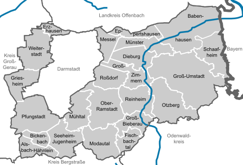
Number of natural monuments by municipality
.svg)
Natural monuments
| image | designation | District, location | description | Art | No.
|
|---|---|---|---|---|---|
.jpg)
|
Linden village square |
Harpertshausen 49 ° 55 '35.8 " N , 8 ° 54' 51.5" E |
Single tree, identified on May 27, 1959. Height 15 m, circumference 2.45 m. Planted in 1924 on the site of the former town hall with prayer room. A "peace linden tree" had already been planted here in 1919, but it died after a few years. | Summer linden tree | |
| Pyramid oak, also known as "Martin Faustmann oak" |
Harreshausen 49 ° 58 ′ 12 ″ N , 8 ° 58 ′ 58.8 ″ E |
Single tree. Already named as ND in 1953, ordinance of May 27, 1959. Height about 20 m, circumference 3.05 m. Planted on May 1st, 1934 as "Adolf Hitler Oak", later renamed after the Babenhausen forest scientist Martin Faustmann . | Column oak Quercus robur 'Fastigiata' | ||
 more pictures |
Pyramid oak "beautiful oak" |
Harreshausen 49 ° 58 ′ 40 ″ N , 8 ° 59 ′ 5 ″ E |
Famous single tree, protected since April 2nd, 1909, again by ordinance of May 27th, 1959. Column shape 'Fastigiata', the mother plant of all pyramid oaks, created by mutation. Age about 580 years, girth 4.15 m, crown shortened after several top breaks. Stands in an open field, surrounded by linden trees as a windbreak. | Column oak Quercus robur 'Fastigiata' |
|
 more pictures |
Abandoned quarry |
Eppertshausen 49 ° 56 '42 " N , 8 ° 48' 14.4" E |
Geological outcrop, wet biotope. Former trachyte quarry, now two ponds in the light mixed forest with damp to swampy bank edges. Spawning waters of common toad , common frog , mountain newt , crested newt and pond newt . Impairment through illegal use as a wild bathing lake. |
|
|
 more pictures |
Zindenauer Schlösschen |
Steinau 49 ° 44 ′ 30.1 ″ N , 8 ° 47 ′ 7 ″ E |
geological natural monument., rock group with oaks and beeches. Already mentioned as a natural monument before 1932, protected by ordinance from 1934. Ordinance of May 27, 1959. | ||

|
Rock group "Spitzer Stein" |
Nonrod 49 ° 45 ′ 19 " N , 8 ° 48 ′ 49.9" E |
former geological natural monument. Deleted November 27, 1996. | ||

|
Rock group "Rimdidim" |
Messbach 49 ° 44 ′ 19.8 " N , 8 ° 48 ′ 2" E |
former geological natural monument. Deleted November 27, 1996. |
|
|
 more pictures |
Granite rock sea of rocks "stone rubble" |
Rodau 49 ° 45 ′ 57.6 " N , 8 ° 47 ′ 27.6" E |
Geological natural monument. On the northern slope of the Altscheuer southwest of Lichtenberg , in a deciduous forest that is not managed. Sea of rocks about 400 × 100 m, streams of blocks and blocks of granite pushed one on top of the other. |
|
|

|
Hainrichsberg group of trees |
Groß-Umstadt 49 ° 51 ′ 54 ″ N , 8 ° 56 ′ 43.4 ″ E |
Former natural monument, deleted on November 27, 1996. Small forest of acacias , chestnuts , junipers and linden trees surrounded by the wine region Einzellage Am Herrnberg and the educational wine trail . Now part of the Herrnberg von Groß-Umstadt nature reserve . | - | |
 more pictures |
Gamb oak |
Semd 49 ° 53 '31.2 " N , 8 ° 54' 7.2" E |
Single tree. Natural monument since 1932. On 6 June 2019 caught fire by lightning strike, had to be felled (see article Gambseiche ). Remains a natural monument even as dead wood. |
English oak | |
 more pictures |
Sausteigeiche | Groß-Umstadt 49 ° 51 ′ 14.4 ″ N , 8 ° 59 ′ 34.8 ″ E |
Single tree. Meeting point for the Umstadt swineherd from the Middle Ages to the beginning of modern times. Estimated age: about 300 years; Largest trunk circumference: 467 cm, height: 29 m. Stands next to the former spring well set in stone. | English oak | |
 more pictures |
Steinbornshohl | Groß-Umstadt 49 ° 52 ′ 4.8 ″ N , 8 ° 56 ′ 27.6 ″ E |
Hollow road, hedges to the side. In dialect: Schdambertshoul , a loess hollow (loess erosion valley): In Roman times until the Middle Ages, part of the connection to Hohen Straße (Frankfurter Straße), a connection on the Odenwald ridge to the south. During the Second World War, tunnels were dug in the loess areas to protect them from air raids. Today only half as big, the rest filled, natural monument (nature conservation monument). |
- | |
_Naturdenkmal.jpg) more pictures |
Gypsy oaks |
Richen 49 ° 54 ′ 18 ″ N , 8 ° 55 ′ 4.8 ″ E |
Single tree. Striking older specimen on the southwestern corner of the forest directly on the L3095 state road between Richen and Altheim with a well-defined treetop . The tree stands in the south-west corner of the central area of the five-part, approx. 566 hectare landscape protection area of the LSG district of Dieburg . | English oak |
|
 more pictures |
At the brickworks of Groß -zimmer |
Groß-Zimmer 49 ° 52 ′ 22.8 ″ N , 8 ° 48 ′ 28.8 ″ E |
Former clay pit, protected by ordinance of August 7, 1991, protection grounds of character and beauty, as well as scientific grounds. Uneven terrain, overgrown with locust trees, pedunculate oaks, birches, sycamore maples, willows, hornbeams, currants. At the edge a border of bushes with hawthorn and sloes. There is a larger meadow in the center. | 432,301
|
|
 more pictures |
Lutherlinde |
Neunkirchen 49 ° 43 ′ 58.8 ″ N , 8 ° 46 ′ 26.4 ″ E |
Single tree. | Summer linden tree | |
 more pictures |
Wildfrauhausberg |
Klein-Bieberau 49 ° 45 ′ 3.6 ″ N , 8 ° 46 ′ 4.8 ″ E |
exposed granite rock groups. | ||

|
1 oak |
Neutsch 49 ° 46 ′ 15.6 ″ N , 8 ° 42 ′ 28.8 ″ E |
Single tree. | English oak | |
| 2 oaks |
Neutsch 49 ° 46 ′ 1.2 ″ N , 8 ° 42 ′ 10.8 ″ E |
Tree Group. | English oak |
|
|

|
On the Schmallert |
Nieder-Ramstadt 49 ° 49 ′ 8.4 " N , 8 ° 42 ′ 25.2" E |
Bird protection wood. | ||

|
Bill stones |
Waschenbach 49 ° 47 '45.6 " N , 8 ° 42' 3.6" E |
geological natural monument (Gabbrofelswand). | ||

|
Summit of the Glockert |
Waschenbach 49 ° 48 '32.4 " N , 8 ° 42' 57.6" E |
Bird and forest protection trees. | ||
 more pictures |
Magnetic stones |
Nieder-Beerbach 49 ° 47 '13.2 " N , 8 ° 40' 4.8" E |
geological natural monument. |
|
|
| Steinbuckel Old basalt quarry | Ober-Ramstadt 49 ° 50 ′ 45.6 " N , 8 ° 42 ′ 43.2" E |
geological outcrop of unique quality. | |||
| Walmersberg |
Rohrbach 49 ° 48 '14.4 " N , 8 ° 45' 7.2" E |
Bird protection wood. |
|
||

|
Abandoned columnar basalt quarry |
Hering 49 ° 49 ′ 12 " N , 8 ° 54 ′ 46.8" E |
geological outcrop of a particular peculiarity. | ||
 more pictures |
Eichgraben near Zipfen |
Lengfeld -Zipfen 49 ° 50 '13.2 " N , 8 ° 55' 8.4" O |
Former quarry. Protection for scientific and historical reasons as well as for its rarity, individuality and beauty. Trees, meadows, sandstone walls, orchids, many animal species. | 432 514 | |

|
Area around the Otzberg |
Herring 49 ° 49 ′ 8.4 ″ N , 8 ° 54 ′ 36 ″ E |
Basalt cone, protection from development. | ||
 more pictures |
Hollow rear and front cow pits |
Nieder-Klingen , Lengfeld 49 ° 49 ′ 37.2 ″ N , 8 ° 53 ′ 56.4 ″ E |
Geological natural monument, bird protection trees: two loess gorges, dry valleys with trees. | ||
 more pictures |
Hollow rock meadow at the lime kiln |
Upper blades 49 ° 47 ′ 34.8 ″ N , 8 ° 53 ′ 13.2 ″ O |
Geological natural monument, bird protection wood. 600 m long loess gorge with spring and stream, trees and bushes, lateral meadow strips. | ||
 more pictures |
Hollow Gauls trenches |
Upper blades 49 ° 48 ′ 3.6 ″ N , 8 ° 53 ′ 20.4 ″ O |
Geological natural monument, bird protection wood. Wooded loess hollow, willow, loess tap and meadow. | ||

|
Hohl Griesbusch |
Upper blades 49 ° 48 ′ 0 ″ N , 8 ° 52 ′ 22.8 ″ O |
geological and ornithological importance. | ||

|
Hollow stockpile |
Upper blades 49 ° 47 '56.4 " N , 8 ° 52' 55.2" O |
geological natural monument, bird protection wood. | ||

|
Hollow barren hell |
Upper blades 49 ° 48 ′ 28.8 ″ N , 8 ° 51 ′ 54 ″ O |
geological natural monument, bird protection wood. | ||
 more pictures |
Hollow cow trough |
Upper blades 49 ° 48 ′ 32.4 " N , 8 ° 52 ′ 37.2" O |
Geological natural monument, bird protection wood. 850 m long wooded loess gorge, spring valley, orchard meadows, poor meadow, loess tapping. | ||

|
Hollow murder chew |
Upper blades 49 ° 48 ′ 3.6 ″ N , 8 ° 52 ′ 8.4 ″ O |
geological natural monument, bird protection wood. | ||
 more pictures |
Hollow extension of the rear cow ditch |
Lengfeld 49 ° 49 ′ 26.4 " N , 8 ° 54 ′ 14.4" E |
Loess ditch with trees and bushes, bird protection. |
|
|
 more pictures |
Pfungstadt dune |
Pfungstadt , Eberstadt 49 ° 48 ′ 39.6 ″ N , 8 ° 37 ′ 17.4 ″ E |
Extensive natural monument, designated February 9, 1954. Dunes of drifting sand overgrown by mixed pine forest, awl grass steppe lawn and silver grass-schiller grass meadows, with rare flora and fauna. At the same time FFH area . | ||

|
Black oak |
Hahn 49 ° 47 ′ 16.8 ″ N , 8 ° 33 ′ 3.6 ″ E |
Single tree. | English oak | |

|
Süntelbuche from Pfungstadt | Pfungstadt 49 ° 46 ′ 48 ″ N , 8 ° 37 ′ 26.4 ″ E |
Single tree. | Süntel beech | |

|
Elm elm | Pfungstadt 49 ° 46 ′ 22.8 " N , 8 ° 32 ′ 56.4" E |
Single tree. | White elm |
|
 more pictures |
Loess wall on the footpath from the Georgenhausen – Zeilhard train station |
Zeilhard 49 ° 49 ′ 51.5 " N , 8 ° 47 ′ 46.8" E |
Exposed loess slope on the path to the former railway stop, east of Dilshofen. Natural monument about 100 × 15 m, including 30 m of loess slope with semi- arid grass and a population of large anemones . Woods as a bird breeding ground. |
|
|
 more pictures |
Rehberg | Roßdorf 49 ° 51 ′ 18 ″ N , 8 ° 44 ′ 49.2 ″ E |
Extensive natural monument. Size 17,729 m 2 . Significant for the townscape and landscape of Roßdorf. Location on the western outskirts, on the slope of the granite and basalt hilltop Rehberg. Former vineyard, now a bird sanctuary and extensive hay meadows. In the south semi-arid grassland with warmth-loving and partly endangered plants and numerous insect species. |
|
|

|
Ship way hollow | Schaafheim 49 ° 54 ′ 46.7 ″ N , 9 ° 0 ′ 0.3 ″ E |
Hollow path with loess edges. | 43
|
|
![Seeheimer Düne (also: Bickenbacher Düne) [4]](https://de.wikipedia.org/wiki/Datei:Seeheim_Bickenbach_Flugsandd%C3%BCne.jpg) more pictures |
Seeheimer Düne (also: Bickenbacher Düne ) [4] |
Seeheim 49 ° 46 ′ 26.4 " N , 8 ° 37 ′ 37.2" E |
Drift sand dune with rare flora and fauna. Steppe lawn. | ||
.jpg) more pictures |
Centlinde |
Jugenheim 49 ° 45 ′ 7.2 ″ N , 8 ° 38 ′ 34.8 ″ E |
Single tree. Former court linden tree with a ruined trunk, height about 19 meters, age about 800 years. Next to the Heiligenberg monastery ruins | Summer linden tree | |
 more pictures |
Village linden |
Malchen 49 ° 47 '22.2 " N , 8 ° 39' 18.1" E |
Single tree. Age estimated at about 500 years; 1972 and 1983/1985 "renovated", re-cut in 2012 and sprouting again; Formerly built on three floors, view obstructed by trees planted too close and the carport on the downhill side. | Summer linden tree | |
| Sand dune flora |
Seeheim 49 ° 45 ′ 36 ″ N , 8 ° 37 ′ 37.2 ″ E |
Sand dunes, pine forest flora. | |||

|
Fuchswiese near Stettbach |
Seeheim-Jugenheim - Ober-Beerbach - Stettbach settlement 49 ° 45 ′ 5.2 ″ N , 8 ° 40 ′ 12.5 ″ E |
Small nature reserve (1.7 ha in 2010, expanded to 3 ha in 2013). Species-rich wet meadow, u. a. Big Wiesenknopf ; is home to two species of blue -button ants | Wet meadow |
|
| Entenpfuhl near Weiterstadt | Weiterstadt 49 ° 54 ′ 7.2 ″ N , 8 ° 33 ′ 54 ″ E |
former sand pit and wetland area. | 432,682 | ||
 more pictures |
Great Rottböll |
Graefenhausen 49 ° 55 ′ 37.2 ″ N , 8 ° 37 ′ 26.4 ″ E |
rare sand dune flora and fauna. | ||
 more pictures |
Little Rottböll |
Graefenhausen 49 ° 55 ′ 33.6 ″ N , 8 ° 37 ′ 19.2 ″ E |
rare sand dune flora and fauna. | ||
 more pictures |
Sand dune at the Apfelbach |
Graefenhausen 49 ° 56 ′ 52.8 " N , 8 ° 35 ′ 27.6" E |
semi-ruderal dry grassland, silver grass fields. | 432,681 | |

|
Castle pond on the Braunshardter pasture |
Braunshardt 49 ° 55 '10.2 " N , 8 ° 35' 16.8" E |
Bird protection wood with a moist core zone. | ||
| Eternal stump bird sanctuary |
Braunshardt 49 ° 55 ′ 5.8 " N , 8 ° 35 ′ 12.2" E |
Bird protection wood, weather protection for small mammals. |


Note
The list entries are taken from the natural monument lists for the individual municipalities and can only be edited there.
The ordinances from the years 1938 to 1959 named as evidence name further natural monuments. Numerous former natural monuments have now been deleted because they either disappeared, their protection status was no longer in accordance with the law, or they are protected by other laws.
Web links
literature
- Horst Bathon, Georg Wittenberger: The natural monuments of the Darmstadt-Dieburg district . In: Series of publications Landkreis Darmstadt-Dieburg, vol. 3, TZ-Verlag, Rossdorf 1986, 253 pages (formerly 157 natural monuments)
- Horst Bathon, Georg Wittenberger: The natural monuments of the Darmstadt-Dieburg district with biotope tours , 2nd expanded and completely revised edition. In: Schriftenreihe Landkreis Darmstadt-Dieburg, (Ed.) District Committee of the Darmstadt-Dieburg District - Lower Nature Conservation Authority, Darmstadt 2016 ( 50 natural monuments including 20 biotope tours ), ISBN 978-3-00-050136-4 . 243 pages
supporting documents
- ↑ a b c "Environmental Protection" card. BürgerGIS district of Darmstadt-Dieburg. Darmstadt-Dieburg district, accessed on May 20, 2020 .
- ↑ a b c d e f g no natural monument listed
- ↑ a b c d e f g h i j k l m n o p q r s t u v w x Ordinance on the protection of natural monuments in the Dieburg district. (pdf; 26 kB) The district committee of the Dieburg district, May 27, 1959, accessed on July 21, 2016 .
- ↑ a b c d e f g h i j k l m n o p q r s t u v Horst Bathon, Georg Wittenberger: The natural monuments of the district of Darmstadt-Dieburg with biotope tours , 2nd expanded and completely revised edition. In: Schriftenreihe Landkreis Darmstadt-Dieburg, (Ed.) District Committee of the District of Darmstadt-Dieburg - Lower Nature Conservation Authority, Darmstadt, 2016. ISBN 978-3-00-050136-4 . 243 pages.
- ↑ Darmstadt-Dieburg district, Lower Nature Conservation Authority, information from May 13, 2020.
- ↑ Ordinance on the protection of natural monuments in the Darmstadt-Dieburg district -Naturdenkmalverordnung-. (pdf; 120 kB) District Committee of the Darmstadt-Dieburg District - Lower Nature Conservation Authority -, August 7, 1991, accessed on July 21, 2016 .
- ↑ a b First supplementary ordinance for the protection of natural monuments in the Darmstadt district. (pdf; 12 kB) The district administrator of the Darmstadt district, July 8, 1939, accessed on July 21, 2016 .
- ↑ a b c Ordinance on Safeguarding Natural Monuments in the Darmstadt District. (pdf; 10 kB) The district committee of the Darmstadt district, November 28, 1955, accessed on July 21, 2016 .
- ↑ Ordinance on safeguarding natural monuments in the Darmstadt district. (pdf; 8 kB) The district committee as the lower nature conservation authority, June 25, 1956, accessed on July 21, 2016 .
- ↑ a b c d e f Ordinance on the protection of natural monuments in the Darmstadt district. (pdf; 26 kB) Darmstadt District Office, May 4, 1938, accessed on July 21, 2016 .
- ↑ Ordinance on safeguarding natural monuments in the Darmstadt district. (pdf; 15 kB) The district administrator of the Darmstadt district as the lower nature conservation authority, September 8, 1951, accessed on July 21, 2016 .
- ↑ a b c d e f Ordinance on the protection of natural monuments in the Darmstadt district. (pdf; 14 kB) The district administrator of the Darmstadt district as the lower nature conservation authority, March 31, 1950, accessed on July 21, 2016 .
- ↑ Ordinance on the protection of natural monuments in the Darmstadt-Dieburg district - Natural monument ordinance - Eichgraben near Zipfen. (PDF; 120 kB) District Committee of the Darmstadt-Dieburg District - Lower Nature Conservation Authority - August 7, 1991, accessed on August 21, 2020 .
- ^ Horst Bathon, Georg Wittenberger: The natural monuments of the Darmstadt-Dieburg district with biotope tours. 2nd expanded and completely revised edition. In: District Committee of the Darmstadt-Dieburg District - Lower Nature Conservation Authority, Darmstadt (Hrsg.): Series of publications, Darmstadt-Dieburg district. 2016, ISBN 978-3-00-050136-4 , pp. 137-144.
- ^ Ordinance on the protection of the natural monument "Süntelbuche von Pfungstadt" in the Darmstadt-Dieburg district. (pdf; 550 kB) The district committee of the Darmstadt-Dieburg district - Lower Nature Conservation Authority-, October 1, 2012, accessed on July 21, 2016 .
- ↑ New NSG inaugurated near Seeheim , information from NABU Seeheim (as of July 28, 2013), accessed on March 29, 2017
- ↑ Ordinance for the protection of natural monuments in the Darmstadt-Dieburg district - Natural monument ordinance - Entenpfuhl near Weiterstadt. (pdf; 96 kB) District Committee of the Darmstadt-Dieburg District - Lower Nature Conservation Authority -, August 7, 1991, accessed on August 7, 2020 .
- ↑ Ordinance on the Protection of Natural Monuments in the Darmstadt-Dieburg District - Natural Monument Ordinance - Sanddüne am Apfelbach. (pdf; 120 kB) District Committee of the Darmstadt-Dieburg District - Lower Nature Conservation Authority -, August 7, 1991, accessed on August 7, 2020 .
Mountain road | Darmstadt | Darmstadt-Dieburg | Frankfurt am Main | Fulda | Casting | Gross-Gerau | Hersfeld-Rotenburg | Hochtaunuskreis | Kassel (Country) | Kassel (city) | Lahn-Dill-Kreis | Limburg-Weilburg | Main-Kinzig-Kreis | Main-Taunus-Kreis | Marburg-Biedenkopf | Odenwaldkreis | Offenbach (State) | Offenbach am Main (City) | Rheingau-Taunus-Kreis | Schwalm-Eder district | Vogelsbergkreis | Waldeck-Frankenberg | Werra-Meißner district | Wetteraukreis | Wiesbaden
Alsbach cockerel | Babenhausen | Bickenbach | Dieburg | Eppertshausen | Erzhausen | Fischbachtal | Griesheim | Groß-Bieberau | Groß-Umstadt | Large rooms | Messel | Modautal | Mühltal | Münster (Hesse) | Ober-Ramstadt | Otzberg | Pfungstadt | Reinheim | Rossdorf | Schaafheim | Seeheim-Jugenheim | Weiterstadt