
Phra Nakhon
| Phra Nakhon พระนคร |
|
|---|---|
| Data | |
| Province: | Bangkok |
| Surface: | 5.536 km² |
| Residents: | 56,684 (2013) |
| Population density : | 12,407.3 U./km² |
| ZIP : | 10200 |
| Geocode : | 1001 |
| map | |

|
|
| Bangkok boroughs | |
Phra Nakhon ( Thai พระนคร ) is one of the 50 khet (districts) in Bangkok , the capital of Thailand . It is the central district that includes the "old town" of Bangkok, the so-called Rattanakosin Island .
Phra Nakhon was also the name of the Bangkok province before it was merged with Thonburi in 1972 to form today's "Bangkok Metropolis".
geography
The district is bounded in the north by the Khlong Phadung Krung Kasem , in the east by the Ratchadamnoen Nok Boulevard and the Khlong Ong Ang, in the south and in the west by the Mae Nam Chao Phraya ( Chao Phraya River ).
The neighboring districts are clockwise from the north: Dusit , Pom Prap Sattru Phai , Samphanthawong , and on the other bank of the Mae Nam Chao Phraya are Thonburi , Bangkok Yai , Bangkok Noi and Bang Phlat .


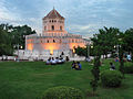
Attractions
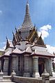
- Sanam Luang - Approximately in the middle of the district is the imaginary "navel of the city", symbolized by the city column ( Lak Müang ) at the southeast corner of Sanam Luang ("Royal Square"). South of Sanam Luang is the Great Royal Palace (Grand Palace) to the Wat Phra Kaeo . In a clockwise direction, Silpakorn University , Wat Mahathat , the historic campus of Thammasat University and the former palace (Wang Na) of Uparat ("Second King"), which now houses the Bangkok National Museum, are located. Directly to the north is the Bangkok National Theater , and on the other side of the Khlong Lot (which is below the driveway to the Phra Pinklao Bridge ) the Bangkok National Gallery .
- The Saha Chat Memorial was dedicated in 1913.
-
Palaces
- Great Royal Palace (Engl .: "Grand Palace"),
- Front Palace (Wang Na) - former palace of Uparat ("second king"), today: National Museum Bangkok,
- Saranrom Palace - old seat of King Mongkut (Rama IV.) ,
- Wang Tha Phra - today: Silpakorn Art College,
- Wang Ban Mo (Ban Mo Palace) - is located on the eastern border of the district on Thanon Atsadang (Atsadang Road) , south of Thanon Charoen Krung
- Wang Bang Khun Prom (Bang Khun Prom Palace) - is located on the banks of the Chao Phraya in the northern part of the district, on what is now the Bank of Thailand
-
Temples - Other attractions in the district:
- In the northern part of the district is located on the busy Thanon today Wisut Kasat (Wisut Kasat-Street) , the eastern entrance to the Rama IX Bridge , the Wat Indrawihan , known for its giant standing Buddha statue.
- To the northeast of the world-famous Khaosan Road tourist center is the Wat Bowonniwet temple , the center of the Thammayut community and the Mahamakut Buddhist University . King Mongkut was abbot in this temple , the current King Bhumibol Adulyadej was ordained here as a monk.
- South of the Great Palace is the Wat Pho , on the east by the "Big Swing" ( Giant Swing ) of Wat Suthat , to the north of Wat Thepthidaram , the Wat Ratchanatdaram with the "iron palace" Loha Prasat and the Democracy Monument .
- Around the center of the district is the Wat Ratchabopit , built by King Chulalongkorn in 1869 , a temple with unusual architecture that is reminiscent of the Phra Pathom Chedi in its structure . Diagonally opposite on the other bank of the Khlong Khu Mueang Derm (also: Khlong Lot) is Wat Ratchapradit , a small temple that is worth seeing because of its fine wall paintings in the viharn.
- At the southernmost tip of the district, the Phra Phutthayotfa Bridge ( Saphan Phut for short ) connects Phra Nakhon with Thonburi. Saphan Phut is the second bridge in Bangkok, it was opened on April 6, 1932. Directly at the bridge is a large statue of the city's founder, King Rama I (Phra Phutthayotfa Chulalok). Opposite is an old temple, the Wat Ratchaburana .
- Forts - Of the original 14 forts that protected the Rattanakosin Island, only two remain: Fort Mahakan in the east of the district and Fort Phra Sumen (also spelled Phra Sumeru - ป้อม พระสุเมรุ ) in the northwest corner.
-
Parks
- Santi-Chai-Prakan-Park ( สวน สาธารณะ สันติ ชัย Rund ) - A small recreational park, the "Santi-Chai-Prakan-Park", was created around the Fort Phra Sumen in 2000 on the banks of the Chao Phraya very popular with the population.
- Saranrom Park ( สวนสราญรมย์ ) - the former garden of the Saranrom Palace , now a public park
- Rommaninat Park ( สวน รมณี นาถ ) - former prison complex in the east of the district
- Theater - The National Theater of Thailand is located north of the National Museum. The Chalermkrung Royal Theater ( ศาลา เฉลิม กรุง ) is located in the southern third of the Phra Nakhon district . It is the oldest cinema in Bangkok and it was the first air-conditioned cinema in Thailand. King Prajadhipok (Rama VII) was enthusiastic about films that he had the cinema built from his own box. Prince Samaichalerm, who studied at the École des Beaux-Arts in Paris, designed the hexagonal building on Charoen Krung Road . The cinema was opened on July 2, 1933 by the king, who also chose the name. In 1992 the theater was completely renovated to bring it up to modern international standards. Today, films are shown only rarely, mainly used for demonstrating traditional Thai Khon dramas.
-
Markets :
- West of the Memorial Bridge on the banks of the Maenam Chao Phraya is the lively Pak Khlong Talad market ( market at the mouth of the canal - which means “Khlong Lod”), one of the city's most important vegetable and flower markets.
- The area around Phahurat Road ( พาหุรัด ) can be described as Thailand's “Little India”. The road was built during the reign of King Chulalongkorn (Rama V) and the Indian immigrants settled here shortly afterwards. The "Siri Guru Singh Sabha", Thailand's first Sikh temple, was built in 1933 in a side street. Today the Phahurat district is known for inexpensive textiles.
The shrine with the city pillar ( หลักเมือง , Lak Mueang) represents the imaginary center of Bangkok

In the evening at the Sanam Luang
Phra Sumen Fort

Democracy Monument


traffic
- bridges
- The Phra Phutthayotfa Bridge (popularly known as "Saphan Phut" for short, also known as Memorial Bridge in English ) was the second bridge over the Chao Phraya in 1932. It connects the south of the Phra Nakhon district with Thonburi . The wider Phra Pokklao Bridge was built right next to it in 1984 to relieve them .
- A little further south is the Phra Pinklao Bridge . It has been connecting Phra Nakhon with the Bangkok Yai district since 1973 .
- The Rama VIII Bridge, opened in 2002 in the north of the district, is one of the most important road connections to the western bank of the Chao Phraya. It connects Phra Nakhon with Bang Phlat .
- Local public transport
The blue line of the Bangkok subway (MRT) runs through the south of the district with the stations Sanam Chai in the sub-district Phra Borom Maha Ratchawang (at the Siam Museum) and Sam Yot in the sub-district Wang Burapha (near Rommaninat Park and Sala-Chaloem- Krung Theater). The central and northern part of Phra Nakhon, however, has not yet been connected to any of the public mass transport systems. However, the district is served by numerous city bus routes. As a result, the situation on the streets is very tense.
Passenger boats operate on the Chao Phraya. Piers serving Phra Nakhon are (from north to south): Thewet, Phra Ram 8, Phra Athit, Maharat, Tha Chang, Tha Tian, Rachini and Saphan Phut . The terminal stop of the boat line on the Khlong Saen Saep is also on the eastern border of the district , which is a fast connection to the eastern districts, especially during rush hour . Various ferries also connect the landing stages in Phra Nakhon with the opposite bank of the Chao Phraya.
administration
The district is divided into 12 sub-districts ( Khwaeng ) :
| No. | Surname | Thai | Pop. | No. | Surname | Thai | Pop. | |
|---|---|---|---|---|---|---|---|---|
| 1. | Phra Borom Maha Ratchawang | พระบรม มหาราช วัง | 4,616 | 7th | Bowon Niwet | บวร นิเวศ | 5,694 | |
| 2. | Wang Burapha Phirom | วัง บูรพา ภิรมย์ | 12,235 | 8th. | Talat Yot | ตลาด ยอด | 2,847 | |
| 3. | Wat Ratchabophit | วัด ราชบพิธ | 3,584 | 9. | Chana Songkhram | ชนะสงคราม | 2.141 | |
| 4th | Samran Council | สำราญราษฎร์ | 3,660 | 10. | Ban Phan Thom | บ้าน พาน ถม | 7,537 | |
| 5. | San Chao Pho Suea | ศาล เจ้าพ่อ เสือ | 3,537 | 11. | Bang Khun Phrom | บาง ขุน พรหม | 5,139 | |
| 6th | Sao Chingcha | เสา ชิงช้า | 2,541 | 12. | Wat Sam Phraya | วัด สามพระยา | 3,153 |
Individual evidence
- ↑ http://www.thapra.lib.su.ac.th/thesis/showthesis_th.asp?id=0000001862
- ↑ Archived copy ( memento of the original from March 29, 2014 in the Internet Archive ) Info: The archive link was inserted automatically and has not yet been checked. Please check the original and archive link according to the instructions and then remove this notice.
- ↑ 2013 population statistics ( Thai ) Department of Provincial Administration. Retrieved August 5, 2014.
Web links
- Phra Nakhon District Official Website (in Thai)
Coordinates: 13 ° 46 ' N , 100 ° 30' E