
Mie prefecture
|
Mie-ken 三重 県 |
|
|---|---|
  |
|
| Basic data | |
| Administrative headquarters : | Tsu |
| Region : | Kinki |
| Main island : | Honshu |
| Area : | 5,774.45 km² |
| Water content: | 0.7 % |
| Residents : | 1,781,948 (June 1, 2019) |
| Population density : | 309 inhabitants per km² |
| Counties : | 7th |
| Municipalities : | 29 |
| ISO 3166-2 : | JP-24 |
| Governor : | Eikei Suzuki |
| Website: | www.pref.mie.jp |
| Symbols | |
| Prefecture flag : |
 |
| Prefecture tree : | Jingu Japanese cedar |
| Prefecture flower : | Japanese iris |
| Vogel prefecture : | Kentish plover |
| Fish prefecture : | Japanese lobster |
| Prefecture mammal : | Japanese serau |
| Prefecture song : |
Mie-kenminka 三重 県 民歌 ("Song of the Citizens of Mie") |
| Citizens Day: | April 18 |
The Mie Prefecture ( Japanese 三重県 Mie-ken ) is one of the prefectures of Japan . The seat of the prefectural administration is Tsu . Mie is located on the main island of Honshū as well as over 200 offshore islands and is assigned to the western Japanese region of Kinki / Kansai in the classic geographical eight-region division of Japan , but in practical contexts it is often included in Tōkai or large-scale Chūbu / central / eastern Japan , so for example with the national police authority, lower house elections, or with the successor companies of the state railway.
Surname
After the Kojiki , the name Mie , literally: "triple", comes from Yamato Takeru . When he sets out to submit to the deity from Mount Ibuki , he first has to conquer a mountain on which this deity sends a heavy freezing rain and then cross the Tagi plain ( 當 藝 野 ). When he finally reaches a village he says:
「吾 が 足 は 三重 の 勾 の 如 く し て 甚 疲 れ た り。」
"Ware ga ashi wa mihe no magari no shikushite ito tsukaretari."
“My legs are bent three times and are extremely tired. English “My legs are like three-fold crooks, and very weary”. "
Thereupon the village and with it the region got the name Mihe or Mie. Yamato Takeru succumbed shortly afterwards.
politics
(as of May 13, 2019)
- Shinsei Mie ("Renewal Mie": Shinsei Mie , Mie minshu rengō [two regional parties made up of ex-democrats], non-party): 21
- Jiyūminshutō kengidan ("Prefectural Parliament Group Liberal Democratic Party "): 15
- Sōmō ( 草莽 ): 6
- Jimintō (" LDP "): 5
- Kōmeitō : 2
- KPY : 1
- Kusa no ne undō Iga ("grassroots movement Iga"): 1
The sixth elected governor of Mie since 2011 is Eikei Suzuki , a former LDP candidate for the national parliament, who narrowly prevailed against the center-left candidate Naohisa Matsuda in the unified regional elections in April 2011 and in the unified elections in 2015 and 2019 was re-elected against only one communist challenger at a time. The parliament, which is also elected in the uniform regional elections, has 51 regular members. In the 2019 elections, the LDP was by far the strongest party with 21 seats, but the Shinsei Mie faction made up of former Democrats is the strongest.
Mie is the home prefecture of former DPJ and Minshinto chairman Katsuya Okada ; and although only the north, which is part of the Pacific city band and belongs to the Chūkyō metropolitan region around Nagoya , is more urbanized and industrialized, the Democratic Party was relatively strong. Since 2017, Mie has only been represented in the National Assembly by four members in the House of Representatives , the lower house, and two in the council house , the upper house. The directly elected MPs from Mie after the 2016 , 2017 and 2019 elections (as of August 2019) are:
- in the House of Representatives
- for constituency 1 with the capital Tsu Norihisa Tamura (LDP, 8th election),
- for constituency 2 north of it to the southern part of Mie 's largest city Yokkaichi Masaharu Nakagawa (nationally independent to the KDP faction, locally to Mie Minshu rengō / "Mie Democratic League", 8th election),
- for constituency 3 in the very north of Mie with the northern part of Yokkaichi Katsuya Okada (nationally non-partisan to the KDP faction, locally to the "Democratic Bund Mie", 10th election),
- for constituency 4 in the more rural south of Mie Norio Mitsuya (LDP, 4th choice), MLIT official before his first election in 2003 ,
- in the council house
- until 2025 Yūmi Yoshikawa (LDP, 2nd choice), before the 2013 election in which she defeated the democratic incumbent Chiaki Takahashi , employee of the Mitsui Sumitomo Bank (English Sumitomo Mitsui Banking), and
- until 2022 Hirokazu Shiba (KDP, 3rd choice), before his first election in 2004 a member of the prefectural parliament for nine years, 2012 deputy head of the cabinet secretariat.
Administrative division


With the introduction of the modern parishes in 1889, the Mie prefecture consisted of an independent city, 18 small towns and 317 villages (in 21 districts). Through incorporations and mergers, the number of municipalities fell from 340 (1920) through 109 (1955) to 69 in 2000. Since 2006, the prefecture has consisted of 14 independent cities ( Shi ) and 15 small towns ( Chō ) in seven counties. Three of these districts consist of only one municipality each. On January 10, 2006, the village of Udono ( 鵜 殿 村 Udono-mura ) in the district of Minamimoru ( Minamimoru-gun ) was incorporated into the small town of Kihō ( 紀宝 町 Kihō-chō ). There are no more villages ( 村 Mura ) in this prefecture.
The most populous city of Yokkaichi received on November 1, 2000 the status of a "special city" ( 特例 市 Tokureishi ).
In the table below, the districts ( 郡 Gun ) are shown in italics, including (indented) the small towns ( 町 Chō ) and villages ( 村 Mura ) within them. A dependency between rural district and small town can also be seen in the first three digits of the code (1st column). At the beginning of the table are the independent cities ( 市 Shi ).
| code | Surname | Area (in km²) | population | Population density (inh / km²) 3 |
||
|---|---|---|---|---|---|---|
| Rōmaji | Kanji | October 1, 2017 1 | October 1, 2019 2 | October 1, 2015 3 | ||
| 24201 | Tsu- shi | 津市 | 711.19 | 276.660 | 279,886 | 393.55 |
| 24202 | Yokkaichi-shi | 四日 市 市 | 206.44 | 310,750 | 311.031 | 1506.64 |
| 24203 | Ise- shi | 伊 勢 市 | 208.35 | 124,650 | 127.817 | 613.47 |
| 24204 | Matsusaka-shi | 松 阪 市 | 623.58 | 160.907 | 163,863 | 262.78 |
| 24205 | Kuwana-shi | 桑 名 市 | 136.68 | 139,878 | 140.303 | 1026.51 |
| 24207 | Suzuka-shi | 鈴鹿 市 | 194.46 | 196.257 | 196,403 | 1009.99 |
| 24208 | Nabari-shi | 名 張 市 | 129.77 | 77.040 | 78,795 | 607.19 |
| 24209 | Owase-shi | 尾 鷲 市 | 192.71 | 16,767 | 18.009 | 93.45 |
| 24210 | Kameyama- shi | 亀 山 市 | 191.04 | 50,035 | 50,254 | 263.05 |
| 24211 | Toba- shi | 鳥羽 市 | 107.34 | 18.306 | 19,448 | 181.18 |
| 24212 | Kumano- shi | 熊 野 市 | 373.35 | 16,459 | 17,322 | 46.40 |
| 24214 | Inabe-shi | い な べ 市 | 219.83 | 45,383 | 45,815 | 208.41 |
| 24215 | Shima- shi | 志摩 市 | 178.95 | 47,653 | 50,341 | 281.31 |
| 24216 | Iga- shi | 伊 賀 市 | 558.23 | 88.111 | 90,581 | 162.26 |
| 24300 | Kuwana gun | 桑 名 郡 | 15.74 | 6200 | 6357 | 403.88 |
| 24303 | Kisosaki-cho | 木 曽 岬 町 | 15.74 | 6200 | 6357 | 403.88 |
| 24320 | Possession-gun | 員 弁 郡 | 22.68 | 25,355 | 25,344 | 1117.46 |
| 24324 | Tōin-chō | 東 員 町 | 22.68 | 25,355 | 25,344 | 1117.46 |
| 24340 | Mie-gun | 三重 郡 | 121.73 | 66,372 | 65,522 | 538.26 |
| 24341 | Komono-cho | 菰 野 町 | 107.01 | 40,590 | 40.210 | 375.76 |
| 24343 | Asahi-cho | 朝日 町 | 5.99 | 10,909 | 10,560 | 1762.94 |
| 24344 | Kawagoe-chō | 川 越 町 | 8.73 | 14,873 | 14,752 | 1689.81 |
| 24440 | Takai-gun | 多 気 郡 | 506.96 | 46.158 | 47.021 | 92.75 |
| 24441 | Taki-cho | 多 気 町 | 103.06 | 14,450 | 14,878 | 144.36 |
| 24442 | Meiwa-cho | 明 和 町 | 41.04 | 22,621 | 22,586 | 550.34 |
| 24443 | Ōdai-chō | 大 台 町 | 362.86 | 9087 | 9557 | 26.34 |
| 24460 | Wataraii gun | 度 会 郡 | 651.10 | 43.205 | 45,467 | 69.83 |
| 24461 | Tamaki-cho | 玉 城 町 | 40.91 | 15,291 | 15,431 | 377.19 |
| 24470 | Watarai-cho | 度 会 町 | 134.98 | 8022 | 8309 | 61.56 |
| 24471 | Taiki-cho | 大 紀 町 | 233.32 | 8212 | 8939 | 38.31 |
| 24472 | Minamiise-chō | 南伊 勢 町 | 241.89 | 11,680 | 12,788 | 52.87 |
| 24540 | Kitamuro gun | 北 牟 婁 郡 | 256.53 | 15,217 | 16,338 | 63.69 |
| 24543 | Kihoku-cho | 紀 北 町 | 256.53 | 15,217 | 16,338 | 63.69 |
| 24560 | Minamimuro gun | 南 牟 婁 郡 | 167.75 | 19,013 | 19,948 | 118.92 |
| 24561 | Mihama-cho | 御 浜 町 | 88.13 | 8306 | 8741 | 99.18 |
| 24562 | Kihō-chō | 紀宝 町 | 79.62 | 10,707 | 11.207 | 140.76 |
| Shi-bu ( All Shi , proportion of urban districts) | 市 部 | 4031.90 | 1,568,856 | 1,589,868 | 394.32 | |
| Gun-bu ( All Gun , percentage of counties) | 郡 部 | 1742.50 | 221,520 | 225.997 | 129.7 | |
| 24000 | Mie-Ken (Mie Prefecture) | 三重 県 | 5774.41 | 1,790,376 | 1,815,865 | 314.47 |
Sources
1 Area data from 2017
2 Estimated population 2018
3 Results of the 2015 census
Biggest places
| VZ year | Residents | |||
|---|---|---|---|---|
| 2015 | 2010 | 2005 | 2000 | |
| Yokkaichi | 311.031 | 307.766 | 303.845 | 291.105 |
| Tsu | 279,886 | 285,746 | 165.182 | 163.246 |
| Suzuka | 196,403 | 199.293 | 193.114 | 186.151 |
| Matsusaka | 163,863 | 168.017 | 168.973 | 123.727 |
| Kuwana | 140.303 | 140.290 | 138.963 | 108,378 |
| Ise | 127.817 | 130.271 | 97,777 | 100.145 |
| Iga | 90,581 | 97.207 | 100,623 | - |
| Nabari | 78,795 | 80.284 | 82,156 | 83.291 |
| Shima | 50,341 | 54,694 | 58,225 | - |
| Kameyama | 50,254 | 51.023 | 49,253 | 39,334 |
| Inabe | 45,815 | 45,684 | 46,446 | - |
| Toba | 19,448 | 21,435 | 23,067 | 24,945 |
| Owase | 18.009 | 20,033 | 22,103 | 23,683 |
| Kumano | 17,322 | 19,662 | 19,607 | 20,898 |
| Ueno | - | - | - | 61,493 |
| Hisai | - | - | 42.191 | 41,063 |
- December 1, 2003 - The small town of Inabe integrates three communities and is raised to the status of an independent town .
- October 1, 2004 - The small town of Shima incorporates four communities and is raised to the status of an independent city
- November 1, 2004 - the independent city of Iga is created by merging the city of Ueno with five municipalities.
- January 1, 2006 - The independent city of Hisai is incorporated into the independent city of Tsu along with eight other parishes .
Population development in the prefecture
| Census year |
Total population |
male population |
female population |
Gender ratio men to 1000 women |
Area in km 2 |
Population density per km 2 |
|---|---|---|---|---|---|---|
| 1920 | 2,089,762 | 1,033,860 | 1,055,902 | 979.1 | 5055.06 | 413.40 |
| 1920 | 1,069,270 | 525,957 | 543.313 | 968.1 | 5702.10 | 187.52 |
| 1925 | 1,107,692 | 544.752 | 562,940 | 967.7 | 5702.10 | 194.26 |
| 1930 | 1,157,407 | 571,000 | 586,407 | 973.7 | 5765.34 | 200.75 |
| 1935 | 1,174,595 | 572,356 | 602.239 | 950.4 | 5765.28 | 203.74 |
| 1940 | 1,198,783 | 585,427 | 613.356 | 954.5 | 5765.28 | 207.93 |
| 1945 | 1,394,286 | 646.954 | 747.332 | 865.7 | 5765.28 | 241.84 |
| 1950 | 1,461,197 | 704.805 | 756.392 | 931.8 | 5762.38 | 253.58 |
| 1955 | 1,485,582 | 717.819 | 767.763 | 934.9 | 5765.85 | 257.65 |
| 1960 | 1,485,054 | 716.715 | 768,339 | 932.8 | 5765.81 | 257.56 |
| 1965 | 1,514,467 | 727.802 | 786.665 | 925.2 | 5767.80 | 262.57 |
| 1970 | 1,543,083 | 742.461 | 800,622 | 927.4 | 5771.92 | 267.34 |
| 1975 | 1,626,002 | 787.280 | 838.722 | 938.7 | 5773.59 | 281.63 |
| 1980 | 1,686,936 | 817,578 | 869.358 | 940.4 | 5776.49 | 292.03 |
| 1985 | 1,747,311 | 847.420 | 899.891 | 941.7 | 5777.57 | 302.43 |
| 1990 | 1,792,514 | 869.515 | 922.999 | 942.1 | 5774.48 | 310.42 |
| 1995 | 1,841,358 | 893.982 | 947.376 | 943.6 | 5773.66 | 318.92 |
| 2000 | 1,857,339 | 901.380 | 955.959 | 942.9 | 5776.40 | 321.54 |
| 2005 | 1,866,963 | 907.214 | 959.749 | 945.3 | 5776.68 | 323.19 |
| 2010 | 1,854,724 | 903.398 | 951.326 | 949.6 | 5777.27 | 321.04 |
| 2015 | 1,815,865 | 883.516 | 932,349 | 947.6 | 5774.40 | 314.47 |
history
- 1868 ( Boshin War / Meiji Restoration ): Foundation of the prefecture (initially -fu , later -ken ) Watarai (seat of the prefecture administration: Yamada in the Watarai district of the Ise province ) from the Yamada (Yamada bugyō) bailiwick of the shogunate
- 1871 ( abolition of the Han , first prefectural mergers and elimination of exclaves):
- Establishment of the Anotsu prefecture (administrative seat: Anotsu [lit. "Port of Anō"], district Anō , province Ise) from the prefectures / ex-principalities (-han) Tsu , Nagashima , Kuwana , Komono , Kameyama and Kanbe
- Expansion of the Watarai prefecture to include the prefectures / ex-principalities of Hisai and Toba
- After adjustment, Watarai comprised five counties of Ise province, all of Shima and a small part of Kii , the rest of Ise and Iga belonged to Anotsu .
- 1872: The administrative headquarters of Anotsu Prefecture are relocated to Yokkaichi in Mie County and renamed to Mie Prefecture
- 1873: Relocation of the capital to Anotsu
- 1876: The Mie and Watarai prefectures are united to form the new Mie prefecture

- 1876: Ise uprisings ( 伊 勢 暴動 Ise bōdō ): In the province of Ise, the rural population rises against the property taxes reformed in 1873, the revolt covers most of Mie and spreads to the neighboring prefectures of Aichi, Gifu and Sakai (today Nara) . The uprising is suppressed by the garrison and police, but the property tax is also reduced in 1877.
- 1946: Establishment of the Ise Shima National Park
- 1956: Rokken railway accident
- 1959: Ise Bay Typhoon: 320,000 victims
- 1973: Partnership between Mie and São Paulo , Brazil
- 1982: Opening of the Mie Art Museum
- 1986: Cooperation between Mie and Henan , China
- 1992: Mie partnership with Valencia , Spain
- 1996: Cooperation between Mie and the Republic of Palau
Attractions
- Iga-style ninja house: A reproduction of a ninja house with hidden plaques and secret paths.
- Ise-jingū : A Shintō shrine which is considered the highest shrine in Japan in the Shintō shrine, consisting of two main shrines and 125 secondary shrines. It reflects the beauty of the past Japanese culture.
- Ise Sengoku: A historic village that represents the Sengoku period and the Azuchi-Momoyama period . The village is often used for historical films.
- Mie Art Museum: Collections on the Western Style of Japanese Art.
- Sakakibara Onsen : This is an onsen in Hisai (today: Tsu).
- Shima-Spain-Mura: A Spanish theme park in Sakazaki, Isobe-chō , Shima.
- Suzuka International Racing Course : World-famous Formula 1 racing track
Festivals
- January 1st: Geta Matsuri in Toba
- 1-5 February: Yaya Matsuri: Festival of Owase-jinja with a daimyo parade.
- Early June: Shiokake Matsuri (Festival of Health) in Owase
- June 24th: Izonomiya Otaue Matsuri in Isobe-chō, Shima (fertility festival for the rice)
- July 11: Shirongo Matsuri in Toba (Entertaining Festival of Women)
- First weekend in August: Ishidobe Matsuri in Kuwana.
- August 17th: Kumano Hanabi Matsuri in Kumano. Celebrated with fireworks .
- Third Sunday in September: Waraji Matsuri (Festival of Straw Sandals) in Daiō-chō , Shima
- 23-25 October: Ueno Tenjin Matsuri in Ueno , Iga (Autumn Festival of the Sugawara-jinja)
- November 3: Nigishima Matsuri ( 二 木 島 祭 ) in Nigishima-chō, Kumano (Festival for city security.)
- December 31: Nanori Shimenawakiri in Daiō-chō, Shima (Festival of the Harvest)
Sports
The Japanese Formula 1 races take place in Suzuka .
Partnerships
Mie Prefecture has partnerships with:

Outline

Ise shrine

Birthplace of Matsuo Bashō

Pearl diver
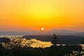
Ago bay

Road signs in Mie Prefecture


Web links
- Kanko Mie Tourist Information Office - English
- Outdoor Japan - Section Mie - English
- Mie International Exchange Foundation - English
Individual evidence
- ^ Nihon Koten Bungaku Taikei: Kojiki , pp. 221: 6
- ^ English translation by Basil Hall Chamberlain
- ↑ Mie Prefectural Parliament : Members by parliamentary group , accessed on August 8, 2019.
- ↑ 統一 地方 選 2019 三重 県 議 選 各 党 議席 . In: NHK Senkyo Web. April 8, 2019, Retrieved August 8, 2019 (Japanese).
- ↑ 統一 地方 選 2019> 三重> 三重 県 議 選 . In: Chūnichi Shimbun . April 2019, Retrieved August 8, 2019 (Japanese).
- ↑ Kokudo Chiriin (GSI - Geospatial Information Authority of Japan), gsi.go.jp 平 成 29 年全国都 道 府 県 市区 町 村 別 面積 調 (Nationwide survey of all prefectures and municipalities 2017), p. 62: 24 Mie-ken (Japanese ), accessed January 30, 2019
- ↑ 簡 単 検 索 ・ 詳細 検 索 ・ 検 索 サ ン プ ル , accessed January 30, 2019 (Japanese)
- ↑ e-stat (English), accessed on January 30, 2019
- ↑ e-Stat database , accessed on January 30, 2019 (English)
- ↑ Mie Prefecture Administration: Timeline of History in the Meiji Period , accessed on November 16, 2019.
- ↑ Mie prefecture administration: 三重 県 庁 舎 (津市 下部 田) , accessed on November 16, 2019.
Aichi | Akita | Aomori | Chiba | Ehime | Fukui | Fukuoka | Fukushima | Gifu | Gunma | Hiroshima | Hokkaidō | Hyōgo | Ibaraki | Ishikawa | Iwate | Kagawa | Kagoshima | Kanagawa | Kochi | Kumamoto | Kyoto | Mie | Miyagi | Miyazaki | Nagano | Nagasaki | Nara | Niigata | Ōita | Okayama | Okinawa | Osaka | Saga | Saitama | Shiga | Shimane | Shizuoka | Tochigi | Tokyo | Tokushima | Tottori | Toyama | Wakayama | Yamagata | Yamaguchi | Yamanashi
Coordinates: 34 ° 42 ′ N , 136 ° 30 ′ E