
Ratzert
| coat of arms | Germany map | |
|---|---|---|

|
Coordinates: 50 ° 39 ' N , 7 ° 37' E |
|
| Basic data | ||
| State : | Rhineland-Palatinate | |
| County : | Neuwied | |
| Association municipality : | Puderbach | |
| Height : | 225 m above sea level NHN | |
| Area : | 2.78 km 2 | |
| Residents: | 237 (Dec. 31, 2019) | |
| Population density : | 85 inhabitants per km 2 | |
| Postal code : | 57614 | |
| Area code : | 02684 | |
| License plate : | NO | |
| Community key : | 07 1 38 058 | |
| Community structure: | 2 districts | |
| Association administration address: | Hauptstrasse 13 56305 Puderbach |
|
| Website : | ||
| Local Mayor : | Gerd Schumacher | |
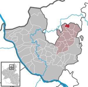
| Location of the local community of Ratzert in the Neuwied district | ||
  |
||

Ratzert is a municipality in the Neuwied district in the north of Rhineland-Palatinate . The community belongs to the Verbandsgemeinde Puderbach . The district Brubbach belongs to Ratzert.
geography
The place is a little off the main traffic arteries north of Puderbach on the edge of the Rhine-Westerwald nature park . The Wambach flows in a south-westerly direction through the place, the development of which rises slightly to the south and east . The Brubbach district to the west and the Waldhof residential area belong to Ratzert .
history
The place Ratzert is mentioned for the first time in 1270. At this time one meets Ludwig von Ratzert (Razerode) there, who attests to the correctness of a document. Ratzert was a single farm owned by Heinrich Stoggeleid and his wife Beatrix . At that time and subsequently, the Stoggeleid family was in the Saynian service. Contze von Ratzert (Raitzroide) belonged to the local nobility in 1478 (March 11th). He owed his Saynic master for the autumn bed. In 1589 a total of eight souls were found in Ratzert , one of which was Saynisch. Ratzert has always belonged to the Niederwambach parish . First encountered in 1612 on a wiedischen courtyard, Hermann II. Von Wied held peculiar. In Ratzert there were a total of 17 houses in 1843, and in 1895 there were 38 houses with 163 inhabitants. They were always banned to the Niederwambach mill. The children went to the parish school in Niederwambach. In 1870 the first school was built in Ratzert for 3740 thalers. In 1891 Ratzert is called the poorest municipality in the Westerwald .
- Cultural monuments
See the list of cultural monuments in Ratzert
- Population development
The development of the population of Ratzert, the values from 1871 to 1987 are based on censuses:
|
|
politics
Municipal council
The council in Ratzert consists of six council members, who in the local elections on May 26, 2019 in a majority vote were elected, and the honorary mayor as chairman.
mayor
Gerd Schumacher is the local mayor of Ratzert. In the direct election on May 26, 2019, he was confirmed in his office for another five years with a share of the vote of 87.33%.
traffic
The next motorway junction is Neuwied on federal motorway 3 . The nearest ICE - Station is in Montabaur on the high-speed line Cologne-Rhine / Main .
literature
- Albert Hardt: From Holzbach to Wied, history of the Puderbacher country. Puderbach 1992, p. 432 ff.
Web links
- Internet presence of the local community Ratzert
- Local community Ratzert on the website of the Verbandsgemeinde Puderbach
- Ratzert in the television program Hierzuland
Individual evidence
- ↑ State Statistical Office of Rhineland-Palatinate - population status 2019, districts, communities, association communities ( help on this ).
- ↑ State Statistical Office Rhineland-Palatinate (ed.): Official directory of the municipalities and parts of the municipality. Status: January 2019 [ Version 2020 is available. ] . S. 51 (PDF; 3 MB).
- ↑ State Statistical Office Rhineland-Palatinate: My village, my city. Retrieved July 11, 2019 .
- ^ The Regional Returning Officer Rhineland-Palatinate: Local elections 2019, city and municipal council elections
- ^ Municipal council in Ratzert was constituted. NR-Kurier, July 4, 2019, accessed on March 18, 2020 .
- ^ The Regional Returning Officer Rhineland-Palatinate: direct elections 2019. see Puderbach, Verbandsgemeinde, eleventh line of results. Retrieved March 18, 2020 .

Cities: Bad Hönningen | Dierdorf | Linz on the Rhine | Neuwied | Uncle . Municipalities: Anhausen | Asbach | Bonefeld | Breitscheid (Westerwald) | Bruchhausen | Buchholz (Westerwald) | Dattenberg | Datzeroth | Dernbach | Döttesfeld | Dry wood | Ehlscheid | Drake | Oath of May | Hammerstein (on the Rhine) | Hanroth | Hardert | Harschbach | Hausen (Wied) | Hümmerich | Isenburg (Westerwald) | Kasbach-Ohlenberg | Kleinmaischeid | Kurtscheid | Leubsdorf (on the Rhine) | Leutesdorf | Linkenbach | Marienhausen | Meinborn | Melsbach | Neustadt (Wied) | Niederbreitbach | Niederhofen | Niederwambach | Oberdreis | Oberhonnefeld-Gierend | Upper wheels | Ockenfels | Puderbach | Ratzert | Raubach | Rengsdorf | Rheinbreitbach | Rheinbrohl | Rodenbach near Puderbach | Rossbach (Wied) | Rüscheid | Saint Catherine | Stebach | Steimel | Street house | Thalhausen | Urbach (Westerwald) | Vettelschoss | Waldbreitbach | Windhagen | Woldert .