
Stebach
| coat of arms | Germany map | |
|---|---|---|

|
Coordinates: 50 ° 31 ' N , 7 ° 40' E |
|
| Basic data | ||
| State : | Rhineland-Palatinate | |
| County : | Neuwied | |
| Association municipality : | Dierdorf | |
| Height : | 240 m above sea level NHN | |
| Area : | 2.38 km 2 | |
| Residents: | 347 (Dec. 31, 2019) | |
| Population density : | 146 inhabitants per km 2 | |
| Postal code : | 56276 | |
| Area code : | 02689 | |
| License plate : | NO | |
| Community key : | 07 1 38 069 | |
| Association administration address: | Poststrasse 5 56269 Dierdorf |
|
| Website : | ||
| Local Mayor : | Karl-Heinz Klein | |
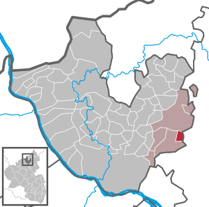
| Location of the local community of Stebach in the Neuwied district | ||
  |
||

Stebach is a municipality in the Neuwied district in the north of Rhineland-Palatinate . It belongs to the Dierdorf Association .
geography
Stebach is located in the southeastern part of the Neuwied district on the border with the Westerwaldkreis . The community is located in the east of the Rhine-Westerwald Nature Park .
Stebach is the smallest of the six communities within the Dierdorf association. The district size is 238 hectares, of which 106 hectares (approx. 45%) represent forest areas and 97 hectares (approx. 40%) represent agricultural areas (status: 2017). The Waldhof residential area also belongs to Stebach .
The brook that bears the name of the place and flows south to the Sayntal rises above the landscape pond between the Dierdorf district of Giershofen and Stebach. It flows through the village and flows into the Saynbach at Hofgut Adenroth between the Großmaischeider district of Kausen and Breitenau .
history
Around 1135, the Rommersdorf monastery , which had previously been founded by the Benedictines and was soon abandoned by them, was taken over by the Premonstratensians and settled again. An Isenburg knight named Revenger entered the monastery between 1202 and 1212 and gave him the "curte Stedebach" (Hof Stebach).
It should be noted here that at that time the later sons were given to monasteries in order to secure their livelihood. The monasteries, in turn, “expected” donations from property with corresponding regular income. The tenants of the land, which then belonged to the monasteries, sometimes had to give up considerable parts of the goods they had earned (a third or half, rarely less) to the monasteries.
After the Premonstratensian Monastery of Wülfersberg was founded as a Rommersdorf daughter monastery a few years later , the Stebach farm came to the Wülfersberg Monastery. In 1521 the Wülfersberg monastery was dissolved, and the Rommersdorf Abbey took over the rights again.
In 1609, the Rommersdorf Abbey took over another farm in Stebach, the "Eltzer Hof". The name of the farm can be traced back to a " Lord of Eltz and Schöneck ".
At the latest in 1803 when Rommersdorf was dissolved and in 1820 when Rommersdorf was sold, Stebach also came into secular hands.
Population development
The development of the population of Stebach, the values from 1871 to 1987 are based on censuses:
|
|
politics
Municipal council
The council in Stebach consists of eight council members, who in the local election in 2019 on 26 May 2019 in a majority vote were elected, and the honorary mayor as chairman.
mayor
Karl-Heinz Klein became local mayor of Stebach on July 1, 2014. In the direct election on May 26, 2019, he was confirmed in his office for another five years with a share of the vote of 73.37%. Klein's predecessor was Friedhelm Jung, who had held the office for 28 years.
coat of arms
|
|
Blazon : "From red to silver, divided by a slanting silver-blue wavy bar, a black bell at the front, a key with a beard upwards at the back, which is crossed by a silver abbot."
With a certificate dated May 17, 2004, the municipality of Stebach received the approval to use the coat of arms after the Koblenz state archives had found the proposed coat of arms to be heraldically flawless. |
| Justification for the coat of arms: The two red bars in silver refer to the manorial rule of Isenburg . They are the coat of arms of the Rembold tribe of Isenburg or the Niederisenburg rule. The key is considered to be the symbol of Peter. Peter was the patron saint of the Wülfersberg monastery . The abbot symbolizes the Premonstratensian Abbey of Rommersdorf . The wave bar symbolizes the Stebach and the bell should refer to the old school bell of the community of Stebach and the local music clubs. |
Economy and Infrastructure
The place, which used to be dominated by agriculture, has developed into a purely residential community, with a certain recreational character, which is determined by the "weekend area" created in the 1960s. The place has hiking trails. The “Stebacher Weiher”, which belongs to the Großmaischeid district but is directly adjacent to Stebach, is used by hikers, swimmers and anglers. A wet biotope also belongs to this landscape pond. Today there is only one full-time farm on the site. The municipality also has a number of craft businesses.
The village school was closed before the Second World War, but reopened after the construction of a new building in 1955, only to be finally closed in the course of the school reform in 1966. Today the children from Stebach attend the primary school in Großmaischeid and the secondary schools in Dierdorf.
In terms of traffic, Stebach is accessible via the K 119 district road leading from Großmaischeid to Dierdorf , as well as the K 118 coming from Kausen. The next motorway junction is Dierdorf on federal motorway 3 . The closest ICE stop is Montabaur train station on the Cologne – Rhein / Main high-speed line .
See also
Web links
- Website of the local community of Stebach
- Information from the Association of Dierdorf about Stebach
Individual evidence
- ↑ State Statistical Office of Rhineland-Palatinate - population status 2019, districts, communities, association communities ( help on this ).
- ↑ a b State Statistical Office Rhineland-Palatinate: Regional data.
- ↑ State Statistical Office Rhineland-Palatinate (ed.): Official directory of the municipalities and parts of the municipality. Status: January 2019 [ Version 2020 is available. ] . S. 49 (PDF; 3 MB).
- ↑ Local election Rhineland-Palatinate 2019, local council
- ^ Karl-Heinz Klein: Meeting telegram July 1, 2014. Verbandsgemeinde Dierdorf, July 9, 2014, accessed on March 22, 2020 .
- ^ The Regional Returning Officer of Rhineland-Palatinate: direct elections 2019. see Dierdorf, Verbandsgemeinde, penultimate line of results. Retrieved March 22, 2020 .
- ^ Arno Schmidt: Stebach - local history in the new municipal coat of arms . In: Heimat-Jahrbuch des Landkreis Neuwied 2005. pp. 77–80.

Cities: Bad Hönningen | Dierdorf | Linz on the Rhine | Neuwied | Uncle . Municipalities: Anhausen | Asbach | Bonefeld | Breitscheid (Westerwald) | Bruchhausen | Buchholz (Westerwald) | Dattenberg | Datzeroth | Dernbach | Döttesfeld | Dry wood | Ehlscheid | Drake | Oath of May | Hammerstein (on the Rhine) | Hanroth | Hardert | Harschbach | Hausen (Wied) | Hümmerich | Isenburg (Westerwald) | Kasbach-Ohlenberg | Kleinmaischeid | Kurtscheid | Leubsdorf (on the Rhine) | Leutesdorf | Linkenbach | Marienhausen | Meinborn | Melsbach | Neustadt (Wied) | Niederbreitbach | Niederhofen | Niederwambach | Oberdreis | Oberhonnefeld-Gierend | Upper wheels | Ockenfels | Puderbach | Ratzert | Raubach | Rengsdorf | Rheinbreitbach | Rheinbrohl | Rodenbach near Puderbach | Rossbach (Wied) | Rüscheid | Saint Catherine | Stebach | Steimel | Street house | Thalhausen | Urbach (Westerwald) | Vettelschoss | Waldbreitbach | Windhagen | Woldert .