
Bonefeld
| coat of arms | Germany map | |
|---|---|---|

|
Coordinates: 50 ° 31 ' N , 7 ° 29' E |
|
| Basic data | ||
| State : | Rhineland-Palatinate | |
| County : | Neuwied | |
| Association municipality : | Rengsdorf-Waldbreitbach | |
| Height : | 345 m above sea level NHN | |
| Area : | 5.21 km 2 | |
| Residents: | 944 (Dec. 31, 2019) | |
| Population density : | 181 inhabitants per km 2 | |
| Postal code : | 56579 | |
| Area code : | 02634 | |
| License plate : | NO | |
| Community key : | 07 1 38 005 | |
| LOCODE : | DE 46B | |
| Association administration address: | Westerwaldstrasse 32–34 56579 Rengsdorf |
|
| Website : | ||
| Mayoress : | Claudia Runkel | |
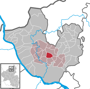
| Location of the local community Bonefeld in the district of Neuwied | ||
  |
||

Bonefeld is a municipality in the Neuwied district in the north of Rhineland-Palatinate . It belongs to the community of Rengsdorf-Waldbreitbach .
geography
The place is on the edge of the Westerwald above the Neuwied Basin in the Rhine-Westerwald Nature Park . The residential development in Bonefeld slopes south and east into the valley of the Völkerwiesenbach , which rises directly north of the village. Bonefeld includes the living spaces at Beim Mohrenhaus, Birkenhof, Bonefelder Höhe, Mittelheidehof, Rüllbach (hunting lodge) and Tannenhof.
history
Bonefeld is mentioned for the first time on June 19, 1321, when the Koblenz chapter of St. Kastor stated that Lambrecht von Stocheim and Wilhelm von Helfenstein owned the tithe of Boninfelt . The castor holdings in and around Bonefeld (Deichwiese) came into the ownership of the Wiedische counts at the time of the Reformation . The Reichensteiner (near Puderbach ) also had a lease near Bonefeld. At the beginning of the 17th century you can still meet a few Junkers who lived there. At times the Bonefelder Hof shares its history with that of the Harderter Hof. Under the Wiedischen Count Friedrich III. Bonefeld had its real heyday through a considerable acquisition, when the place had 14 houses.
Population development
The development of the population of Bonefeld, the values from 1871 to 1987 are based on censuses:
|
|
politics
Municipal council
The municipal council in Bonefeld consists of twelve council members, who were elected by a majority vote in the local elections on May 26, 2019 , and the honorary local mayor as chairman.
mayor
Claudia Runkel became the local mayor of Bonefeld in 2014. In the direct election on May 26, 2019, she was confirmed in her office for another five years with 90.83% of the votes. Claudia Runkel's predecessor was Claus Gördes, who carried out the task for 20 years.
coat of arms
The description of the coat of arms reads: “Split by gold and blue by a curved, lowered silver tip, inside a group of four black basalt columns (1: 2: 1), in front four red sloping bars covered with a lobed black spiral ring , behind two silver overlapping oak leaves with two silver acorns. "
Culture and sights
Cultural monuments
- Celtic graves
To the east of the location at the hill “Steinskopf” there is a burial ground consisting of six burial mounds, which is assigned to the younger Hallstatt period (650–475 BC, end of the Bronze Age, beginning of the Iron Age). So far only one of the graves has been opened. The burial mound examined by the Provincial Museum Bonn in 1919 was surrounded by a wreath of basalt blocks about 10 meters in diameter. When the grave was opened, the finds were a basalt chisel, a bronze needle and a quartz shard. The graves have been designated as an excavation reserve since 2000 .
- Old castle
The area known as "Alteburg Bonefeld", which is also to the east of Bonefeld and only a few hundred meters from the Celtic graves, was assigned to the late Middle Ages or early modern times in the investigations carried out in 1919 based on the findings.
Natural monuments
The imperial oak was planted in 1871. At the oak is the memorial for the fallen of the First and Second World Wars .
Theater - music - community
- The theater group of the Verbandsgemeinde Rengsdorf gives their performances in the hall of the historic Deichwiesenhof.
- There is a women's choir, a men's choir, and an accordion club.
- The Bonefeld Boys' Association has existed since 1893.
Sports
There is a hard soccer field, a small soccer field and a skate track . In addition, an air rifle shooting range and meanwhile a shooting range with the latest technology.
Economy and Infrastructure
There is a restaurant for the residents, the Deichwiesenhof. It is said to stand on the foundations of a former building belonging to the Counts of Wied.
The majority of jobs in Bonefeld are created by a company in mechanical engineering.
traffic
- The federal highway 256 runs directly through the community and leads from Neuwied to Altenkirchen . This section of the street is also known as the historic Raiffeisenstraße .
- The next motorway junction is Neuwied on federal motorway 3 .
- The closest train station is Neuwied train station , the next ICE train stations are Koblenz main train station and Montabaur train station on the Cologne-Rhine / Main high-speed line .
literature
- Albert Hardt: In the Wiedisches Land. Rengsdorf 1989, p. 154 ff. There : The Alteburg and a grave from the Hallstatt period .
Web links
Individual evidence
- ↑ State Statistical Office of Rhineland-Palatinate - population status 2019, districts, communities, association communities ( help on this ).
- ↑ State Statistical Office Rhineland-Palatinate (ed.): Official directory of the municipalities and parts of the municipality. Status: January 2018 [ Version 2020 is available. ] . S. 34 (PDF; 2.2 MB).
- ↑ State Statistical Office Rhineland-Palatinate - regional data
- ^ The Regional Returning Officer Rhineland-Palatinate: Local elections 2019, city and municipal council elections
- ^ The Regional Returning Officer for Rhineland-Palatinate: direct elections 2019. see Rengsdorf-Waldbreitbach, Verbandsgemeinde, second line of results. Retrieved February 22, 2020 .
- ^ NR-Kurier: Claus Gördes a committed and versatile local politician. December 15, 2017, accessed February 22, 2020 .
- ↑ Description of the Celtic graves on the website of the Bonefeld community
- ^ Description of the Alteburg on the website of the community of Bonefeld

Cities: Bad Hönningen | Dierdorf | Linz on the Rhine | Neuwied | Uncle . Municipalities: Anhausen | Asbach | Bonefeld | Breitscheid (Westerwald) | Bruchhausen | Buchholz (Westerwald) | Dattenberg | Datzeroth | Dernbach | Döttesfeld | Dry wood | Ehlscheid | Drake | Oath of May | Hammerstein (on the Rhine) | Hanroth | Hardert | Harschbach | Hausen (Wied) | Hümmerich | Isenburg (Westerwald) | Kasbach-Ohlenberg | Kleinmaischeid | Kurtscheid | Leubsdorf (on the Rhine) | Leutesdorf | Linkenbach | Marienhausen | Meinborn | Melsbach | Neustadt (Wied) | Niederbreitbach | Niederhofen | Niederwambach | Oberdreis | Oberhonnefeld-Gierend | Upper wheels | Ockenfels | Puderbach | Ratzert | Raubach | Rengsdorf | Rheinbreitbach | Rheinbrohl | Rodenbach near Puderbach | Rossbach (Wied) | Rüscheid | Saint Catherine | Stebach | Steimel | Street house | Thalhausen | Urbach (Westerwald) | Vettelschoss | Waldbreitbach | Windhagen | Woldert .