
Sankt Katharinen (Neuwied district)
| coat of arms | Germany map | |
|---|---|---|

|
Coordinates: 50 ° 35 ' N , 7 ° 21' E |
|
| Basic data | ||
| State : | Rhineland-Palatinate | |
| County : | Neuwied | |
| Association municipality : | Linz on the Rhine | |
| Height : | 319 m above sea level NHN | |
| Area : | 13.85 km 2 | |
| Residents: | 3348 (Dec. 31, 2019) | |
| Population density : | 242 inhabitants per km 2 | |
| Postcodes : | 53562, 53547 (Als-Au, Sengenau) | |
| Area code : | 02645 | |
| License plate : | NO | |
| Community key : | 07 1 38 068 | |
| Association administration address: | Am Schoppbüchel 5 53545 Linz am Rhein |
|
| Website : | ||
| Local Mayor : | Willi Knopp ( CDU ) | |
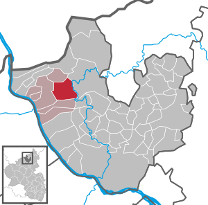
| Location of the local community of Sankt Katharinen (district of Neuwied) in the district of Neuwied | ||
 _in_NR.svg) |
||


Sankt Katharinen (district of Neuwied) is a municipality in the district of Neuwied in Rhineland-Palatinate . The municipality belongs to the Verbandsgemeinde Linz am Rhein , which has its administrative seat in the city of Linz am Rhein .
geography
Geographical location
St. Katharinen is at an altitude of 319 m above sea level. NHN , 6 km northeast of the city of Linz on the Rhine. The district town of Neuwied is 30 km south of the municipality. The village extends into the western foothills of the Westerwald in the Rhine-Westerwald Nature Park . In the north, St. Katharinen borders the local community Vettelschoss , to the east are the communities Neustadt (Wied) and Roßbach , in the south the high elevations of the community Dattenberg and in the west the city of Linz on the Rhine. With the districts of Als-Au and Sengenau, the municipality extends into the Wiedtal .
The highest elevations in the municipality are:
- Strödter Hügel, also Strödter Kopf ( 323.5 m above sea level ), formerly 341 m high, abandoned basalt quarry, lake inaccessible
- Gorse Hahner Kopf (375.6 m), with a 156 meter high transmission mast
- Notscheider Kopf (374.4 m), formerly 396 m high, abandoned basalt quarry, lake accessible
- Hummelsberg (407.4 m), formerly 445 m high, abandoned basalt quarry, lake inaccessible
Community structure
- Als-Au
- Anxbach
- Brochenbach
- Gorse rooster
- Grendel
- Hargarten
- Hilkerscheid
- Hinterlorscheid
- Homscheid
- Kaimig
- Lorscheid
- Noll
- Notscheid
- Rödder
- Sengenau
- Steinshardt
- Strays
Living spaces of the local community St. Katharinen are Klostermühl (Kausemannsmühle), crosses, and Ramheckhöfe Rödderhof.
,_Steinshardt_002.jpg)
history
As part of the Rhineland-Palatinate administrative and territorial reform that began in the mid-1960s, the until then independent municipalities were established on the basis of the "Fifth State Law on Administrative Simplification in the State of Rhineland-Palatinate", which came into force on June 7, 1969 Hargarten , Lorscheid and Notscheid were dissolved and the new community of Sankt Katharinen was formed from them. The districts of the former communities were also dissolved and have since formed the district of St. Katharinen . Previously, the municipal councils of the three municipalities had decided in favor of a merger and chosen the name of the former St. Katharinen monastery located in today's center as the name for the new municipality . In 1974, in the context of the new formation of the community, area corrections were made, which led to the western part of the Ginsterhahn district, which formerly belonged to the city of Linz am Rhein, today belongs to Sankt Katharinen.
Celtic ring wall
The historically researched first settlement in today's local community dates back around 2,500 years. In 1936, the Rhenish provincial administration in Bonn examined a ring wall on Hummelsberg, located in the Hargarten district, which had already been largely destroyed by basalt mining , with the result that the ring wall can be assigned to the Hunsrück-Eifel culture and in the period from 600 to 400 BC BC served as a fortified hilltop settlement. There are no remains of the ring wall.
St. Catherine's Monastery
The first documentary mentions date from around the year 1201, when the aristocratic women's monastery near the Rennburg Castle burned down and Gerhard von Rennenberg and his wife Benedikta von der Neuerburg initiated the foundation or founding of the St. Katharinen Monastery in 1257. The monastery church was built in 1238, parts of which are still preserved in today's parish church. Due to the Reichsdeputationshauptschluss , the monastery was dissolved in 1803.
Catholic Parish Church of St. Catherine
_(02).jpg)
The crucifixion group from the workshop of Hans Backoffen (around 1514, from Eifeler Tuffstein) fell victim to the war on March 13, 1945. Only the body of the Christ body remained. In 1961, as part of the repair of the severe war damage, architect Hansjoachim Neckenig from Neuwied installed it in a modern cross designed by him, which serves to protect the body and at the same time keeps the memory of the horrors of the last days of the war alive. The cross hangs in the chancel of the church.
History of the districts
Since today's local community only came into being in 1969, the most important historical events relating to the districts are listed in chronological form:
- The oldest known form of the name Lorscheid comes from the year 1258.
- The district of Noll is mentioned in 1281 by a tithe donation from Hermann von Rennenberg to the abbey in St. Katharinen.
- The Hilkerscheid district is also mentioned for the first time in 1281.
- A monastery mill on Brochenbach has been documented since 1312. This was destroyed in the 17th century, the monastery ordered a new building above the old mill, after a checkered history the monastery mill burned down in 1958.
- Homscheid is mentioned for the first time in 1670, the place probably originated earlier.
- The Brochenbacher Bannmühle was built in 1681. This mill still exists today and is a listed building.
- The Apollonia chapel in the Hargarten district was built in 1690. The bells are from 1628 and 1718.
- The Strödt district was first mentioned in 1716 in connection with a donation to the abbey in St. Katharinen.
- In the St. Peter's Chapel from 1797 in the Steinshardt district, there is a reliquary plaque dating from around 1511.
Ore and basalt
2.jpg)
In the municipality of St. Katharinen there were several ore mines along the Anxbach, the "Anxbach mine" belonging to the municipality of Neustadt (Wied) is reported to have been ore mining here as early as the 16th century . In 1876 began underground mining , were promoted siderite , but also lead, zinc and copper ores. The residents of Steinshardts were mainly active in mining. The “Anxbach mine” was in operation until 1961.
Also was basalt mining for the region and for the community of considerable importance. Basalt was mined in three quarries ( Hummelsberg , Strödter Kopf and Notscheider Kopf) in the municipality for around a hundred years, from the 1860s to the 1960s .
Population development
The development of the number of inhabitants in relation to today's municipal area; the values from 1871 to 1987 are based on censuses:
.svg)
|
|
politics
Municipal council
The municipal council in Sankt Katharinen consists of 20 council members, who were elected in a personalized proportional representation in the local elections on May 26, 2019 , and the presiding local mayor .
The distribution of seats in the municipal council:
| choice | SPD | CDU | FWG | FDP | total |
|---|---|---|---|---|---|
| 2019 | 1 | 11 | 7th | 1 | 20 seats |
| 2014 | 1 | 12 | 7th | - | 20 seats |
| 2009 | 2 | 11 | 7th | - | 20 seats |
| 2004 | 2 | 13 | 5 | - | 20 seats |
- FWG = Free Voting Community St. Katharinen e. V.
mayor
The honorary local mayor is Willi Knopp (CDU), he was directly elected in the 2014 local elections with 66.4 percent of the vote . In the 2019 local elections, he was confirmed in office with 71.8 percent of the votes.
coat of arms
|
|
Blazon : “Split and divided in front; forward above in silver a continuous black bars cross , the bottom of a silver red key with gothic quatrefoil ride and linkshin inverted bit; back in blue half, broken along the splitting golden Richtrad with eight spokes of the wheel throughout, covered by a fallen silver sword with silver and red double row geschachtem handle. " |
|
Justification of the coat of arms: The black cross indicates that it was part of Kurköln . The fact that part of the community (Hargarten and Notscheid) was once part of the Linz parish is documented by the Petrus key on the Linz city arms. The straightening wheel and sword are the attributes of the martyr St. Catherine , the patroness of the Cistercian monastery that gave the place its name and was founded in the 13th century and closed in 1803 . The interlocking of the sword handle corresponds to the interlaced sloping beam of the Cistercian coat of arms.
The coat of arms has been legally valid since April 2, 1973, draft by AN Schmitz. |
Culture and sights
Cultural monuments
Regular events
- Fun fair in St. Katharinen: on the second weekend in November, since 2010: third weekend in October
- Fair in Hargarten: on the third weekend in May
- Fair in Noll: the last weekend in July
- Kirmes in Notscheid: on the Sacred Heart Weekend (10 days after Corpus Christi)
- Fair in Steinshardt: on the last weekend in July
- Carnival event Hühball des TC Blau Weiß St.Katharinen e. V .: 1st weekend in January
Economy and Infrastructure
Established businesses

In the industrial area in Strödt there is a production facility of the shoe manufacturer Birkenstock as well as the production plant of Niedax GmbH & Co. KG (manufacturer of cable laying systems). In St. Katharinen you also meet the company Oskar Pahlke, which is represented with its main plant on Linzer Straße and since 2013 with Plant II in the Am Rennenberg industrial area.
traffic
To the west of the community runs the federal highway 42 , which leads from Koblenz to Bonn . The next motorway junction is Bad Honnef / Linz am Rhein on the federal motorway 3 .
The next train station is in Linz on the Rhine ( right Rhine route ).
There used to be a station on the Linz (Rhine) –Flammersfeld railway line in the Notscheid district .
Personalities
- Engelbert Engel (born January 21, 1887 in Hargarten, † October 20, 1962 in Trier), Catholic pastor
literature
- Adalbert N. Schmitz: Around the Hummelsberg. The Verbandsgemeinde Linz am Rhein . Ed .: Verbandsgemeinde Linz am Rhein. 1984, p. 103-130 .
Web links
Individual evidence
- ↑ State Statistical Office of Rhineland-Palatinate - population status 2019, districts, communities, association communities ( help on this ).
- ↑ State Statistical Office Rhineland-Palatinate (ed.): Official directory of the municipalities and parts of the municipality. Status: January 2019 [ Version 2020 is available. ] . S. 50 (PDF; 3 MB).
- ↑ Official municipality directory (= State Statistical Office of Rhineland-Palatinate [Hrsg.]: Statistical volumes . Volume 407 ). Bad Ems February 2016, p. 178 (PDF; 2.8 MB).
- ↑ State Statistical Office Rhineland-Palatinate - regional data
- ↑ ELECTION RESULTS. Retrieved May 29, 2019 .
- ↑ The Regional Returning Officer for Rhineland-Palatinate: Local elections 2014, election of the honorary local and city mayors
- ^ The State Returning Officer Rhineland-Palatinate: direct elections 2019. see Linz am Rhein, Verbandsgemeinde, fifth row of results. Retrieved February 20, 2020 .

Cities: Bad Hönningen | Dierdorf | Linz on the Rhine | Neuwied | Uncle . Municipalities: Anhausen | Asbach | Bonefeld | Breitscheid (Westerwald) | Bruchhausen | Buchholz (Westerwald) | Dattenberg | Datzeroth | Dernbach | Döttesfeld | Dry wood | Ehlscheid | Drake | Oath of May | Hammerstein (on the Rhine) | Hanroth | Hardert | Harschbach | Hausen (Wied) | Hümmerich | Isenburg (Westerwald) | Kasbach-Ohlenberg | Kleinmaischeid | Kurtscheid | Leubsdorf (on the Rhine) | Leutesdorf | Linkenbach | Marienhausen | Meinborn | Melsbach | Neustadt (Wied) | Niederbreitbach | Niederhofen | Niederwambach | Oberdreis | Oberhonnefeld-Gierend | Upper wheels | Ockenfels | Puderbach | Ratzert | Raubach | Rengsdorf | Rheinbreitbach | Rheinbrohl | Rodenbach near Puderbach | Rossbach (Wied) | Rüscheid | Saint Catherine | Stebach | Steimel | Street house | Thalhausen | Urbach (Westerwald) | Vettelschoss | Waldbreitbach | Windhagen | Woldert .