
Dierdorf
| coat of arms | Germany map | |
|---|---|---|

|
Coordinates: 50 ° 33 ' N , 7 ° 40' E |
|
| Basic data | ||
| State : | Rhineland-Palatinate | |
| County : | Neuwied | |
| Association municipality : | Dierdorf | |
| Height : | 240 m above sea level NHN | |
| Area : | 31.9 km 2 | |
| Residents: | 5741 (Dec. 31, 2019) | |
| Population density : | 180 inhabitants per km 2 | |
| Postal code : | 56269 | |
| Area code : | 02689 | |
| License plate : | NO | |
| Community key : | 07 1 38 012 | |
| LOCODE : | DE YOU | |
| City structure: | 5 districts | |
| Association administration address: | Poststrasse 5 56269 Dierdorf |
|
| Website : | ||
| City Mayor : | Thomas Vis ( CDU ) | |
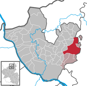
| Location of the city of Dierdorf in the Neuwied district | ||
  |
||


Dierdorf is a town in the Neuwied district in Rhineland-Palatinate . It is the administrative seat of the Verbandsgemeinde Dierdorf and belongs to it.
geography
Geographical location
Dierdorf is located in the Vorderen Westerwald in the so-called "Dierdorfer Senke". The area has long been shaped by forestry and agriculture. The Holzbach , a tributary of the Wied, flows through the city . The next larger cities are Neuwied in the southwest and Altenkirchen and Hachenburg to the north . The neighboring communities are Raubach in the northwest, Marienhausen in the east and Dernbach in the west.
City structure
The districts of Dierdorf are:
| district | Area in ha | Residents |
|---|---|---|
| Dierdorf | 1,146 | 2,780 |
| Brückrachdorf | 569 | 755 |
| Elgert | 552 | 412 |
| Giershofen | 531 | 766 |
| Wienau | 389 | 1,160 |
| total | 3,187 | 5,873 |
(Residents with main residence as of December 31, 2007)
history
Name interpretation
In the first written mention from the year 1204, the place is referred to as Dyrdorph and Dyrdorp . In the following years the spellings Dyrdorf (1344), Deerdorf (1537) and Thierdorff (second half of the 17th century) were used.
There are several attempts at interpretation, but none of them are conclusive. One is based on the assumption that Dierdorf originally consisted of three parts and that the place name originated from "Driedorf" = "Dreidorf". This could also be related to the triangular memorial in the coat of arms, the triangle with the two crossbars was already used in the city seal around 1600. Another possibility for the interpretation is that Dierdorf is derived from "the arid village". In this case, however, “dürr” could be derived from the Franconian “durr” or “dern”, which means “much” or “large” (see also Dürrholz ).
Another interpretation can be found in Henning Kaufmann, Rheinische Städtamen, Munich 1973: He suspects a personal name * Dioro and thus originally * Dierendorf, since place names on -dorf usually contain a personal name in the epithet. This personal name is traced back to the tribe Theuda-, which is provided with the frequent West Franconian r-containing suffix for the nickname Theudaro. This is then shortened to * Theudro-, * Theuro-, * Theoro- and finally to Thīro- and Thēro-. These linguistic processes correspond with the first mentions 1204 Dyrdorph and 1326 Deyrdorph, 1344 Dirdorf.
middle Ages
In the already mentioned documentary mention from the year 1204, Dierdorf and the parish Dyrdorph are mentioned as the property of the Lords of Braunsberg and Isenburg. So Dierdorf was already settled in 1204, the first settlement should date back to around 1100 at the latest. In the first half of the 13th century, the rights of the Rommersdorf Abbey in the parish of Dierdorf are mentioned in a document. In 1324, Count Johann I von Braunsberg, Lord of Isenburg († after 1327), pledged his castle in Dierdorf to the Walpoden Ludwig von Reichenstein, who promised him to keep the truce and to close the castle again immediately after the pledge was repaid vacate. Count Wilhelm I of Wied and Isenburg (1324–1383), a grandson of Johann I, sold his possessions in Dierdorf in 1344 to the Archbishop of Trier and Elector Baldwin of Luxembourg . In this context, the first fair in the Westerwald is mentioned, which took place on St. James' Day and was probably part of the local parish fair. In 1355 Wilhelm I received the Dierdorf properties of the Trier diocese as a fief.
City rights
On June 17, 1357, Count Wilhelm I received city rights for Dierdorf from Emperor Karl IV . During this time, Dierdorf received what was then the main hallmark of a town, a town wall with several towers. Two of the towers and part of the city wall are still preserved. A moat was built around the city, which was flooded by the Holzbach. The castle, already mentioned in 1324, stood outside the city fortifications, presumably on the site of the later built castle on the island of today's castle pond.
Until 1580 Dierdorf has demonstrably no city coat of arms or seal. The oldest existing seal imprint dates from 1651 and shows features similar to today's coat of arms, a triangle with two crossbars, but the triangle pointed downwards.
In 1598, under Count Wilhelm IV von Wied-Runkel (1560-1612), an “economic order” was issued for Dierdorf, which was accepted by the three hosts at the time. The landlords' profit for the wine was limited, the rejection of strangers was forbidden and certain requirements were made for the cleanliness of the rooms and stables, even a "price notice" was prescribed. In 1600 Wilhelm IV also issued the first “church ordinance” as well as the first “school ordinance”. In 1610, an "Authorities Ordinance" followed, which addressed the mayor and the mayor and regulated the guarding of the gates and the safekeeping of the keys.
On July 7, 1957, Dierdorf was granted city rights again after 600 years.

reformation
In 1556, Count Johann IV von Wied († 1581) introduced the Protestant church constitution in Dierdorf. One of Johann IV's uncle was Hermann V. von Wied (1477–1552), who was Archbishop of Cologne from 1515 to 1547 and converted to the Protestant faith after his resignation from the office of bishop. For Dierdorf, as well as for the county, the Heidelberg Catechism was introduced and the Catholic church customs abolished.
Under Count Hermann II von Wied and Isenburg (1580–1631), successor to Wilhelm IV and his nephew, a new “church ordinance” was introduced in 1616, which also regulated compulsory schooling and the behavior of subjects as well as stipulating penalties for offenses. The offenses reproduced here in excerpts seem strange today: falling asleep while preaching, indecent eating and drinking; the death penalty was threatened in the event of rebellion against the authorities or in the case of sorcery. Gypsies were to be expelled from the country.
Thirty Years' War
During the Thirty Years' War , Dierdorf was not spared by the war bands that passed through. In 1620, the troops of Count Anholt occupied the city and moved into their winter quarters here. The Spaniards passed through under Spinola , and in 1622 Dierdorf was occupied by the Spaniards. The troops of the imperial general Tillys followed in 1624 . He was followed in 1625 by soldiers from Kratz von Scharfenstein, in 1627 by soldiers from Wallenstein , and later from Kurtrier and Kurbrandenburg soldiers. In the two decades that followed, Dierdorf was not spared by marching warriors, the population was starving. In 1637 the Dierdorf rule was plundered by eight imperial companies passing through .
Count Hermann II von Wied und Isenburg seems to have made a closer acquaintance with Tilly; in 1624 Tilly is the godfather of Hermann's ninth child, Luise Juliane.
After the war, there were still 97 households in Dierdorf and the villages of Brückrachdorf, Giershofen and Wienau.

Witch trials
There were also witch trials and burnings in Dierdorf until the 17th century . The last witch trial is reported in 1651, around 100 years after the Reformation was introduced in Dierdorf. The interrogations and trials took place in the clock tower. There are detailed protocols and there was a separate court order in which not only the procedure for interrogation, torture and execution was specified, but also the remuneration for the lay judges and the executioner.
According to the existing witch protocols, 91 people were burned as witches in the Dierdorf office, namely from: Dierdorf 23, Giershofen 3, Brückrachdorf 3, Offhausen 1, Wienau 7, Freirachdorf 2, Raubach 9, Elgert 5, Urbach 5, Harschbach 1, Dernbach 2 , Puderbach 5, Muscheid 4, Breitscheid 1, Hanroth 4, Niederhofen 1, Daufenbach 2, Werlenbach 1, Linkenbach 2, Lautzert 1, Wiedischhausen 1.
18th to early 20th century
- 1701: Construction of the castle of the Counts von Wied-Runkel begins and is completed in 1725.
- 1742: The Jewish community of Dierdorf is founded.
- 1755: Capuchins want to build a monastery in Dierdorf. The plan fails because of the resistance of the residents, the count has to revoke his promise.
- 1772: The clock tower receives a new clock, created by the Neuwied clockmaker Kinzing.
- 1781: First documentary mention of a princely Latin school.
- 1805: The Catholic Church is consecrated.
- 1806: Due to the Reichsdeputation Hauptschluss , the sovereign independence of the Princes of Wied-Runkel ends. Dierdorf is awarded to the Prince of Nassau-Usingen and thus the official seat.
- 1815: The Dierdorf office falls to Prussia through the treaties of the Congress of Vienna .
- 1829: The first synagogue in Dierdorf is opened. In 1929 a new building was built which was destroyed in 1938.
- 1838: The city fortifications are largely demolished in order to obtain the building material for the Protestant school building on the dam.
- 1848: Prince Hermann zu Wied-Neuwied, to whom Dierdorf fell after the death of the last Prince zu Wied-Runkel, renounces the rights of rulership to which he is still entitled. The administrative business is now completely transferred to the Prussian government.
- 1872: A large part of the city is destroyed in a large fire, all of the houses on the market square and the town hall become victims of the flames.
- 1902: The castle is closed due to dilapidation. The new evangelical church is built from the stones. The church tower from the Middle Ages remains.
Bombing in 1945

On Palm Sunday, March 25, 1945, the city was bombed and half destroyed in the course of the Allied advance. At that time the city had 71 deaths. More than 50 houses were completely destroyed and many of the remaining houses suffered significant damage. One day later, on March 26, 1945, Dierdorf was occupied by troops of the US Army after brief skirmishes with the remnants of the Wehrmacht .
According to American sources, 67 Marauder B-26 bombers flew the air raid on Dierdorf. They dropped a total of 272 bombs over the target area in 8 attack waves. Each of the bombs weighed 450 kg.
Population development
The following overview shows the population development of Dierdorf (today's territorial status).
|
|

politics
City council
The city council in Dierdorf consists of 22 council members, who were elected in a personalized proportional representation in the local elections on May 26, 2019 , and the honorary city mayor as chairman.
The distribution of seats in the city council:
| choice | SPD | CDU | FDP | FWG | Green | total |
|---|---|---|---|---|---|---|
| 2019 | 5 | 9 | 4th | 2 | 2 | 22 seats |
| 2014 | 6th | 12 | 2 | 2 | - | 22 seats |
| 2009 | 8th | 9 | 3 | 2 | - | 22 seats |
| 2004 | 7th | 8th | 2 | 5 | - | 22 seats |
mayor
Mayor of Dierdorf has been Thomas Vis from the CDU since 2009. In the 2019 local elections, he was re-elected in a runoff election with 57.7 percent of the votes cast.
Incorporations
As part of the administrative and territorial reform that began in Rhineland-Palatinate in the mid-1960s , the previously independent local communities Brückrachdorf (438 inhabitants), Giershofen (470) and Wienau (458) became the city of Dierdorf with effect from June 7, 1969 incorporated and have been districts since then. The also independent local community Elgert (264) was incorporated with effect from March 17, 1974.
Town twinning
- Since 1995, the town of Dierdorf and the French municipality of Courtisols in north-eastern France in the historic Champagne region have been twinned.
- A partnership with Fountain Hills , Arizona, USA has also existed since 2005 . This emerged from a student exchange that has existed between the Martin-Butzer-Gymnasium in Dierdorf and the Fountain Hills-High-School since 1998 .
coat of arms
|
|
Blazon : "In gold a black Gemerk in the form of two upward tapered, chamfered at the corners and gable inflated by a broken triangular beams." |
| Reasons for the coat of arms: The triangular memorandum, probably an old place name or district mark, appears first in prints of the Dierdorf town seal from 1651. Origin and meaning are unknown. The coat of arms has been legally valid since April 16, 1958. |
Attractions
Castle park with castle pond
The royal palace of the princes of Wied-Runkel stood on the island in the castle pond until 1902 . The castle was built in 1701. As early as 1324, a moated castle is mentioned here. Today the park, pond and island are used for leisure and sport.
Mausoleum of the princes of Wied-Runkel

This neo-Gothic grave chapel was built between 1816 and 1821 under Prince Karl Ludwig Friedrich Alexander zu Wied-Runkel . The mausoleum in Dierdorf served as the tomb of the Princely House and to keep the tombs of his ancestors. Here you can also see the tombstone of the Archbishop of Cologne and Elector Salentin von Isenburg, originally in the Rommersdorf Abbey , showing Salentin in knight armor.
Owl Tower and city fortifications
From the city fortifications built after 1357, remnants of the city wall are still preserved along the dam on the Holzbach. The "Owl Tower", an approximately 27 m high round tower, is a typical defense tower for the Middle Ages and also served as a dungeon. How the "Untertorturm" got the name "Owl Tower" is not known.

Clock tower and Kinzinguhr
The approximately 24 m high "clock tower" was also part of the city fortifications from the 14th century as the "Obertorturm". Later, after the city fortifications were expanded, it was given the name "Central Tower". Numerous witch trials took place here in the 17th century , at least 23 people were executed during this time. The tower was later used by the city guard as an apartment. It has been called the "clock tower" since the beginning of the 17th century, and there was a city clock on the tower as early as 1601. Today's clock on the top of the tower was created by Christian Kinzing in 1772 and the original has been preserved.
Protestant church
The Evangelical Church in its current form was built in 1903 and 1904. Stones from the castle that was laid down in 1902 were used as building material for the quarry stone church. The glass windows were created by the workshop Rudolf and Otto Linnemann from Frankfurt.
The tower essentially comes from the previous church, which was built around 1200 and was dedicated to St. James. Since Count Johann IV of Wied , and with him the entire county to which Dierdorf belonged at the time, converted to the Protestant faith in the middle of the 16th century, the previous church was the Protestant parish church of Dierdorf.
Catholic parish church of St. Clement
The previous church of the Catholic parish church of St. Clemens was completely destroyed in the bombing of Dierdorf on March 25, 1945. The previous church was built between 1803 and 1805. The baptismal font from 1848 has been preserved from her in the new church, which was built between 1948 and 1950.
"Copper house"
The copper house , near the castle park, was built in 1933 as a residence by the then Wiedi hereditary prince couple Hermann and Maria Antonia. The special feature was that the outer walls were clad with copper and the roof was also covered with copper sheets. All copper was removed in the early 1940s for “war needs”. After 1945 the house served as refugee accommodation and as a Wiedische chief forester. The eldest son of Hermann and Maria Antonia, Friedrich Wilhelm Prinz zu Wied , lived here in the first post-war years and attended the local rectorate school. From the royal family, Marie Antonia von Gordon , Princess zu Wied, last lived in this house until 2003. The house has been uninhabited since then and was demolished in 2019.
See also
List of cultural monuments in Dierdorf
Economy and Infrastructure
traffic
Dierdorf is on the A 3 , exit 37, roughly halfway between Cologne / Bonn and Frankfurt . The B 413 , which runs through the city, connects Dierdorf with Neuwied and Hachenburg .
Dierdorf is crossed by the Holzbachtalbahn , which, however, is only used for freight traffic on this section (restarted March 3, 2006). The Dierdorf train station (Bz. Koblenz) has been closed since 1984, it is now owned by the TWE company and will therefore not be available in the future either. On the outskirts of the urban area, the high-speed route Cologne – Rhein / Main runs along the motorway , the nearest train station being in Montabaur .
The Dierdorf-Wienau airfield is located in the Wienau district . It is used for aviation operations in the summer and is classified as a special airfield .
Established businesses
- TWE Dierdorf GmbH & Co. KG (formerly: Lohmann Vliesstoffe)
schools
In the 1950s, the city became an important school location. In 1956 the first Abitur took place at the Martin-Butzer-Gymnasium . In 1955 a secondary school branch was spun off. The later Nelson-Mandela secondary school emerged from this. The primary and secondary school has been called the Gutenberg School since 2004. From the school year 2010/2011, the Realschule will be converted into a Realschule Plus. The main school classes are therefore accepted. The Gutenberg School will be a pure elementary school.
Personalities
Honorary citizen
- Friedrich Wilhelm Prince zu Wied (1931–2000), entrepreneur, patron , president of the “ International Council for Game and Wildlife Conservation ”, member of the Neuwied City Council and the Neuwied District Council, sponsor and member of the board of trustees of the Johanniter Hospital in Dierdorf
Sons and daughters of the city of Dierdorf
- Wilhelm Marmé (1832–1897), pharmacologist and university professor
- Willy Abel (1875–1951), designer and inventor
- Ernst Heydorn (1904–1979), politician (FDP) and member of the state parliament
- Eva Grebel (* 1966), astronomer, professor at the Center for Astronomy at Heidelberg University
- Guido Hammesfahr (* 1968), actor
- Juan Holgado (* 1968), Spanish archer (Olympic champion 1992)
literature
- City of Dierdorf (Hrsg.): Dierdorf… pretty much up front in the Westerwald - 650 years of the city. ISBN 978-3-00-021016-7 .
- Wilhelm Groß: From ancient times I - Chronicle of Dierdorf. New edition of the original edition from 1900. Reinhard Zado Verlag, Niederhofen 2002, ISBN 3-936256-02-0 .
- Heinrich Neu and Hans Weigert: The art monuments of the Neuwied district. L. Schwann, Düsseldorf, 1940, pp. 83-97.
Web links
- Website of the Verbandsgemeinde Dierdorf
- Castle and location (PDF; 176 kB) at hermann-joseph-loehr.de
Individual evidence
- ↑ State Statistical Office of Rhineland-Palatinate - population status 2019, districts, communities, association communities ( help on this ).
- ↑ State Statistical Office Rhineland-Palatinate: Regional data.
- ^ The Regional Returning Officer Rhineland-Palatinate: Local elections 2019, city and municipal council elections
- ↑ Candidate Thomas Vis: "Developing Dierdorf as a digital city"
- ↑ The Regional Returning Officer: Local elections 2019, results of direct elections
- ↑ Official municipality directory 2006 ( Memento from December 22, 2017 in the Internet Archive ) (= State Statistical Office Rhineland-Palatinate [Hrsg.]: Statistical volumes . Volume 393 ). Bad Ems March 2006, p. 174 (PDF; 2.6 MB). Info: An up-to-date directory ( 2016 ) is available, but in the section "Territorial changes - Territorial administrative reform" it does not give any population figures.

Cities: Bad Hönningen | Dierdorf | Linz on the Rhine | Neuwied | Uncle . Municipalities: Anhausen | Asbach | Bonefeld | Breitscheid (Westerwald) | Bruchhausen | Buchholz (Westerwald) | Dattenberg | Datzeroth | Dernbach | Döttesfeld | Dry wood | Ehlscheid | Drake | Oath of May | Hammerstein (on the Rhine) | Hanroth | Hardert | Harschbach | Hausen (Wied) | Hümmerich | Isenburg (Westerwald) | Kasbach-Ohlenberg | Kleinmaischeid | Kurtscheid | Leubsdorf (on the Rhine) | Leutesdorf | Linkenbach | Marienhausen | Meinborn | Melsbach | Neustadt (Wied) | Niederbreitbach | Niederhofen | Niederwambach | Oberdreis | Oberhonnefeld-Gierend | Upper wheels | Ockenfels | Puderbach | Ratzert | Raubach | Rengsdorf | Rheinbreitbach | Rheinbrohl | Rodenbach near Puderbach | Rossbach (Wied) | Rüscheid | Saint Catherine | Stebach | Steimel | Street house | Thalhausen | Urbach (Westerwald) | Vettelschoss | Waldbreitbach | Windhagen | Woldert .