
Reichelsheim (Wetterau)
| coat of arms | Germany map | |
|---|---|---|
.png)
|
Coordinates: 50 ° 21 ' N , 8 ° 52' E |
|
| Basic data | ||
| State : | Hesse | |
| Administrative region : | Darmstadt | |
| County : | Wetteraukreis | |
| Height : | 128 m above sea level NHN | |
| Area : | 27.6 km 2 | |
| Residents: | 6706 (Dec. 31, 2019) | |
| Population density : | 243 inhabitants per km 2 | |
| Postal code : | 61203 | |
| Area code : | 06035 | |
| License plate : | FB, BÜD | |
| Community key : | 06 4 40 021 | |
| LOCODE : | DE RLM | |
| City structure: | 6 districts | |
City administration address : |
To the town hall 1 61203 Reichelsheim |
|
| Website : | ||
| Mayor : | Bertin Bischofsberger ( CDU ) | |
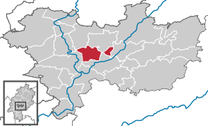
| Location of the city of Reichelsheim (Wetterau) in the Wetterau district | ||
 _in_FB.svg) |
||

Reichelsheim (Wetterau) is a city in the Hessian Wetteraukreis .
geography
location
Reichelsheim is located between Frankfurt am Main and Gießen , in the heart of the "Goldenen Wetterau " (about 30 km north of Frankfurt). The Horloff river flows east of Reichelsheim . Reichelsheim is divided by the Friedberg-Nidda railway line . To the northwest of the railway line are the new development area and the mixed area Im Mühlahl . The old Reichelsheim town center is located southeast of the railway line; adjoining it is the old new building area (1960s). In the northeast, the mixed area Im Mühlahl borders the nature reserve Bingenheimer Ried .

Neighboring communities
Reichelsheim borders in the north on the communities Wölfersheim and Echzell , in the east on the community Ranstadt , in the south on the city of Florstadt , and in the west on the city of Friedberg .
City structure
Reichelsheim comprises five districts.
| district | coat of arms | |
|---|---|---|
| Beienheim | 1574 | |
| Blofeld | 441 | |
| Dorn-Assenheim | 1285 | |
| Hypocritical home | 414 | |
| Reichelsheim ( core town ) | 2151 | |
| Weckesheim | 1036 |
history
middle Ages
The oldest surviving mention of Reichelsheim comes from the year 817. There is even a surviving mention of 773 for the Beienheim district. In the late Middle Ages , the lords of Hanau occupied the place temporarily .
Early modern age
Reichelsheim belonged to the Fuldischen Mark and was then from 1566 a Nassau exclave , enclosed by the territory of the Landgraviate Hessen-Darmstadt . Reichelsheim later belonged to the County of Nassau-Weilburg . In 1665 it was granted city rights by Count Friedrich and in 1668 the young city received market rights . From 1787 Reichelsheim was the seat of the Reichelsheim office
Modern times
After the German War , Nassau was annexed by Prussia . In Art. 15 No. 3 of the peace treaty of September 3, 1866 , an exchange of territory was agreed. The Reichelsheim office was added to the Grand Duchy of Hesse , where it was assigned to the Friedberg district (Hesse) . The consequence of the transition to the Grand Duchy of Hesse was that a nested particular law applied: In addition to Hessian law, Nassau law, which in turn overlaid Mainz land law, and - under customary law - also Title 28 of the Solms land law (matrimonial property law), but not in full . It was not until January 1, 1900, when the Civil Code , which was uniformly valid throughout the German Reich , that the old particular law was suspended.
As part of the regional reform in Hesse , the new town of Reichelsheim / Wetterau was formed on February 1, 1972 through the amalgamation of the town of Reichelsheim with the communities of Beienheim, Dorn-Assenheim from the Friedberg district and the Blofeld and Heuchelheim communities from the Büdingen district. Reichelsheim was designated as the administrative seat. On August 1, 1972, the Weckesheim community was incorporated by virtue of state law. At the same time, the city was incorporated into the newly formed Wetteraukreis.
politics
City Council
The local elections on March 6, 2016 produced the following results, compared to previous local elections:
| Parties and constituencies |
% 2016 |
Seats 2016 |
% 2011 |
Seats 2011 |
% 2006 |
Seats 2006 |
% 2001 |
Seats 2001 |
||
|---|---|---|---|---|---|---|---|---|---|---|
| SPD | Social Democratic Party of Germany | 44.3 | 12 | 42.9 | 11 | 52.5 | 16 | 53.2 | 17th | |
| CDU | Christian Democratic Union of Germany | 31.8 | 9 | 39.9 | 11 | 40.7 | 13 | 36.9 | 12 | |
| GREEN | Alliance 90 / The Greens | - | - | 11.1 | 3 | - | - | - | - | |
| FWG | Free voter community Reichelsheim | 23.9 | 6th | 6.1 | 2 | 6.8 | 2 | 7.4 | 2 | |
| FDP | Free Democratic Party | - | - | - | - | - | - | 1.3 | 0 | |
| NPD | National Democratic Party of Germany | - | - | - | - | - | - | 1.2 | 0 | |
| total | 100.0 | 27 | 100.0 | 27 | 100.0 | 31 | 100.0 | 31 | ||
| Voter turnout in% | 57.0 | 51.1 | 48.9 | 58.9 | ||||||
mayor
Bertin Bischofsberger (CDU) has been mayor of Reichelsheim since 2009. He was elected to office on September 21, 2008 in the second ballot with 50.4 percent of the vote. The turnout was 52.9 percent.
Before that, Gerd Wagner (SPD) was mayor from 1985 to 2008.
coat of arms
In a divided shield, above in the blue gold-shingled field a striding, golden lion with red armor, below in gold a black cross, surrounded by two red vine leaves. The colors blue and gold as well as the lion are a reminder of the former belonging to the Nassau house. The cross points back further into history, namely that the place belongs to the Fulda Mark. The vine leaves are to be understood as a symbol for the historically documented viticulture in the district.
Cultural monuments
See the list of natural monuments in Reichelsheim / Wetterau
Economy and Infrastructure
traffic
The Reichelsheim train station, which has been manufactured by the Kibri company as a mirror-inverted H0 model for some time, became world-famous . The double-track Reichelsheim train station as well as the Weckesheim stop are on the single- track Beienheim – Schotten railway line , on which the Hessian state railway runs every hour in the direction of Friedberg and Nidda. The Beienheim separation station is also located in the Reichelsheim district of the same name.
The public transport , the transport company Oberhessen GmbH as part of the Rhine-Main Transport Association safely.
The German Limes Cycle Route runs through the city. This follows the Upper German-Raetian Limes over 818 km from Bad Hönningen on the Rhine to Regensburg on the Danube .
The Reichelsheim airfield, classified as a commercial airfield, is located south of Reichelsheim . On June 12, 2011, a Goodyear airship crashed here . Three passengers survived, the pilot was killed.
Brown coal
Until 1991, the area around the Reichelsheim districts Reichelsheim, Heuchelheim, Dorn-Assenheim and Weckesheim was characterized by lignite underground and open-cast mining. The lignite was mined by HEFRAG , later PREAG , and processed in the Wölfersheim power plant . Initially, the lignite was extracted in civil engineering . At that time there were pits in Heuchelheim and Weckesheim. In 1961 the company switched to open-cast mining and the mining operations for opencast mines II / III (Weckesheim / Heuchelheim), opencast mines VI (Reichelsheim) and VII (Dorn-Assenheim) were gradually started. The lignite was transported to the coal-fired power station in Wölfersheim using the company's own mine railway . For this purpose, a loading bunker was built west of Reichelsheim. The lignite got there from the opencast mines VI / VII on conveyor belts.
On September 30, 1991, the last lignite was mined from open pit VII. At the end of October, the supplies at the Wölfersheim power plant were also exhausted and operations were stopped.
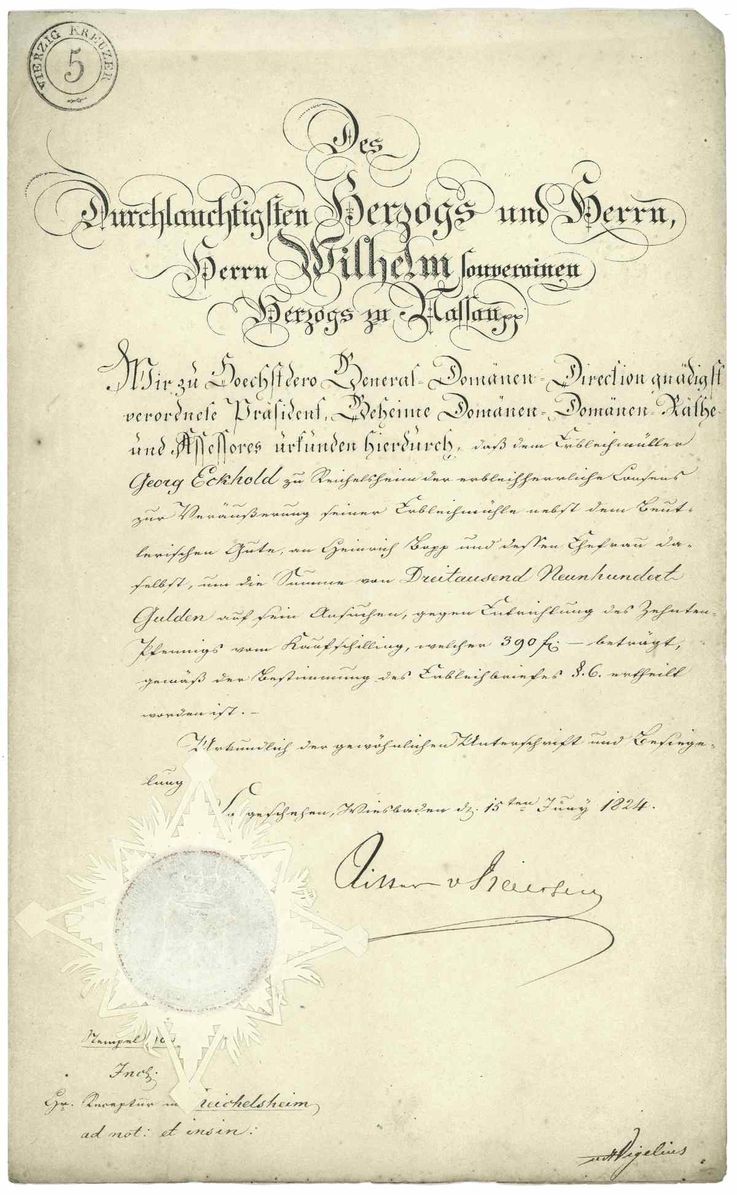
Mill

The former Reichelsheim mill was sold to the miller Heinrich Bopp in 1824 and operated by him and later by his son Heinrich Wilhelm Bopp until 1926. From 1977 to 1988 the mill was the home for a dozen young people and the location for the social-educational youth housing group Reichelsheim (formerly Jugendwerk St. Gottfried, Ilbenstadt ).
Personalities
- Gerhard Herbert (* 1955), politician (SPD)
- Karl von Buseck (1776–1852), member of the Hessian state parliament
literature
- Dieter Wolf , On the medieval fortification of villages and spots in the Wetterau - with special consideration of Rodheim vor der Höhe. in: Rodheimer Hefte Nr. 2, 1996, pp. 25-83. zu Reichelsheim, pp. 75-78.
- Literature about Reichelsheim in the Hessian Bibliography
- Literature by and about Reichelsheim in the catalog of the German National Library
Web links
- Internet presence of the city of Reichelsheim / Wetterau
- Alexander Hitz: Reichelsheim in the Wetterau. Local history, information. In: www.alexanderhitz.de. Private website
- Reichelsheim in der Wetterau, municipality, Wetteraukreis. Historical local dictionary for Hessen. In: Landesgeschichtliches Informationssystem Hessen (LAGIS).
- Reichelsheim in the Wetterau, Wetteraukreis. Historical local dictionary for Hessen. In: Landesgeschichtliches Informationssystem Hessen (LAGIS).
- Link catalog on Reichelsheim at curlie.org (formerly DMOZ )
Individual evidence
- ↑ Hessian State Statistical Office: Population status on December 31, 2019 (districts and urban districts as well as municipalities, population figures based on the 2011 census) ( help ).
- ^ City of Reichelsheim: Inhabitants and areas
- ^ Uta Löwenstein: County Hanau . In: Knights, Counts and Princes - Secular Dominions in the Hessian Area approx. 900–1806 = Handbook of Hessian History 3 = Publications of the Historical Commission for Hesse 63. Marburg 2014. ISBN 978-3-942225-17-5 , p. 209 .
- ↑ Printed by: Ernst Rudolf Huber: Documents on German Constitutional History 2 = German Constitutional Documents 1851–1900. 3rd edition, Stuttgart 1986. ISBN 3-17-001845-0 , No. 192, pp. 260ff.
- ↑ Arthur Benno Schmidt : The historical foundations of civil law in the Grand Duchy of Hesse . Curt von Münchow, Giessen 1893, p. 108 and notes 38 and 40.
- ^ Reichelsheim in der Wetterau, Wetteraukreis. Historical local dictionary for Hessen. (As of May 4, 2017). In: Landesgeschichtliches Informationssystem Hessen (LAGIS).
- ↑ Law on the reorganization of the districts of Büdingen and Friedberg (GVBl. II 330-19) of July 11, 1972 . In: The Hessian Minister of the Interior (ed.): Law and Ordinance Gazette for the State of Hesse . 1972 No. 17 , p. 230 , §§ 7 and 18 ( online at the information system of the Hessian state parliament [PDF; 1,2 MB ]).
- ^ Result of the municipal election on March 6, 2016. Hessian State Statistical Office, accessed in April 2016 .
- ↑ deed 1824
- ↑ Reichelsheim Mill

Altenstadt | Bad Nauheim | Bad Vilbel | Büdingen | Butzbach | Echzell | Florstadt | Friedberg (Hesse) | Gedern | Glauburg | Hirzenhain | Karben | Kefenrod | Limeshain | Munzenberg | Nidda | Niddatal | Ober-Mörlen | Ortenberg | Ranstadt | Reichelsheim (Wetterau) | Rockenberg | Rosbach v. d. Height | Wölfersheim | Wöllstadt