
Ruma
|
Рума Ruma |
|||||
|
|||||
| Basic data | |||||
|---|---|---|---|---|---|
| State : | Serbia | ||||
| Province : | Vojvodina | ||||
| Okrug : | Srem | ||||
| Opština : | Ruma | ||||
| Coordinates : | 45 ° 0 ′ N , 19 ° 50 ′ E | ||||
| Height : | 111 m. i. J. | ||||
| Residents : | 30,656 (2011) | ||||
| Telephone code : | (+381) 22 | ||||
| Postal code : | 22400 | ||||
| License plate : | RU | ||||
| Structure and administration | |||||
| Community type: | city | ||||
| Website : | |||||


Ruma ( Serbian - Cyrillic Рума ) is a small town in the Serbian Okrug Srem . According to the 2011 census, the administrative center of the municipality named after her has 30,656 residents.
Ruma is located on the edge of the East Syrmian Loess Plateau in the Pannonian Plain south of the Danube and Fruška Gora and north of the Sava lowlands . The city is a traffic junction on the connecting axes west-east ( European route 70 ) and north-south ( Bosnia - central Serbia - Vojvodina ).
geography
location
Ruma is located at an altitude of 111 m in the center of the East Syrmian Intercurrent Land. The 45th parallel runs through Ruma, which defines the transition from the subtropical zone to the temperate zone . Therefore, the number 45 is also shown in the city arms. The urban area of Ruma is essentially divided by three brooks of the Fruška Gora. The central urban area is bordered by the Kudoš brook to the west and by the Borkovačka brook to the east. The district of Breg lies between the loess plateau, which is formed by the Borkovčka reka and the Jelence brook. The center of Ruma is on the right side of the Borkovačka reka.
topography
Despite the location in a lowland area, differences in altitude are evident in Ruma due to the peripheral location on the gently sloping Syrmian Loess Plateau and the gentle rise to the north towards the Fruška Gora. The loess plateau in the area around Ruma drops from about 200 m to 100 m at the edge of the plateau at a distance of 10 km. In the actual urban area, the northern parts of the city are in Kudoš and Borkovačko naselje at 115 m and sink to the train station in the south to 94.4 m. The official height is given as 111.1 m. The Borkovačka reka valley is the only river that cuts through the inner city of Ruma. The Muldental of the Borkovačka reka is only built up in the central part along the main road due to its steep slopes. In the northern part of the Borkac valley in particular, it is forested and is used for recreation (sports facilities).
geology
Geologically, Ruma is located on the edge of the East Syrmian loess plateau on Young Pleistocene loess . The Srem loess plateau is up to 30 m thick. A 20 m thick loess profile near Ruma contains numerous paleo soils . The sequence of cold-time loess and warm-time soil formations impressively documents climate changes in the Pleistocene .
The relief of the loess plateau, which slopes gently to the south, is characterized by undulating loess knolls and hollow valleys cut into them by the numerous streams of the Fruška Gora. At the streams of the Kudoški potok , Jelenci potok and Borkovačka reka , the loess sediments have created profiled slopes. The meandering to meandering streams in deep and wide hollow valleys have irregular arches and the highest natural cutting depths of all flatland water types. Numerous reservoirs have been created there through water management measures. Since the almost vertical banks, undercut on the impact slopes, remain stable due to the cohesive loess material, practically no erosion protection measures are necessary. The accumulations of several hectares in the Borkovačko and Pavločacko (Kudeško) jezero are used as popular summer bathing lakes and serve to irrigate fruit and vegetable plantations.
Natural landscape and vegetation
The peripheral position in the Pannonian Basin corresponds to the natural landscape transition position of Syrmia, which is characterized by a more oceanic east and south and a more continental west. The dominant features of the semi-arid tree (semi) steppes of the East Syrmian lowlands on the Loess Plateau are contrasted by the more oceanic West Syrmian alluvial forests and the formerly swampy areas of the East Syrmian lowlands. The loess plain of Eastern Syrmia was an open landscape with sparse trees and a steppe flora of the Pannonian type, even before the agricultural overprint. The characteristic species of the steppe flora include, for example, the grass species Stipa joannis , Festuca (Association Festucion rupicolae ) and Sesleria . Artemisio-Festucetum pseudovinae salt marshes are characterized by Artemisia monogyna and Festuca pseudovina . Among others are still Centaurea sadleriana and Adonis vernalis and the steppe trees Acer tataricum and Quercus pubescens (Association Aceri tata rico-Quercion typical).
climate
Despite the location, Ruma's climate is temperate continental with severe winters and hot summers. Precipitation maxima coincide with the highest level of the sun. On the other hand, midsummer and late summer (July to September) are dry. The long warm phase, which extends from March to October, is remarkable. As early as the middle of March, the radiation gains are higher than the radiation losses. This early positive gain in radiation affects the rapid change of seasons from winter to spring and from spring to summer. Due to the stable high pressure situation, late summer is extended to an Indian summer ( Miholjsko leto ) by several weeks. The change to autumn is all the more pronounced.
Since there is no official meteorological station of the Hidrometeorološki Zavod Srbije in Ruma, only the nearest official weather station in Sremska Mitrovica, 17 km away, can be used for the climatic conditions. The data come from the control period 1981–2010. Since it can be assumed with a comparable location and altitude that only the air humidity due to the Sava River flowing through Sremska Mitrovica differs more (due to the higher evaporation above the water surface), the data from the Sremska Mitrovica weather station are listed below.
| Sremska Mitrovica | ||||||||||||||||||||||||||||||||||||||||||||||||
|---|---|---|---|---|---|---|---|---|---|---|---|---|---|---|---|---|---|---|---|---|---|---|---|---|---|---|---|---|---|---|---|---|---|---|---|---|---|---|---|---|---|---|---|---|---|---|---|---|
| Climate diagram | ||||||||||||||||||||||||||||||||||||||||||||||||
| ||||||||||||||||||||||||||||||||||||||||||||||||
|
Average monthly temperatures and precipitation for Sremska Mitrovica 1981–2010
|
||||||||||||||||||||||||||||||||||||||||||||||||||||||||||||||||||||||||||||||||||||||||||||||||||||||||||||||||||||||||||||||||||||||||||||||||||||||||||||||||||||||||||||||||||||
City structure
Ruma is divided into the districts of Berak, Tivoli, Kudoš, Borkovačko naselje, Vrbare and Breg. The village of Voganj is 1.5 km west of Tivoli am Rumski drum, 9 km to the north is the village of Pavlovci and 12 km south of Buđanovci. In the eastern part of the city, east of the district of Breg in the Maledine parcel behind the cattle market square (Vašarište), there is a larger Roma settlement.
population
Ruma has 32,229 inhabitants (2002).
Ethnic groups in Ruma:
politics
Municipal council
In the Serbian municipal elections on May 6, 2012, with 27,435 ballots cast, 57.5% of those eligible to vote took part. According to this, five parties are represented in the municipal council of Opština Ruma with the following distribution:
| Political party | DS | SNS | SRS | SPS-PUPS * | DSS | total |
| Seats | 14th | 11 | 7th | 6th | 5 | 43 |
| Share of votes | 25.6% | 19.8% | 12.5% | 13% | 9.3% | 100% |
* SPS-PUPS: community of voters
Community partnerships
-
 Samtgemeinde Bersenbrück ( Germany ), since 2017
On November 24, 2017, the Bersenbrück municipality and the Serbian municipality of Ruma entered into a partnership.
history

prehistory
The beginnings of human settlement in the area of today's Ruma date back to prehistory . At the Gomolava locality , a tell with stratifiable layers from the middle Neolithic Vinča culture , the Copper Age Baden and Kostolac culture, the middle to late Bronze Age , La Tène I and II , the Roman epoch up to the Middle Ages was archaeologically excavated. Pre-Roman cultures in the region are attested by Illyrians and Celts .
Roman city of Bassianae
Not far from the Ruma village Donji Petrovci ten kilometers east of Ruma on the Roman Jarčina Canal was the second largest Roman city of Syrmia , Bassianae. Parts of a Roman castrum were also exposed between the villages of Dnji Petrovci and Dobrinci. Bassianae became a Municipium in AD 124, and Colonia in 214 at the latest. As one of the most important cities of Pannonia secundas, a high Roman official resided there as procurator gynaecii Bassianensis Pannoniae secundae . In the 4th century Bassianae had a gynaecia (imperial wool weaving). Destroyed by the Huns in the 5th century, Bassianae fell to the Byzantine Empire in 510, and in the late 6th century, Bassianae was finally destroyed by the Avars .
The city of Ruma in the Middle Ages and during the Ottoman era

A medieval market town in the area of today's Ruma called Arpatarlo was first mentioned in 1324. The cemetery on today's northwestern outskirts on the Kudoš brook refers to Arpatarlo. Archaeological excavations during the construction of the motorway in Syrmia in 1983 revealed graves from the 10th to 15th centuries at the Stara Kudoška livada land mark . Outlines of a simple clay church from the 12th century have also been excavated there. Even under Hungarian rule , the towns north of Ruma on the slopes of the Fruška Gora developed. Irig remained superior to Ruma in importance until the 18th century. In Vrdnik, one of several fortifications from medieval times has been preserved that the Hungarians built on the slopes of the Fruška Gora to ward off the Ottomans . In 1521 the Ottomans razed the Vrdnik castle and in 1526 Peterwardein fell . In 1556/57 Ruma was mentioned as a middle-sized village in a Syrmian Defter . The place was populated by Serbs who had a church and a clergyman. As a Serbian-settled village under Ottoman rule, Ruma continued to exist in the subsequent period.
The Ottomans administered Syrmia with a western and an eastern district, in each of which a pasha resided ( Ilok and Peterwardein). From Peterwardein there was only one important land connection in a north-south direction to Jelence. The Ottoman military camp Ruma was built there under Sultan Ahmed I at the beginning of the 17th century. The field name Pašino Polje ( Pascha field ) in the east of Ruma can be traced back to this. The villages of Jelence and Alt-Ruma were merged to provide food for the military personnel, and the Borkovacbach was repopulated. The Ruma military camp existed from the early 17th century until the Great Turkish War (1683–1699). Syrmia itself was the main theater of the decisive battles. In 1688 the imperial troops stormed Belgrade and in 1691 they defeated the Ottomans in the Battle of Slankamen . The Peace of Karlowitz in 1699 was signed in the Syrian town of Sremski Karlovci . This led to the division of Syrmia into a Habsburg and an Ottoman domain. Ruma, lying exactly on the border, remained in the Ottoman Empire. In 1717, in the decisive battle of Peterwardein , the remaining part of Syrmia was incorporated into the Habsburg Empire for 200 years in the Peace of Passarowitz in 1718.
The agricultural basis of Hungary and thus Syrmia was severely affected by the Turkish wars. Villages fell into disrepair and farmland was reclaimed by nature. The reconstruction in Ruma took place through efforts of the court chamber in Vienna to repopulate the devastated regions. After Claudius Florimund Count Mercy made the first successful attempt in Weißenkirchen in 1725 to settle German settlers across the Danube in the Banat and later also in Syrmia, more settlers were recruited in the regions of Central Europe that were impoverished by the Thirty Years War . Ruma fell with the regions of western Syrmia as a fief in 1728 to Count Johann Baptist von Colloredo and Waldsee. After the Croatian Baron Marko Pejačević had leased this property, the modern history of New Ruma began with the establishment of the military border and the purchase of the Mitrowitz property by Baron Pejačević in 1745 from the Counts of Colloredo and Waldsee for 80,000 Rhenish guilders .
Rumas re-founded in 1746 and Swabian colonization

The re-establishment of Rumas became necessary after the military border in Syrmia had been re-established in 1745 and Baron Marko Pejačević had to look for a new center of his domain by confiscating almost two thirds of his property. So in 1746 a large new settlement with right-angled streets was created as the center of the Pejačević possessions. The streets were drawn in a west-east direction. From north to south these were Stefanigasse, Hauptstrasse and Johannesgasse. In the north-south direction, the main streets were crossed by narrower streets.
The city was granted numerous privileges to encourage the settlement of colonists. The first residents of Ruma were the resettled Serbs of old Ruma. With the arrival of a large group of German settlers who came to Ruma across the Danube from Regensburg in so-called Ulmer Schachteln in 1746, Ruma began to grow into the cultural center of the German nationality of Syrmia. In a short time the population of the German settlers grew to 60 percent of the population and Ruma soon became the agricultural center of Syrmia.
The first German Rumanians, who were appointed in several groups for trial settlement in the years 1746–1748, came mostly from the northern Bavarian administrative districts of Upper Palatinate , Upper and Lower Franconia . Only a few came from Lower and Upper Bavaria. Due to the folk costumes of the 18th century, most of them probably came from the area of the Bamberg diocese . The ships were made of raftsman wood that was washed down the Lech on the Danube. The ship columns of the emigrants were assembled in Regensburg, where the emigrants of the car columns from Bamberg and Nuremberg were embarked. With a passport, which was approved by the Austrian embassy in Munich, the emigrants were given permission to travel for a month down the Danube to Sremski Karlovci . The settlers were then brought from Sremski Karlovci to Ruma in 30 large wagons.
In 1749 Ruma was granted the status of a free trading town, with the right to hold some fairs every year as well as a Sunday market. The first mass took place in Ruma as early as 1747.
The Charter Povelja slobode i raznih pogodnosti ( Charter of Freedom and Other Privileges ) of January 1, 1749, which Baron Marko Pejačević gave the trading town, made Ruma attractive to the new settlers. Larger groups of German settlers finally came in 1749 and 1762, so that a large part of Ruma's residents were of German descent. The other inhabitants were Croatians and Magyars .
In 1762, the general mail service, which also took care of travel, was started for the first time. The mail and tourist traffic took place from Osijek via Vukovar to Sremska Mitrovica and then on from Ruma to Zemun . From Ruma a second line branched off to Sremski Karlovci and Irig. Ruma developed into a handicraft and trading center, in which more than half of the population belonged to the German nationality until 1944 .
Third Schwabenzug 1786
In 1786, in the third and last Swabian procession, Protestant and Reformed colonists settled in Ruma under Emperor Josef II, who arrived in the spring of 1786 at a request from Pejačevic in 1784. Since the Catholic old colonists feared for their privileges and Baron Pejačević had made no arrangements for the 557 families of the new settlers and also did not approve any support, the majority of these Ruma colonists had to go to about 100 caves that were dug in the loess slopes of the streams Outlast winter. 338 of these new settlers fell victim to the cold and hunger in the winter of 1786/87. The survivors later moved to the Batschka and founded the village of Jarek there .
Until the First World War
The economy took a steady upswing from the 19th century and beer breweries, shoe and leather processing and brickworks established themselves. In 1883 Ruma was connected to the Syrian railway from Zemun via Indija to Sremska Mitrovica. On September 15, 1901, the Royal Hungarian State Railways commissioned the Ruma – Klenak local railway (approx. 30 km long) , which promised a significant improvement in export and import traffic between Hungary and Serbia.
Telephone traffic was introduced in 1904. With the upswing of the railroad, the still existing station building was expanded in 1913 and the freight station was equipped with a magazine. After the Sava route had been expanded to two tracks in 1928, Ruma's rail traffic had its heyday. All express trains, including the Orient Express , stopped at Ruma station as an inspection station . Ruma was also the location of a CIWL dining car on the Ruma-Zagreb route.
In 1906 Ferdinand Riester from Ruma from Ruma became mayor of the city. Since 1906, as the winner of the census elections for the Ruma-Irig constituency, Riester was also the only German member of the ruling party in the state parliament of the Kingdom of Croatia-Slavonia. In 1910 he was again confirmed in office. In 1911 Riester was also sent as a delegate of the Croatian Sabor as the only German member of the Hungarian Reichstag until the collapse of the Danube monarchy.
At the political level there were often tensions between Croats and Germans, which culminated in the 1911 conference in the Sabor. In Slavonia and Syrmia, German voters helped the ruling party of Banus Nikola Tomašić to victory in the previous state elections and called for greater rights for their ethnic group. From 1904 to 1919 the German-language Deutsche Volksblatt für Syrmien was published in Ruma . Ruma's growing importance as a political center of the Germans of Slavonia and Syrmia was again made clear in 1912 when it became the venue for the meeting of the Carpathian Germans . In 1913 the Croatian government approved the statutes of the Federation of Germans in Croatia and Slovenia, the founding meeting of which took place on September 28, 1913 in Ruma. The general assembly of the German Confederation under the sign of an intensifying nationality conflict in Croatia in general and the German and Slavic population in particular was held on June 1, 1914 in Ruma. With the outbreak of the First World War , these tensions were initially of no importance.
Between the wars and the Second World War
In 1918 Ruma became part of the Kingdom of Serbs, Croats and Slovenes and lost its importance for the German national movement. According to the 1921 census, Germans were still the largest ethnic group, with 28% Serbs, 11% Croats, 3½% Magyars and 2% Jews being counted.
After the German attack on Yugoslavia on April 6, 1941, up to 10,000 soldiers of the Royal Army of Yugoslavia were in the city. The German Wehrmacht , which had already reached the suburbs of Ruma on April 12th, accepted the surrender of the numerous Yugoslav units in Ruma without a fight, 3 generals and 243 officers were interned in the school and later deported to Germany as prisoners of war. During the occupation by the Wehrmacht, the Rumas synagogue was destroyed, the so-called Dobrovoljcen (Serbian settlers) were expelled and on April 20, the Fiihrer's birthday was celebrated in a mass rally and marches by the Ruman Germans of the Wehrmacht and the Ustaša .
With the establishment of the Ustaša regime in Croatia, the national contrast between Croats, Germans and Serbs was focused in Ruma. Ethnically and ideologically motivated mass murders and war crimes were committed by the various sides during the war years, which soon culminated in a hateful war of extermination between the Ustaša and partisan apes of Syrmia. After Heinrich Himmler announced the annexation of Syrmia to the Croatian puppet state during his visit to Syrmia in Inđija in mid-May 1941, the Ustaša began to take over the administration in Ruma. The German ethnic group was represented by Branimir Altgayer in the independent state of Croatia, but German cultural activities in Ruma were marginalized by the Croatian authorities. In 1941, however, a German grammar school was opened in Ruma. In 1942 the Tito partisans began to control parts of the region and to carry out targeted attacks. The Ustaša began to terrorize the Serbian population in the summer of 1942. With Aktion Tomić (after Viktor Tomić, special representative of the Ustaša for the purges in Syrmia), court judgments were made against Serbs and a wave of arrests and liquidations was initiated in Syrmia. In Ruma, the house of Skopal was established by the secret police and used to liquidate communist sympathizers and other Serbian residents. In 1942 there were mass shootings of Ruma Serbs by the Ustaše, 80 Serbs were shot on the outskirts of the city in 1942 and buried in mass graves. In 1943 another 92 of the respected Ruma Serbs were shot.
With the advance of the 3rd Ukrainian Front through Romania with the massive encroachment of the war front on Serbia from September 22nd, the change of front of Bulgaria on September 8th and the declaration of Serbia as a war zone by Field Marshal von Weichs on October 2nd, 1944 , the Syrian level included in the strategic operations of the war in Southeast Europe. The Ruma train station was bombed by the Allies on September 1st, 1944.
Due to the military situation, the order to evacuate the ethnic Germans was decided on September 12, 1944 in Berlin and also transmitted to Ruma on October 3, 1944. The first evacuations of women and children to Osijek took place on October 6th. On October 8, 2082 people were evacuated from Ruma by military columns. Until October 17th, trains took over the removal. The last three large treks of ethnic Germans left Ruma on horse-drawn carts between October 17th and 21st.
In the further planning of the German Commander-in-Chief Southeast, the Syrmian region came to the establishment of a new defense line ("Nibelungen Line") to form the withdrawing Army Group F in the Middle Balkans and thus also the Greek Army (Army Group E) withdrawing through Serbia to enable an essential strategic role in the further course of the war. The gradual relocation of the front in Syrmia, whose so-called "Brown" (Putinice-Dobrinci) and "Green" (Irig-Jarak) lines were near Ruma, should form a new, strongly defended Balkan front ( Syrmian front ). Since the main parts of the 2nd and 3rd Ukrainian front swung to the Bačka and the main thrust of the Red Army into south-eastern Central Europe was to take place via Hungary and the capture of Budapest, the Wehrmacht also succeeded in defending the defensive positions between the Danube Bend and the Save with strong forces Red Army units to become involved in a direct confrontation are also expanding.
After the Wehrmacht had no prospect of holding Belgrade on October 13, von Weichs relocated the staff and headquarters of the Commander-in-Chief Southeast to Ruma on October 15. After the liberation of Belgrade by Tito partisans and units of the Red Army on October 20, 1944, parts of the 3rd Ukrainian Front and the partisans from 21/22 October over the Sava. The remnants of Stettner's mountain division, which had been worn out in Belgrade, were also transferred to Syrmia on October 22nd via the Save near Šabac. At the same time the 16th Division of the NOV took the route over the Save near Skela to Syrmia. The Army Group F retreated from Belgrade on the bitterly contested Zemun direction Ruma and Sremska Mitrovica back to new positions back. In addition to 25,000 soldiers from the Böttcher combat group, 15,000 Wehrmacht soldiers from the Stettner and Kühlwein divisions deployed in the rear formed the main combat units of the Wehrmacht in Syrmia. The partisan brigades of the 16th Division advancing from the south on Ruma were only able to liberate the Syrmian villages in individual battles against the lack of Soviet mechanized large combat units. So they reached on 22./23. October Šimanovici, on October 24th there was an unsuccessful attempt to take Dobrinci. A counter-offensive by the Wehrmacht in Putinci on October 24th led to bitter fighting as the partisans continued their advance on Ruma. The Wehrmacht defended Ruma in an outer defense line of the emerging Syrmian front on the Jarčina Canal via Jarak, Dobrinci, Petrovci to Putinci with approx. 4000 soldiers. Another advance by the partisans took place on October 25 with the help of heavy artillery and Soviet multiple missile launchers Katyusha . Irig in the north of Ruma was liberated on October 25th, so the way from the north to Ruma was open. On October 26, 1944, Putinici was finally liberated and the external defensive front around Ruma was broken with the capture of Dobrinci.
The final advance on Ruma took place with three partisan brigades from Putinci, Dobrinci and Buđanovci. On the afternoon of October 26th, the attack on Ruma began with Soviet artillery bombardment with two artillery batteries and a rocket launcher division. The Germans were able to repel the attacks until evening. Only after another artillery bombardment could the partisan units advance into Ruma during the night with the help of the reserve. The fighting in Ruma continued into the morning hours of October 27th. On October 27th, Ruma was finally freed from the occupation and this day still serves to commemorate the dead of the war in Ruma.
Of the approximately 10,000 ethnic Germans Rumanians, 1047 could not or did not want to take part in the evacuation and initially remained on site. Most of them were shot by the partisans in November 1944 and buried in a mass grave. The survivors were taken to the Svilara concentration camp in Sremska Mitrovica. The AVNOJ resolutions also expropriated persons of German ethnicity and were not allowed to take legal action against them for their personal or legal protection. The only exceptions were Germans who were married to a person of a different ethnicity or who had participated in the resistance against the German occupying power. The expropriated farms, houses and business enterprises of the Volksdeutsche were nationalized, the houses were handed over to new owners by giving them to mostly Serbian colonists.
Until the Second World War there was a field airfield near Ruma, which was also used for military purposes.
Culture


The cultural heritage of Ruma and the Ruma community includes an archaeological and architectural heritage that can be traced back to the Bronze Age and Roman antiquity. For the archaeological history of the late Vinča , as well as the Bronze and Early Iron Ages, the Gomolava site is a center for research into the development of settlements in the Syrmian intercurrent. A large Roman necropolis was also found in Gomolava from the ancient era, which suggests continuous settlement from the Bronze Age to antiquity.
Nine kilometers west of today's city was a larger and, besides Sirmium, the most important Roman urban settlement in this part of Roman Pannonia. The Roman foundation of Bassiana is not documented, but it existed from the I. to the VI. Century. Bassiana developed from a civitas via a muncipium to a colonia (occupied from 214). In addition to the fortified town with fortified towers, a military camp was also uncovered. There were numerous agricultural goods around Bassiana, so-called Vicis and Villa rusticae .
Ruma probably had a Christian church early on. At the end of the 16th century, three priests were mentioned in Ruma. The oldest surviving church is now the Orthodox St. Nikolas Church, the earliest mention of which dates back to 1731. This original wooden church was replaced by the current structure in 1758. It is one of the oldest baroque churches in all of Vojvodina. The large iconostasis belongs to the age of classicism and was created by Georgije Dević in 1847.
The Ascension Church was built on a former Orthodox cemetery. This led to disputes with the Catholic believers about the building site, as no Orthodox church near the Catholic one was tolerated and Empress Maria Theresa finally had to settle the dispute. The icons of the church are among the main works of the Ukrainian Baroque and were created by Stefan Teneci around 1772.
The original construction of the Catholic Church of the Assumption of the Holy Cross was also initially a wooden structure and stood in the city center in place of the current church, built in 1813. This can hold up to 2000 believers. It is adorned with late Baroque frescoes and shows an altar painting by Vincent Dojcer depicting the Ascension of the Holy Cross.
The Greek Church or All Saints Church is Ruma's third Orthodox city church. Its predecessor was also originally made of wood. Since numerous Greek and Wallachian traders lived in the city center of Ruma in the 18th century and they wanted their own place of worship, an initiative was started among their fellow citizens to build a new Orthodox church. Due to the Turkish wars and the negative attitude of the Catholics that an Orthodox church should be built opposite the Catholic Church, the construction was delayed. The roof of the Greek church was not finished until the middle of the 19th century. In 1905, the important Serbian realist Uroš Predić donated the icons of the iconostasis.
Among the numerous churches and monasteries in Ruma villages is the baroque Archangel Church of St. Gabriel in Buđanovci from 1766 with the icons of the iconostasis made by Janko Halkozović before 1769. The fresco painting in the naos was created by Petar Čortanović in 1838. Inside the church you can still find the painted throne of the metropolitan and the choir stalls. The church of St. Nicholas, built around the middle of the 18th century in the Ruma suburb of Voganj, is part of the ensemble of churches that were built in the late Baroque and Rococo periods. The oldest icon of Christ, dated 1761, was signed by Aksentije Ostojić, who also did the original fresco painting. The original village of Voganj is registered in its entirety as an architectural ensemble in the list of protected cultural monuments of Serbia.
The Ruma Museum is located in a building that Baron Marko Pejačević had built in 1772. Among the Pejačević foundations, the family castle of Count Pejačević in the former Count Ruma Salaš Erem is of historical importance.
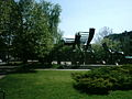
Among the memorial sculptures are the plague cross, the so-called Kipovi on the Ruma-Irig street as a reminder of the plague epidemic of 1795/96 in the form of a baroque Catholic altar, the large cast metal sculpture of the revolutionary monument in the city center of Svete Daviča and Miše Davida from 1976, as well as the Monument Most razmene (German: The Bridge of Exchange) as a memorial of the anti-fascist war (NOR) in Syrmia at the point where an exchange of prisoners between Germans and partisans at a bridge took place since 1943. The concrete sculpture Spomenik razmene was erected on the left and right of the Ruma-Stejanovci street in 1971.
Ruma has a high school, a cinema with two halls in the cultural center (with a sports hall, exhibition rooms), a city library and two city parks. Its own theater has existed since the early 1990s.
traffic


Ruma is a traffic junction. There the traffic routes intersect in the relations east-west (Zagreb - Belgrade) and north-south (Novi Sad - north-west Serbia, Bosnia).
Ruma station is located on the rail corridor X on the Zagreb-Belgrade route (international train connection to Istanbul , Athens , Venice , Zurich and Munich ), as well as on the non-electrified local line in the direction of Šabac, Loznica, Zvornik and further on in the direction of Bosnia. Six EuroCitys stop at Ruma train station every day .
Two important street corridors also cross in Ruma. The highway from Batrovci on the border with Croatia to Belgrade runs south of the town, the highway Novi Sad-- Ruma - Sabac bypasses the city to the east.
economy

The main economic branch of the city is agriculture. There are extensive agricultural areas in the vicinity of the city. Grain, maize, sugar beet and sunflowers in particular are grown on the fertile loess soils . Viticulture plays an important role on the slopes of Fruška Gora. White wine in particular is produced there. The most famous wine in the region is the Iriški Rizling (after the bottling location in Irig ). The largest melon plantations in Serbia are located in the municipality, especially around Platicevo, Buđanovci and Šašinci. The so-called Bostanijade takes place in Šašinci every year at the beginning of September . This festival is dedicated to the sugar melon (Bostan = melon). Several reservoirs, including in Borkovac and Pavlovac, were built to irrigate the orchards (apples, apricots, plums and peaches). The formerly important livestock industry now only exists on a smaller scale. There are still herds of cattle in the direction of the Fruška Gora, pig breeding especially in the floodplains of the Sava. The earlier agronomic division of the okrug Srem into the Vinski- (wine) and Svinski- (pig) Srem still exists today, albeit to a lesser extent.
In addition to the rubber, leather and textile industries originating from the socialist self-government economy, mainly agricultural processing companies are located. The most important of the larger industrial and service companies are the state construction company Sremput with 335 employees, the state transport company Rumatrans and the private transport, logistics and construction company Borovica . The most important chemical company is Ruma Guma . After an initial privatization by an American buyer, the company belongs to a Czech company and has since been modernized to EU standards. Ruma is the most important market place in Srem, on Wednesdays and Saturdays there is a large farmers' market. Every third month there is a fair, the Rumski vašar , on the city limits. The focus is on an extensive cattle market (horses, cattle, pigs, sheep), around which small traders (mostly spare parts for agricultural machines, but also ready-made articles and technical devices) crowd. Ruma is also an important destination in hunting tourism. Hunting areas are located around the alluvial forests between Klenak and Obrež in the Karakuša hunting area . This extends over 1200 hectares and offers hunting for small and large game.
The test site of the military-technical research training area Nikinci ( Opitni poligon Nikinci ) is located on 3060 hectares near Nikinci . As Tehnički opitni centar Nikinci it belongs to the Technical Test Center (TOC) of the armed forces of Serbia . Numerous geodetic and technical test devices have been set up in the test area with various up to 24 kilometers long tracks for ballistic projectiles and missiles.
tourism


Ruma is an agricultural settlement that hardly offers any tourist interest. There are numerous places for excursions in the community with recreational opportunities and culturally significant evidence of art history, as well as several memorials to the former partisan movement in World War II. To the north, the Fruška Gora National Park is 11 km from the city. In addition to the species-rich Central European beech forests, numerous Orthodox monasteries, some of which date back to the 15th century, are the main attractions. Known include the probably oldest monastery in Syrmia Mala Remeta , the Novo Hopovo monastery belonging to the Morava school , the baroque jewel Monastery Jazak, where since the great Serbian exodus under Patriarch Arsenije III. Čarnojević the coffin of Tsar Dušan's son Stefan Uroš V is kept, as well as the pilgrimage monastery Nova Ravanica in Vrdnik , where the remains of Prince Lazar from the end of the 17th century to 1989 were kept. In Vrdnik there is also a nationally known thermal bath that is used for the rehabilitation of rheumatic patients. The best-known partisan memorial is the large sculpture Sloboda on the Iriški venac . It was created in 1951 by the sculptor Sreten Stojanović .
The scenic floodplains of the Save with the old arm of the Obedska bara are well-known game locations and important European bird breeding and wintering areas. Among the preserved village ensembles, Jazak, Buđanovci and Kupinovo are worth mentioning. With their intact village centers, they are examples of the traditional Pannonian hoof and street village .
Infrastructure
Ruma has a hospital , hotels, several sports fields and maintains local public transport between the train station and the new housing estate Voganj in the west. A local radio program is also broadcast.
Personalities
- Atanasije Stojković (1773–1832), Serbian-Russian physicist and university professor
- Slavko Mađer (* 1929), Croatian writer
- Paško Rakić (* 1933), American neurologist of Croatian origin
- Stjepko Gut (* 1950), Serbian and American jazz musician
- Dragan Šarac (* 1975), Serbian football player
- Milorad Popović (1979-2006), Serbian football player
gallery

Orthodox Church

Catholic Church
Sculpture in the city center


literature
- Carl Bishop the Elder J .: The history of the market town of Ruma. In: Donauschwäbische Contributions. 25. 1958, Pannonia Verlag, Freilassing.
- Слободан Ђуриц: Населја Срема - Гәографске карактеристике. Матица Српска, institut za geografiju, Novi Sad 2001.
- Владан Гаврилобич: Срби у градовима срәма 1790–1849. Nevkos i Istocnik, Novi Sad 1995.
- Franz Wilhelm: Ruma Documentation I. 1990.
- Franz Wilhelm: Ruma Documentation II. 1997.
Web links
- City website (Serbian / English)
- Website of the Ruma hometown community with a presentation of the history of the Germans in the city
- Historical map of Rumas, 1816
Individual evidence
- ↑ http://media.popis2011.stat.rs/2011/prvi_rezultati.pdf , p. 29.
- ^ Slobodan B. Markovic et al. 2007: Late Pleistocene loess-palaeosol sequences in the Vojvodina region, north Serbia . In: Journal of Quartarnary sciences 2008, 23 (1), 73–84 ( PDF )
- ^ Franz Wilhelm: Rumaer Documentation 1745-1945 - center of the German movement in Syrmia, Slavonia and Croatia . Donauschwäbische Kulturstiftung, Series IV: Contributions to Danube Swabian folk and local history research. P. 68, Stuttgart.
- ^ Slobodan B. Markovic et al. 2009: Middle and Late Pleistocene loess sequences at Batajnica, Vojvodina, Serbia. In: Quartarnary International, Vol. 198, pp. 255-266, doi : 10.1016 / j.quaint.2008.12.004 .
- ↑ DRAŽENKO NENADIĆ & VLADIMIR SIMI, 2005. Stratigraphy and lithology of the loess deposits in eastern Srem (Serbia). In: ANNALES GÉOLOGIQUES DE LA PÉNINSULE BALKANIQUE, 66 (2004–2005), 21–26, Belgrade ( PDF )
- ↑ RETKE, RANJIVE I UGROŽENE BILJNE I ŽIVOTINJSKE VRSTE NA PODRUCJU JP "VOJVODINAŠUME" ( PDF )
- ^ Protections of Biodiversity of the Sava river basin floodplains. ( PDF )
- ↑ Weischet, W. and W. Endlicher (2000): Regional Climatology Part 2 - The Old World - Europe, Africa, Asia. Stuttgart, Leipzig, Teubner Verlag, Bib: 1310-155 II
- ↑ City of Ruma ( page no longer available , search in web archives ) Info: The link was automatically marked as defective. Please check the link according to the instructions and then remove this notice.
- ↑ In Neue Osnabrücker Zeitung on November 24, 2017: "Samtgemeinde Bersenbrück and Ruma now partners"; accessed on December 24, 2018
- ↑ Marija Gimbutas, p. 247 The gods and goddesses of old europe 7000 - 3500 BC
- ↑ spomenici kulture Srbije Basijana
- ^ The later Roman Empire, 284-602: a social economic and administrative survey-Arnold Hugh Martin Jones
- ↑ Slobodan Đurić: Naselja Srema - Geographical characteristics. 1995, p. 212.
- ↑ Humka kod stare vodenice
- ↑ MAGISTRAT TRGOVIŠTA RUMA
- ^ Inge Morgenthaler Winter in Ruma
- ^ Volkswirthschaftliche Nachrichten. (…) Traffic. Local railway Ruma – Klenak. In: Pester Lloyd , No. 221/1901 (XLVIII. Volume), September 15, 1901, p. 1, center right. (Online at ANNO ). .
- ^ Franz Wilhelm, 1997: Rumaer Documentation 1741-1945 . Vol. 2, p. 90, Stuttgart. ( PDF )
-
^ Zoran Janjetović, Society for Serbian-German Cooperation (ed.): German Minority Press and Publishing in the Inter-War Yugoslavia . (English). Beograd s. a., p. 5, online (PDF; 95 kB) ( Memento of the original from January 9, 2016 in the Internet Archive ) Info: The archive link was inserted automatically and not yet checked. Please check the original and archive link according to the instructions and then remove this notice. , accessed June 10, 2013; ZDB ID 2386014-5 .
- ↑ ibid. Franz Wilhelm, 1997, p. 185 ( PDF )
- ↑ Peter Broucek, 1988: A General in Twilight - The Memories of Edmund Glaises von Horstenau. P. 165.
- ↑ ibid: Franz Wilhelm, 1997, p. 187 ( PDF )
- ↑ PDF at ruma.donauschwaben.net
- ↑ [1]
- ↑ ЉУБИВОЈЕ ПАЈОВИЋ, ДУШАН УЗЕЛАЦ, МИЛОВАН ЏЕЛЕБЏИЋ, Sremski Front 1944-1945 . УСПОСТАВЉАЊЕ СРЕМСКОГ ФРОНТА И БОРБЕ У СРЕМУ ДО КРАЈА 1944. P. 35 ff. ( PDF )
- ↑ Karl Hnilicka, The End in the Balkans , In: Chapter III. The military evacuation of Yugoslavia by the German Wehrmacht in 1944/45, p. 74. Studies and documents on the history of the Second World War. ( PDF )
- ↑ PDF at www.znaci.net
- ↑ Spitor Lagator, 4. Vojvodjanska Brigada. БОРБЕ ЗА КОНАЧНО ОСЛОБОЂЕЊЕ СРЕМА (PDF; 546 kB)
- ↑ http://www.sremskenovine.co.rs/2011/10/obelezen-dan-oslobodjenja-rume/
- ^ White Book of Germans from Yugoslavia, Munich 1991, p. 713
- ^ The suffering of the Germans in communist Yugoslavia. Volume III. Pp. 75-79
- ↑ Gomolava
- ↑ Basijana
- ↑ Српска Православна црква Св. Николе
- ↑ Churches ( Memento of the original dated February 6, 2010 in the Internet Archive ) Info: The archive link was inserted automatically and has not yet been checked. Please check the original and archive link according to the instructions and then remove this notice.
- ↑ Српска Православна црква Св. Вазнесења Господњег
- ↑ Spomenici Kulture u Srbiji - (Cultural monuments in Serbia) - From the data-base of a digital repository which contains material protected by the Institute for Monument Protection of Serbia, Archaeological Institute of the Serbian Academy of Sciences and Arts, National Library of Serbia , and Kalenić Monastery. Српска Православна црква Сошествија Св. Духа
- ^ The Saint Archangel Gabriel's Church
- ↑ Zgrada Muzeja
- ^ Večernje Novosti, September 1, 2012 Grofovski salaš Erem ima 60 stanovnika
- ^ Politika, May 8, 2011 Mesto na kome je kuga zaustavljena
- ↑ Kulturno istorijski spomenici Rume ( Memento of the original from July 15, 2012 in the Internet Archive ) Info: The archive link has been inserted automatically and has not yet been checked. Please check the original and archive link according to the instructions and then remove this notice.
- ↑ Bostanijade ( page no longer available , search in web archives ) Info: The link was automatically marked as defective. Please check the link according to the instructions and then remove this notice.
- ↑ Rubber products
- ↑ Karakuša ( Memento of the original from January 29, 2010 in the Internet Archive ) Info: The archive link was inserted automatically and has not yet been checked. Please check the original and archive link according to the instructions and then remove this notice.
- ↑ CENTAR ZA ISPITIVANjE NVO “NIKINCI” - TOC Vojske Srbije
- ↑ Specijalna bolnica za rehabilitaciju TERMAL ( Memento of the original of March 12, 2010 in the Internet Archive ) Info: The archive link was automatically inserted and not yet checked. Please check the original and archive link according to the instructions and then remove this notice.