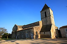
Saint-Sauvant (Vienne)
| Saint-Sauvant | ||
|---|---|---|
|
|
||
| region | Nouvelle-Aquitaine | |
| Department | Vienne | |
| Arrondissement | Poitiers | |
| Canton | Lusignan | |
| Community association | Grand Poitiers | |
| Coordinates | 46 ° 22 ′ N , 0 ° 3 ′ E | |
| height | 122-159 m | |
| surface | 59.58 km 2 | |
| Residents | 1,258 (January 1, 2017) | |
| Population density | 21 inhabitants / km 2 | |
| Post Code | 86480 | |
| INSEE code | 86244 | |
 Town hall (Mairie) of Saint-Sauvant |
||
Saint-Sauvant is a French village with 1,258 inhabitants (as of January 1 2017) in the department of Vienne in the region Nouvelle-Aquitaine ; it belongs to the arrondissement of Poitiers and the canton of Lusignan . The inhabitants are called Saint-Sauvantais .
geography
Saint-Sauvant is about 36 kilometers southwest of Poitiers . Saint-Sauvant is surrounded by the neighboring municipalities of Rouillé in the north, Lusignan in the north and northeast, Celle-Lévescault in the northeast, Payre in the east, Rome in the south and southeast, Vançais in the south, Chenay in the southwest and Avon in the west.
The Via Turonensis , a variant of the Camino de Santiago , runs through the municipality.
Population development
| year | 1962 | 1968 | 1975 | 1982 | 1990 | 1999 | 2006 | 2013 |
|---|---|---|---|---|---|---|---|---|
| Residents | 2.023 | 1,814 | 1.611 | 1,403 | 1,315 | 1,291 | 1,305 | 1,320 |
Attractions
- Exoudun dolmen
- Church of Saint-Romain from the 11th century with alterations from the 13th century, a historic monument since 1979
- Protestant Church
literature
- Le Patrimoine des Communes de la Vienne. Volume 1, Flohic Editions, Paris 2002, ISBN 2-84234-128-7 , pp. 491-496.
Web links
Commons : Saint-Sauvant - collection of images, videos and audio files

