23-as főút
| 23-as főút in Hungary | ||||||||||||||||||||||||||||||||||||||||||||||||||||||||||||||||||||||||||||||||||

|
||||||||||||||||||||||||||||||||||||||||||||||||||||||||||||||||||||||||||||||||||
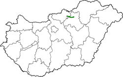
| map | ||||||||||||||||||||||||||||||||||||||||||||||||||||||||||||||||||||||||||||||||||
| Basic data | ||||||||||||||||||||||||||||||||||||||||||||||||||||||||||||||||||||||||||||||||||
| Operator: | Magyar Közút Nonprofit Zrt. | |||||||||||||||||||||||||||||||||||||||||||||||||||||||||||||||||||||||||||||||||
| Start of the street: |
Bátonyterenye -Kisterenye |
|||||||||||||||||||||||||||||||||||||||||||||||||||||||||||||||||||||||||||||||||
| End of street: |
Tarnalelesz |
|||||||||||||||||||||||||||||||||||||||||||||||||||||||||||||||||||||||||||||||||
| Overall length: | 33 km | |||||||||||||||||||||||||||||||||||||||||||||||||||||||||||||||||||||||||||||||||
|
Megyék ( counties ): |
||||||||||||||||||||||||||||||||||||||||||||||||||||||||||||||||||||||||||||||||||
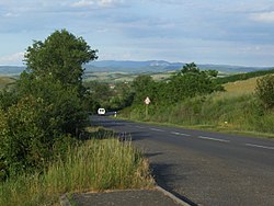
| The street at Ivád | ||||||||||||||||||||||||||||||||||||||||||||||||||||||||||||||||||||||||||||||||||
|
Course of the road
|
||||||||||||||||||||||||||||||||||||||||||||||||||||||||||||||||||||||||||||||||||
23-as főút ( Hungarian for 'Main Street 23') is a Hungarian main road that connects State Road 21 with State Road 25 .
course
The road begins in Bátonyterenye - Kisterenye , where it branches off from national road 21 to the east. The first 11 kilometers are on the Zagyva . The road leads on the northern edge of the Mátra Mountains via Pétervására to Tarnalelesz where it joins the national road 25.
The total length of the road is 33 kilometers.
history
The road was built in the 1920s.
See also
Web links
Commons : 23-as főút - collection of images, videos and audio files
- Hungarian Public Road Non-profit AG (Magyar Közút Nonprofit Zrt.) (Hungarian)
- National infrastructure developer, private company (Hungarian, partly English)
Individual evidence
- ↑ Magyarország, autóatlasz 1: 200,000, Honvédelmi Minisztérium Térképészeti Kht., ISBN 978-963-257-087-7 .

