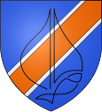
Anthy-sur-Léman
| Anthy-sur-Léman | ||
|---|---|---|

|
|
|
| region | Auvergne-Rhône-Alpes | |
| Department | Haute-Savoie | |
| Arrondissement | Thonon-les-Bains | |
| Canton | Sciez | |
| Community association | Thonon agglomeration | |
| Coordinates | 46 ° 21 ′ N , 6 ° 26 ′ E | |
| height | 372-470 m | |
| surface | 4.62 km 2 | |
| Residents | 2,171 (January 1, 2017) | |
| Population density | 470 inhabitants / km 2 | |
| Post Code | 74200 | |
| INSEE code | 74013 | |
| Website | www.anthy-sur-leman.fr | |
 Hôtel de ville by Anthy-sur-Léman |
||
Anthy-sur-Léman is a French commune in the department of Haute-Savoie in the region of Auvergne Rhône-Alpes .
geography
Anthy-sur-Léman is 400 m , 5 km west-southwest of the city of Thonon-les-Bains (beeline). The village extends slightly above the south bank of Lake Geneva , in the Bas-Chablais region.
The area of the 4.62 km² municipal area includes a section on the south bank of Lake Geneva, the lakeshore line is approximately 3.5 km. The community area extends from the flat lakeshore southwards over a gently rising slope to the adjacent Bas-Chablais plateau. In the east, the border runs along the Pamphiot stream , while in the south it is mostly formed by the main road N5. Only a small fraction is across this street. The highest point is reached at 460 m on the edge of a moraine of the Ice Age Rhone glacier near Margencel.
Anthy-sur-Léman includes the Marclaz ( 428 m ) settlements on the main road and part of Séchex ( 410 m ) east of the Ruisseau du Redon valley. Neighboring communities of Anthy-sur-Léman are Thonon-les-Bains in the west and Allinges and Margencel in the south.
history
The area around Anthy-sur-Léman was inhabited very early. The oldest traces come from two Neolithic settlements on the edge of the river bank . Some wall foundations are preserved from a Roman vicus that was inhabited from the 2nd to the 4th century AD. In 1973 Anthy-sur-Léman merged with Thonon-les-Bains. However, this merger was reversed in 1982, so that the place has since formed an independent municipality again.
population
| Population development | |
|---|---|
| year | Residents |
| 1962 | 494 |
| 1968 | 579 |
| 1975 | 896 |
| 1982 | 1,121 |
| 1990 | 1,383 |
| 1999 | 1,767 |
| 2004 | 1,857 |
With 2171 inhabitants (as of January 1, 2017) who call themselves Les Anthychois , Anthy-sur-Léman is one of the smaller communities in the Haute-Savoie department. In the last few decades there has been a continuous strong growth in the number of inhabitants. Outside the village center and along the lakeshore, larger single-family quarters and second homes were built.
Economy and Infrastructure
Anthy-sur-Léman was a predominantly agricultural village well into the 20th century . Today there are various local small businesses as well as construction and trading companies. An industrial and commercial zone developed on the main road in the Marclaz area, in which mainly tertiary sector companies (shopping centers, specialty shops) settled. Many workers are commuters who do their work in Thonon-les-Bains.
Although located near the lake, Anthy-sur-Léman does not have a port. The village is close to the main road N5 that leads from Geneva to Thonon-les-Bains. Further road connections exist with Allinges and Margencel.
