Bogenhausen (city district)
|
Bogenhausen
State capital Munich
Coordinates: 48 ° 8 ′ 53 ″ N , 11 ° 37 ′ 0 ″ E
|
|
|---|---|
| Area : | 23.71 km² |
| Residents : | 90.173 (Jan 31, 2020) |
| Population density : | 3,803 inhabitants / km² |
| Incorporation : | January 1, 1892 |
| Postcodes : | 81675, 81677, 81679, 81925, 81927, 81929 |
| Area code : | 089 |
|
Location of the district 13 Bogenhausen in Munich
|
|
Bogenhausen is the city district 13 of the Bavarian capital Munich .
In the Bogenhausen area there are eight districts of Munich that used to be separate localities, including the town of Bogenhausen, which gives the district its name .
location
The district of Bogenhausen is located in the northeast of the city on the right side of the Isar . Its borders are in the west the west bank of the Isar, in the north and east the city limits (to Unterföhring and Aschheim / Dornach) and in the south the Prinzregentenstrasse to a little outside the middle ring . From there, the southern border runs west of Vogelweideplatz to the south to the Munich – Mühldorf railway line , which it follows to the overpasses of the A 94 and Riemer Straße. From here it runs along the Hüllgraben and the Salt Road to the northeast to the city limits.
Bogenhausen borders (counted clockwise) on the Munich boroughs of Trudering-Riem in the southeast, Berg am Laim and Au-Haidhausen in the south and Altstadt-Lehel and Schwabing-Freimann in the west across the Isar. In addition, the district borders on the communities Unterföhring in the north and Aschheim in the northeast.
history
As the first part of today's city district, the eponymous town Bogenhausen was incorporated into Munich in 1892 , followed by Oberföhring in 1913 . Together these districts formed the XXIX district. In 1930, this was expanded to include four more towns, Daglfing , Denning , Englschalking and Johanneskirchen , which until then had jointly formed the Daglfing community . In 1937, as part of a consolidation, the districts of Zamdorf and Steinhausen , which had been incorporated into Munich as part of the Berg am Laim community in 1913, were assigned to the Bogenhausen district. The western end of Steinhausen, south of today's Vogelweideplatz , in which the Kirchstein gasworks was located, was even incorporated in advance in 1894.
In 1992, the former district XXIX became today's district 13.
Districts
Bogenhausen
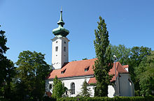
The old town center can be found at the old parish church of St. Georg , Bogenhauser Kirchplatz 1, and at Ismaninger and Hompeschstraße. Since the late founding period, a large, representative villa and tenement district was built from Prinzregentenstrasse in the direction of St. Georg with clear urban planning, which still shapes the image of Bogenhausen in public opinion today. Examples are the Villa Stuck (which is now in the Au-Haidhausen district ), the Hildebrandhaus and the Fleischerschlösschen, in which the Federal Fiscal Court is now located. In World War II hardly damaged, the quarter was largely retained its character. The development in the outer areas with several preserved village centers received important impulses from large residential complexes built in the post-war period . It all started in 1957 with Parkstadt Bogenhausen as Munich's first large residential complex with high-rise buildings. In the following 30 years, seven more large residential complexes with around 15,000 residential units were built, which have since developed into districts with their own identity.
Oberföhring
Oberföhring was first mentioned on July 3, 750 as ad Feringas . The place is named after the Feringa family, who arranged the crossing over the Isar there before the bridge was built. This very bridge, over which the salt trade ran, became a point of contention between Heinrich the Lion and the Diocese of Freising and was finally destroyed. The salt trade had to use a bridge further south, which is said to have contributed significantly to the foundation of Munich in 1158. In 1818 Oberföhring became an independent municipality. The incorporation to Munich took place on July 1, 1913 on own request.
The old town center is on the banks of the Isar around the Catholic parish church of St. Lorenz, Muspillistraße 31. Oberföhring is considered an upscale residential area. Beautiful old single-family houses and spacious green areas characterize the picture. There are some larger modern tenement houses in the southeast.
Daglfing
Daglfing was first mentioned on December 10, 839 as ad Tagolfingas . It was the eponymous place for the community of Daglfing formed in 1818 , which was incorporated into Munich in 1930.
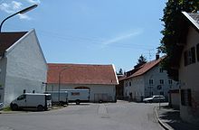
The old town center can be found around the Catholic Church of St. Philip and Jacob . This district has largely retained its rural character, numerous historical courtyards are still preserved. In the south the picture is dominated by single-family and terraced houses with large gardens as well as some old farmsteads. The Daglfing trotting track is also located there .
Denning
Denning was first mentioned in a document around 1200 as Tenningen or Danningen , which probably goes back to the personal name "Tenno". In 1930 it was incorporated into Munich, but only eleven months after the other parts of the municipality of Daglfing.
The townscape of Dennings is characterized today by residential areas with single-family houses surrounded by gardens. There is a high-rise estate between Denninger Strasse and Wartestrasse. Denning's main axis is East Prussia Street, where over 100 shops and service providers are located.
Englschalking
Englschalking was first mentioned in a document in 1231/1234 as Engelschalchingen . In 1930 it was incorporated into Munich as part of the Daglfing community.
In the historical center of Englschalking there are large courtyards in an irregular arrangement around the 13th century church of St. Nikolaus . This town center, which is a listed building ensemble, has roughly the same size as the village in the early 19th century. To the north-west of the town center is Fideliopark, built between 1966 and 1970 with four to nineteen-story apartment blocks, further west is Cosimapark, built between 1964 and 1969, with four-story apartment blocks and ten to nineteen-story high-rise buildings surrounded by balconies.
Johanneskirchen
The oldest documented mention of Johanneskirche is a document from the year 815, in which the church of St. Johann Baptist is mentioned. In 1930 it was incorporated into Munich as part of the Daglfing community.
The historic core of Johanneskirchen is still dominated village, farms surround the fortified church built village church of St. John the Baptist from the 13th century. The agriculturally used areas of the Johanneskirchner Moos already adjoin this village center . The garden city of Johanneskirchen , built in 1984–1986, is located in these open spaces with single, double and terraced houses between which there are extensive green spaces. West of the railway line are the new development areas Johanneskirchen Nord (1964–1968) and Johanneskirchen West (1988–1999) with their apartment blocks.
Zamdorf
Zamdorf was first mentioned in 1021 as Zamindorf , in 1913 it was incorporated into the municipality of Berg am Laim in Munich, and in 1937 it was assigned to the Bogenhausen district.
Between Denninger Anger and Bundesautobahn 94 there are residential quarters with single-family houses, the colonial settlement built in 1934 and the Zamilapark settlement built between 1983 and 1991 . Between the A 94, the Leuchtenbergring – Daglfing line and Hultschinerstraße, there is an industrial area and the Steinhausen railway works , the base of the Munich S-Bahn. Zamdorf is dominated by the conspicuous SV high-rise , which had to be built with a reduced height after a referendum .
Steinhausen
Steinhausen is the youngest part of the district of Bogenhausen. It was not until 1808 that a homestead near Zamdorf was named with this name. In 1913 Steinhausen was incorporated into Munich as part of the Berg am Laim community, and in 1937 it was assigned to the Bogenhausen district.
Steinhausen is located in the south of the Bogenhausen district north of the Leuchtenbergring – Berg am Laim railway. A large industrial and commercial area is located between the A 94 and the railway line. a. with the printing center of the Süddeutscher Verlag. Around Vogelweideplatz there are predominantly larger blocks of flats, north of the A 94 is the Steinhausen settlement of single-family houses.
District parts
For administration and statistical purposes, the Bogenhausen district is divided into seven districts, which, however, are only roughly based on the historical districts.
- Oberföhring
- Johanneskirchen
- Herzogpark
- Englschalking
- Daglfing
- Parkstadt
- Altbogenhausen
Of these, only the districts of Oberföhring, Johanneskirchen and Daglfing correspond to the respective districts. The Bogenhausen district corresponds roughly to the area formed by the districts 3, 6 and 7, the Englschalking district contains the historic districts Englschalking, Denning, Zamdorf and Steinhausen.
General
Land use
Even though several large high-rise estates were built in the Bogenhausen district in the second half of the 20th century, it still has large open spaces. Of the 2,370 hectares (as of January 1, 2008), around 657 hectares (27.7 percent) are used for agriculture, another 330 hectares (13.9 percent) are recreational areas (green spaces, sports facilities, etc.). Buildings and associated open spaces occupy 969 hectares (40.9 percent), traffic areas 334 hectares (14.1 percent).
Social structure
Members of all social classes have found a home in the Bogenhausen district. The social structure is considered to be balanced. The social structure of the district follows the urban development conditions in the district parts: in Bogenhausen itself, as in Herzogpark, the upper middle class dominates to this day. The number of employees and civil servants is four times the number of workers. At 17.1 percent, the proportion of foreigners is below the city-wide level.
economy
The service sector in particular offers jobs, strongly concentrated in the area of the Arabellapark : Health care ( Klinikum Bogenhausen , several private clinics, medical practices); Banking, retail and technology (HypoVereinsbank in the prominent Hypo-Haus , BayWa , Giesecke & Devrient ), hotel industry (five stars: Westin Grand; four stars: Sheraton, NH, Park Inn, Holiday Inn, Freisinger Hof, Rothof). Manufacturing, which provides around a fifth of jobs, is mainly located in Steinhausen.
traffic
The city district is accessed through three main traffic axes: In the south through Prinzregentenstrasse and, as an extension, Töginger Strasse / A 94 . In a north-south direction, the Mittlerer Ring runs through the city district via the Richard Strauss Tunnel , Effnertunnel and Isarring . From Effnerplatz to the north and on to the A 9 , Effnerstraße complements the traffic axes of the city district. Both the side street of the Mittlerer Ring ( Richard-Strauss-Straße to Effnerplatz) and Effnerstraße lead to other larger residential streets that open up the other parts of the city.
The public transport is mainly due to the U4 to the subway stations Prinzregentenplatz , Böhmerwaldplatz , Richard Strauss Street and Arabella Park , the tram lines 16 and 18 as well as the S8 with the stations Daglfing overcome Englschalking Johanneskirchen. There are plans for an extension of the U4 to the airport S-Bahn ; Due to an uncertain benefit-cost indicator , no planning approval is currently being carried out.
Culture
- Bürgerpark Oberföhring , Oberföhringer Straße 156, with a small puppet stage
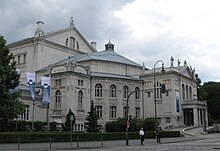
- Prinzregententheater , Prinzregentenplatz 12, with academy theater and theater academy
- Goetz Collection , Oberföhringer Straße 103
education
- Branch of the Munich adult education center in the Arabellapark
- Branch of the Munich City Library in the Arabellapark
- Bavarian Theater Academy August Everding , Prinzregentenplatz 12
- Ecological education center of the Munich Adult Education Center and the Munich Environment Center, Englschalkinger Straße 166
- Wilhelm Hausenstein -Gymnasium, Elektrastrasse 61
Public facilities
- Bogenhausen Clinic
- Cosima wave pool
- Prinzregentenstadion and Prinzregentenbad
- Bavarian State Ministry for the Environment and Consumer Protection
- Federal Fiscal Court
- Central office for information technology in the security area
Bogenhausen is home to an unusually large number of consulates general . The following countries are present: Greece, Italy, Iran, Austria, Poland, Russia, Serbia, Slovakia, Spain, Hungary, United Kingdom, United Arab Emirates (may not be complete).
statistics

(As of December 31, residents with main residence)
| year | Residents | including foreigners | Inhabitants per km² |
|---|---|---|---|
| 2000 | 70,936 | 11,562 (16.3%) | 2,991 |
| 2001 | 71,716 | 11,921 (16.6%) | 3,024 |
| 2002 | 72,429 | 12,178 (16.8%) | 3,054 |
| 2003 | 73.070 | 12,654 (17.3%) | 3,081 |
| 2004 | 72,982 | 12,513 (17.1%) | 3,078 |
| 2005 | 73,860 | 13,042 (17.7%) | 3.115 |
| 2006 | 75,657 | 13,419 (17.7%) | 3,190 |
| 2007 | 76,709 | 13,892 (18.1%) | 3,235 |
| 2008 | 77.112 | 14,097 (18.3%) | 3,252 |
| 2009 | 76,684 | 13,628 (17.8%) | 3.234 |
| 2010 | 77,542 | 13,987 (18.0%) | 3,270 |
| 2011 | 79,175 | 14,913 (18.8%) | 3,339 |
| 2012 | 80,816 | 16,166 (20.0%) | 3,408 |
| 2013 | 82,138 | 17,126 (20.9%) | 3,464 |
| 2014 | 83,900 | 18,286 (21.8%) | 3,539 |
| 2015 | 85,947 | 20,257 (23.6%) | 3,625 |
| 2016 | 87.164 | 21,453 (24.6%) | 3,676 |
| 2017 | 85,971 | 20,935 (23.7%) | 3,626 |
| 2018 | 87,950 | 21,484 (24.4%) | 3,709 |
| 2019 | 90.025 | 22,401 (24.9%) | 3,797 |
Source with further data
politics
The district committee of Bogenhausen was last elected on March 15, 2020. The distribution of seats is as follows: CSU 12, Greens 11, SPD 6, FDP 2, DaCG / ÖDP 2, FW 1, LEFT 1. Of the 65,103 residents of Bogenhausen who are entitled to vote, 33,502 have exercised their right to vote, bringing the turnout to 51.5 Percent lay.
| year | CSU | SPD | Green | FDP | DaCG * | comment |
|---|---|---|---|---|---|---|
| 1996 | 1 | first direct choice | ||||
| 2002 | 15th | 14th | 3 | 2 | 1 | |
| 2008 | 13 | 13 | 4th | 4th | 1 | |
| 2014 | 15th | 10 | 6th | 2 | 2 | |
| 2020 | 12 | 6th | 11 | 2 | 2 | |
| * Note: DaCG = David versus Goliath | ||||||
literature
- Reinhold Häfner, Willibald Karl: Bogenhausen. From a rural parish village to a posh district . Buchendorfer Verlag, Munich 1992, ISBN 3-927984-11-6 .
- Willibald Karl, Karin Pohl: Bogenhausen. Time travel to old Munich . Volk Verlag, Munich 2014, ISBN 978-3-86222-113-4 .
- Florian Breu: The Munich districts after the urban area reorganization . In: Munich Statistics . No. 1 , 1996, ISSN 0171-0583 , p. 1-14 .
- Klaus Gallas : Munich. From the Guelph foundation of Henry the Lion to the present: art, culture, history . DuMont, Cologne 1979, ISBN 3-7701-1094-3 (DuMont documents: DuMont art travel guide).
- Willibald Karl (Ed.): Villages on the brick land . Daglfing, Denning, Englschalking, Johanneskirchen, Zamdorf. Buchendorfer Verlag, Munich 2002, ISBN 978-3-934036-90-1 .
- Roland Krack (Ed.): The Parkstadt Bogenhausen in Munich . Volk, Munich 2006, ISBN 978-3-937200-10-1 .
- Lutz Fritz: Daglfing, Denning, Englschalking, Johanneskirchen 50 years near Munich (1930–1980) . Extended address for the 50th anniversary of the incorporation of the former municipality of Daglfing into the state capital of Munich on October 13, 1980. Munich City Archives, Munich 1982.
- Lutz Fritz: Oberföhring . For the 75th anniversary of the incorporation of Oberföhring. Buchendorfer Verlag, Munich 1988.
- Helmuth Stahleder : From Allach to Zamilapark. Names and basic historical data on the history of Munich and its incorporated suburbs . Buchendorfer Verlag, Munich 2001, ISBN 3-934036-46-5 .
- Klaus Bäumler: Paris as a role model. In the footsteps of Count Montgelas in Munich, on the Isar and in Bogenhausen . Bavaria and Marianne, Munich 1997 (Charivari special issue).
Web links
- Bogenhausen district - state capital Munich
- City District and District Committee 13 Bogenhausen - City of Munich
Individual evidence
- ↑ Statistical Pocket Book 2020 (PDF). Statistical Office of the State Capital Munich. Retrieved March 3, 2020.
- ↑ Statistical Pocket Book 2008 of the City of Munich
- ^ Consulate database
- ^ Archive district information . State capital Munich. Retrieved July 20, 2017.
- ↑ a b c Election of the District Committee - District 13 - Bogenhausen . State capital Munich. Retrieved May 1, 2020.


