Elm (mountain range)
| Elm | |
|---|---|
| Highest peak | Eilumer Horn ( 323.3 m above sea level ) |
| location | Districts of Helmstedt and Wolfenbüttel ; Lower Saxony , Germany |
| Coordinates | 52 ° 12 ′ N , 10 ° 45 ′ E |
| Type | Broad saddle |
| rock | Limestone, marl stones, loess |
| Age of the rock | Triassic, Quaternary |
The Elm is a 25 km long, 3 to 8 km wide, maximum 323.3 m above sea level. NHN high and wooded low mountain range southeast of Braunschweig in the districts of Helmstedt and Wolfenbüttel in Lower Saxony ( Germany ).
The largely settlement-free forest area with the largest beech forest in Northern Germany and the Reitlingstal is part of the Elm-Lappwald Nature Park . Geologically, the Elm is mainly made up of fossil-rich limestone from the Middle Triassic ( shell limestone ), which as Elm limestone has been a sought-after building material since the Middle Ages.
geography
location
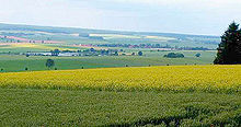
The Elm is part of the Lößbörden in the North German lowlands in the Elm-Lappwald Nature Park . It spreads between the cities of Königslutter in the north, Schöningen in the southeast and Schöppenstedt in the south. Within sight of the ridge are the city of Braunschweig in the northwest, around 20 km away , Wolfsburg around 25 km in the north, Helmstedt in the east and Wolfenbüttel in the west.
Adjacent are the significantly lower mountain ranges Asse , around 10 km southwest, Dorm , around 10 km northeast and Lappwald , around 18 km northeast. Except for the Asse, all or part of them belong to the Elm-Lappwald Nature Park.
Natural allocation
The low mountain range forms the natural area of Elm (512.15) in the main natural unit group Northern Harz Foreland (No. 51), in the main unit East Brunswick Hügelland (512) and in the subunit Asse-Elm-Hügelland (512.1 ). The landscape falls to the east into the Heeseberg natural area (512.12), to the south into the Schöppenstedter Lößmulde natural area (512.13) and to the west into the Sickter Hügelland (512.14) natural area , all of which are part of the Asse-Elm-Hügelland. To the north it falls into the natural area Dormhügelland ( 512.20) belonging to the subunit Helmstedt-Oscherslebener Mulde (512.2) . In the northwest, in the main unit group Weser-Aller-Flachland (62), in the main unit Ostbraunschweigisches Flachland (624) and in the subunit Schunterwinkel (624.1) the natural area Lehrer Wold (624.12) joins.
Surveys
The highest elevation in the Elm is the Eilumer Horn near Erkerode at 323.3 m . These and other Elm elevations and their foothills are - sorted by height in meters (m) above sea level (MSL; unless otherwise stated):
- Eilumer Horn ( 323.3 m ), east-southeast of Erkerode
- Amplebener Berg ( 314.8 m ), point at K 9, northeast of Ampleben
- Osterberg (approx. 314 m ), between Königslutter and Sambleben
- Drachenberg (approx. 313 m ), between Erkerode and Lelm ; with three transmission towers
- Burgberg (approx. 312 m ), between Erkerode and Lelm, on Reitlingstal
- Herzberg (approx. 309 m ), northwest of the Osterberg
- Kiefelhorn (approx. 306 m ), south-south-east foothills of the Drachenberg
- Small table mountain (approx. 302 m ), near Destedt
- Great Table Mountain (approx. 296 m ), near Honigkuchengrund
- Warberg (approx. 290 m ), near Warberg and Schöningen
Flowing waters
The interior of the Elmgebirge is relatively poor in sources of flowing water , because the rainwater immediately seeps into greater depths in a fine fissure system in the limestone. This water only reappears at the edges of the ridge in overflow springs . The most important rivers that arise in or on the Elm are:
- Altenau , rises northeast of Eitzum and is an Oker tributary
-
Schunter , rises near the Forsthaus Brunsleberfeld or at the Schunter springs southwest of Räbke and is a tributary of the Oker
- Lutter , rises south-southwest of Königslutter and is a Schunter tributary
- Schierpkebach , rises at Langeleben and is a tributary of the Schunter
- Wabe , rises east of Erkerode and is a Schunter tributary
All of the above-mentioned rivers originate in the north-western part or in the flatter central part of the Elm and drain to the Oker, which passes the Elm about 10 km to the west. Thus the north-western three quarters of the Elm belong to the catchment area of the Weser . The brooks that arise in the southeastern quarter, such as the Bremsenbach / Manebeek near Groß Dahlum or the Missaue near Warberg, drain over the Schöninger Aue to the east to the Bode , which is part of the Elbe river system . The Elbe-Weser watershed thus runs more or less across the ridge line of the Elm and not, as is typical for watersheds, along the ridge line.
geology
Geological history


The Elm ridge is built from relatively weather- and erosion-resistant limestone. These limestones were formed around 240 million years ago, in the Middle Triassic in a shallow sea that covered Central Europe at that time. The activity of algae or evaporation-related supersaturation caused the finest particles of calcium carbonate ("lime") to precipitate in the water, which sank to the sea floor together with clay particles and collected there as lime sludge, which later solidified into limestone. Other components of the limestone come from marine animals with shells or other hard parts made of calcium carbonate, such as arm pods , mussels or sea lilies . Over a period of around 10 million years, a mighty sequence of limestone layers was created in the Middle Triassic, which is now also found on the surface of the earth in other regions of Central Europe, especially in Central and Southern Germany, and is known as Muschelkalk .
In the geological ages after the deposition of the shell limestone, further layers of sediment were deposited partly by rivers and in lakes but also in the course of later sea coverings: the sand, clay and limestone of the Upper Triassic ( Keuper ), the Jura and the Cretaceous Period . The shell limestone itself was deposited on older sediment layers that had previously accumulated in the Elm region: the reddish sandstones of the Buntsandstein about 250 million years ago (Lower Triassic) and the salt deposits of Zechstein about 255 million years ago (Upper Permian ). The uplift of the Elm Mountains was caused by a flat salt dome , which probably rose from these Zechstein salt deposits from the turn of the Triassic Jura , around 200 million years ago. In the millions of years that followed, the salt dome slowly but steadily pushed up the layers that were deposited on the Zechstein salt. This created a geological structure known as a saddle or cathedral . In addition, the uplift ensured that the sedimentary rocks of the Jura and the Cretaceous were completely removed again over the past 60 million years . The Elm saddle can be seen very clearly on a geological map. In its core, layers of the Upper Buntsandstein come to light, which are adjoined to the outside by Lower, Middle and Upper Muschelkalk. The extensive biting of the shell limestone and the shallow collapse of the layers on the flanks of the saddle structure identify the Elm as a so-called broad saddle . Outwardly, the Upper Muschelkalk is followed by the Keuper, which, however, does not form a relief and is therefore already outside the actual ridge.
Before the Ice Age began , about 2 million years ago, the Elm was about 200 meters higher than it is today, but was then abraded by the inland ice . During the penultimate glaciation of Central Europe, the Saale glaciation about 200,000 years ago, the Elm was covered by glacier ice for the last time, as evidenced by erratic boulders that can be found scattered in the region today. During the most recent glaciation, the Vistula Ice Age, which lasted until around 10,000 years ago, the inland ice no longer reached the Elm region. Nevertheless, there was an arctic climate. During this period the Elm received its loess layer, which is locally up to 60 centimeters thick. The loess cover combined with the underlying limestone creates favorable growth conditions for the forests of the Elm.
rocks
The layers of the Upper Bunter (abbreviated as ) in the core of the Elm-saddle are made of clay, silt and marl stones and geringumfänglich plaster. These are relatively prone to erosion, which is why the little river Wabe could cut its way relatively deep into the Elm plateau (see → Reitlingstal ).
The Lower Muschelkalk ( mu ) consists of up to 200 meters thick marl limestone, which is also known as "wave limestone" because of the undulating appearance of the stratification. Benches made of often very hard, relatively pure limestone are interposed between the layers of limestone. Two of these limestone banks come to light in the north of the Elm and are assigned to the foam limestone zone of the Lower Muschelkalk. They are therefore also called foam lime banks , are well suited as stone and are mined under the trade name “Elmkalkstein” in quarries near Königslutter.
The Middle Muschelkalk ( mm ) consists of relatively soft limestone marls.
The Upper Muschelkalk ( mo ) is divided into two rock units: the very rich fossil Trochitenkalk ( mo1 ) and the fine-grained Ceratitenkalk ( mo2 ). As a relatively pure limestone, the trochitic limestone is particularly hard and resistant to erosion. The Eilumer Horn, the highest elevation in the Elm, consists of this rock unit.
Fossils
Remains and legacies of living beings can be found in almost all layers of the shell limestone.
Lower Muschelkalk
Fossils of the lower shell limestone can be found in the Metzner quarry in Hainholz near Königslutter. The sea in which these layers formed had a relatively high salinity due to the warm and dry climatic conditions in the region. As a result, there were only a few species, but they were represented by a large number of individuals. Limestone layers with massive occurrences of snails, such as Omphaloptycha or Loxonema , and mussels, such as Hoernesia or Myophoria, bear witness to this .
Animals also lived in the sediment on the sea floor. Worms and arthropods were buried in the limestone mud. Therefore, numerous burial tunnels and feeding structures can still be found in the rock today , which are among the so-called trace fossils . Such a trace fossil, mostly preserved as a "U", seldom with several windings on layer surfaces, is Rhizocorallium . The name only designates the trail, not the animal that created the trail, which is unknown anyway.
Much rarer in the Lower Muschelkalk, not only of the Elm, are the teeth and vertebrae of Nothosaurus , a predatory marine reptile about one meter long, teeth of Placodus , a representative of the Placodontia (plaster tooth dinosaur ) , and some well-preserved calyxes of the sea lily Encrinus carnalli .
Middle shell limestone
When the Middle Muschelkalk was deposited, the salt content in the Muschelkalkmeer was even higher and therefore the living conditions were even worse than when the Lower Muschelkalk was deposited. That is why there are in fact no fossils in the Middle Muschelkalk.
Upper Muschelkalk
At the time when the Upper Muschelkalk was deposited, the salt content in the Muschelkalkmeer had fallen back to a normal level and the conditions were once again life-friendly. Remnants of sea lilies , mostly their stems ( trochites ), can be found in the trochitic limestone - including in the Erkerode quarry on the western edge of the Elm. The species Encrinus liliiformis is particularly common there , with its compact, robust calyx. In recent times, entire communities of mussel and sea lilies have been found in the Elm, which formed tightly defined, reef-like complexes. The Otto Klages collection in Königslutter has several hundred sea lilies, including a large stone slab with 16 goblets and stems up to 70 centimeters long. When the Ceratite limestone was deposited, the sea level in the Elm region was higher than when the Trochitic limestone was deposited. Therefore the Ceratite limestone is much finer-grained and less rich in fossils. A typical fossil is the ammonite Ceratites nodosus , a cephalopod related to today's squid , which is characterized by small thickenings (knots) on the wide ribs of the housing.
Sinkholes
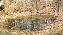
In the Elm there are a large number of sinkholes , circular, funnel-shaped depressions, which are also known as sinkholes . The figures vary between 200 and 600. The largest is the legendary "Bornumer Erdfall". In the “Teufelsküche” near Reitlingstal , the “Mönchespring” creek disappears in such a sinkhole (→ Schluckloch ). The youngest sinkhole was built in 1949 near Veltheim . The reason for the frequency of these structures in the Elm lies in the subsoil, which is rich in limestone, gypsum and salt rock. These types of rock, especially salt, are prone to being dissolved by groundwater, creating cavities in the subsoil which, if too large, collapse and lead to collapse funnels up to 15 meters deep on the surface. In the high elevations of the Elm, the depressions are dry, whereas in the lowlands they are filled with water.
history
Early history
Man already lived in the Elm in prehistoric times. This is proven by finds from the Middle Stone Age that are now kept in the Braunschweigisches Landesmuseum , including:
- a Neolithic chamber grave above Evessen ,
- numerous Bronze Age barrows and
- the so-called Reitling fortifications ( Wallburg systems) above the Reitlingstal (Krimmelburg, Brunkelburg, Wendehai walls and Wurtgarten).
middle Ages
In the Middle Ages there were numerous knight's castles in the Elm, including
- the hilltop castle Warburg , the remains of which were excavated in the 1960s;
- the Elmsburg , which was temporarily owned by the Teutonic Order and is also only preserved in remains of the ground;
- Langeleben Castle , which was destroyed in the Thirty Years War and is now in ruins;
- the moated castle of the Teutonic Knights Order on the large pond in Reitlingstal, later Vorwerk , of which no remains have remained; in their place there is now a pasture and farm.
While the Elm is almost uninhabited today, except for individual buildings, there were several settlements in the Middle Ages . These were the villages of Groß Rode and Brunsleberfeld (now foresters) and the hamlet of Langeleben with its castle.
Protected areas
On the Elm are the landscape protection areas of the same name Elm ( CDDA no. 320601; designated 1984; 53.747 km² in size), which extends from north to southeast, and Elm (CDDA no. 320600; 1995; 59.28 km²), which extends spreads from south to northwest. In the north-west are the nature reserves Reitlingstal (CDDA no. 165134; 1989; 12.6 ha ) and limestone quarry and semi -arid grassland on Eich-Berg near Hemkenrode (CDDA no. 82027; 1982; 10 ha) as well as the fauna and flora habitat - Northwestern Elm area (FFH no. 3730-303; 14.6 km²).
Land use and vegetation
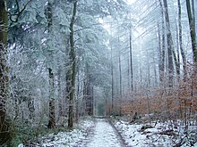
The Elm is mainly used for forestry . Due to its loess over limestone soil, the Elm was always covered with forest. In its natural form, this was a mixed deciduous forest . Important types of wood were above all the elm , which gave the Elm its name, the beech , which thrives well on limestone soil, and the oak , the fruits of which were preferably used in pig fattening . On these original forest have from earlier times traditional place names in Elm out how Buchberg (beech), Heine Book (hornbeam), Lindental (Linde), Hassel angle (hazel).
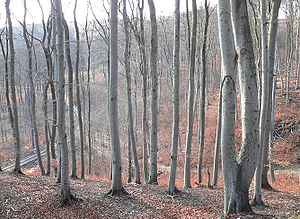
Today beech forest is widespread as a high forest in the north of the Elm . The beeches there are up to 30 meters high and around 150 years old. Since the trunks rise like a column and the leaf-bearing branches only begin at a height of about 15 meters, the forest takes on a hall-like character. One speaks therefore of a "beech forest" or a "forest cathedral", based on the architectural style of Gothic churches. Since the trees have a dense canopy and hardly any light can penetrate, there is almost no undergrowth in this type of forest. Extensive natural regeneration with beeches usually only occurs with the beginning of final forest use. Here, over a period of several decades, the beech trees that are ready to be cut are removed step by step, thus enabling young beech plants to emerge.
The Elm is of relatively great importance as a source of raw materials for the wood processing industry. The amount of logging per hectare is above the German average and the proportion of timber (approx. 80 percent) is high with little fuel and waste wood. As early as 1874, the poet Wilhelm Raabe praised the Elm in his work Master Author or The Stories of the Sunken Garden as a model forest that is known far beyond the German borders.
The forest area of the Elm today covers over 8000 hectares. Of these, 50% are state and 50% private forests. The Lower Saxony Forestry Office Wolfenbüttel is responsible for the management. 32% of the Elm are designated as a forest reserve. As a forest location, the Elm has a very good rating on a scale from 1 to 6 with a 5.
The declared aim of the state forest administration is to increase the proportion of varied deciduous and mixed forests, the proportion of old trees and groups of trees as well as dead trees in which many rare animals and plant species live. This goal has already been implemented in large parts of the state forest areas in the Elm. The forest administration would like to plant more ash, maple, cherry and oak, i.e. more native woods, in the Elm. Conifers are to be pushed back. The Elm, as the largest contiguous beech forest area in northern Germany (north of the Hessian mountainous region ) will be retained - the proportion of beeches will even increase slightly. The common beech is mainly represented. In addition to the concept developed by the Forestry Office, experts from the Lower Saxony Forest Planning Office also mapped the biotope . This serves as a guide for the preservation of valuable habitats for animals and plants.
History of land use
forestry
Until about the 10th century, the Elm was a royal forest district. Afterwards the forest of the ridge was used for agriculture by the around 70 surrounding villages. Each village had its own share of the Elm with its forest owners, the march comrades. At annual wood courts , under the chairmanship of an elected wood count, the use of the forest, such as the appointment of foresters, penalties for wood theft (wood crime) was discussed.
In 1530 the first forest regulations for the Elm were issued. Since then it has been managed as planned. Since 17./18. In the 19th century, the beech was strongly promoted, so that the Elm is now known as “Northern Germany's most beautiful beech forest”. The first conifers were spruce in 1726 , and the first larches in 1763 in the Warberg Forest. They develop very favorably and there are specimens 40 to 50 m high.
hunt
The Elm has always played a major role as a hunting area . Numerous place names such as Bärensohl, Wolfskuhlen, Saukuhle and Herzberg (Hirschberg) remind of the rich game population. Hunting in the Elm was originally reserved only for the German king. In 997, however, Emperor Otto III. the wild ban to Bishop Arnulf von Halberstadt .
Animal fattening
Since the Middle Ages, pigs have been herded with acorns and beechnuts in the Elm every year from October to December . According to the records from a good fattening year (1687), up to 4000 animals were in the Elm forests. But cattle, horses and sheep also used the forest pasture. The forest names Kuhspringtal, Bockslager, Ziegenberg still refer to the mast sites. The trift paths on which the cattle were driven into the Elm, for example the Evesser and Küblinger Trift, can still be recognized today as wide grass paths.
Stone quarrying
In earlier centuries the quarries in the Elm served to extract the Elm limestone , which was used for building purposes. Not only were the churches, castles and palaces built around the Elm, such as the Kaiserdom Königslutter , from the limestone , but it was also used in more distant buildings, such as in Braunschweig for the old town hall and the magnificent facade of the Gewandhaus . Stone carvings from the Elm were already transported to Bremen in 1404 for the construction of the Bremen Roland .
tourism
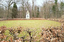
The Elm is mainly used for tourism as a recreation and hiking area. Until the turn of 1989 , visitors from West Berlin in particular used it for weekend trips due to its proximity to the inner-German border . There are several rest homes for young people where the Langeleben settlement used to be . The Elm Super Trail has been held annually since 2011 and runs as an ultra marathon from Warberg Castle around the Elm and through the Reitlingstal.
Since the end of the last century, numerous forest restaurants have been built in the Elm:
- Reitling restaurant in Reitlingstal
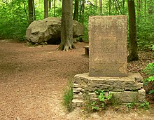
- Forest restaurant and monument on the Tetzelstein , on the L 290 between Königslutter and Schöppenstedt
- Elmhaus above Schöningen
- Forest peace above Esbeck
- Lutterspring at the Lutter spring near Königslutter
- Watzum house (former forester's house) above Eitzum
- To the Schunter spring on the Elmrad, to Räbke
- Diana Ruh am Elmrand, to Bornum am Elm
Elm mountain gymnastics festival
With the Elm mountain gymnastics festival , the second oldest German mountain gymnastics festival takes place every summer on the Tetzelstein between Schöppenstedt and Königslutter . Its history goes back to 1866.
References and comments
- ↑ a b Height indication "323.3 M " according to the summit cross on the Eilumer Horn (highest Elm elevation)
- ↑ Federal Agency for Nature Conservation: Landscape profile 51201 Ostbraunschweigisches Hügelland on bfn.de, accessed on April 8, 2018
- ^ Theodor Müller : Geographische Landesaufnahme: The natural space units on sheet 87 Braunschweig. Federal Institute for Regional Studies, Bad Godesberg 1962. → Online map (PDF; 4.8 MB)
- ↑ a b Map services of the Federal Agency for Nature Conservation ( information )
- ↑ Mountain height according to unknown / not researched source
- ↑ Fritz J. Krüger (Ed.): Walks in the Earth History, Volume 19, Braunschweiger Land. Publishing house Dr. Friedrich Pfeil, Munich, 2006, ISBN 3-89937-066-X , pp. 66–86
- ^ Richard Goedeke, Eberhard Grüger, Hans-Jürgen Beug : On the question of the number of ice ages in the north German lowlands. Sinkhole investigations on the Elm . In: News of the Academy of Sciences in Göttingen II. Mathematical-physical class . No. 15 , 1965, p. 207-212 .
literature
- Heinz-Bruno Krieger : Elmsagen. Oeding, Braunschweig-Schöppenstedt 1967.
- Heinz Röhr: The Elm. Oeding, Braunschweig-Schöppenstedt 1962.
Web links
- Description of the limestone beech forests in the Elm, on region-braunschweig.de


