Humla
| हुम्ला जिल्ला Humla district
|
|
|---|---|
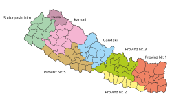
 Location of the Humla district (darker purple) in the Karnali province and in Nepal |
|
| Basic data | |
| Country | Nepal |
| province | Karnali |
| Seat | Simikot |
| surface | 5655 km² |
| Residents | 50,858 (2011 census) |
| density | 9 inhabitants per km² |
| ISO 3166-2 | NP-P6 |
| Website | www.ddchumla.gov.np |
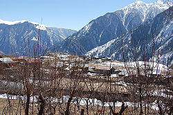
| Simikot, the administrative center of Humla | |
Coordinates: 29 ° 59 ' N , 82 ° 2' E
The Humla District ( Nepali हुम्ला जिल्ला Humlā Jillā ) is one of 77 districts in Nepal and has belonged to the Karnali Province since the 2015 constitution . The administrative seat is Simikot .
geography
The district is located in the far northwest of the country and borders on Tibet ( PR China ). It comprises a glaciated mountain range north of the main Himalayan ridge. Humla is traversed by the Humla Karnali initially in a south-south-east and later in a south-westerly direction. The district lies in the catchment area of the Humla Karnali.
At the end of 2018, Humla was the only district not yet connected to the national road network after the neighboring Dolpa district was connected to the Jajarkot district by a road in November . In 2017 it was also one of the ten poorest and most underdeveloped districts of Nepal with a Human Development Index value of less than 0.4.
Humla is at an altitude of 1524 meters to 7337 meters above sea level. Due to the mountainous terrain, mostly with rocks, gravel or snow, only about half of the area of the district is suitable for agriculture. Wheat and barley are only grown to a small extent, potatoes are the main source of food.
The maximum temperature in this district is between 10 ° C and 25 ° C and the minimum temperature is between −10 ° and −28 °. The annual rainfall of between 25.4 and 146.9 mm is comparatively low compared to other areas of Nepal.
Residents
At the 2001 census it had 40,595 inhabitants; In 2011 there were 50,858.
Administrative division
The district consists of the following Gaunpalikas:
By 2017, the district was divided into the following Village Development Committees (VDCs):
Web links
Individual evidence
- ↑ Schedule-4 States, and Districts to be included in the concerned States. - Nepal Law Commission. Retrieved December 13, 2018 .
- ^ Dolpa headquarters linked to national road network. Accessed January 1, 2019 .
- ↑ Bajura, not Saptari, is the most backward district of Nepal. December 14, 2017, accessed January 17, 2019 .
- ↑ a b संक्षिप्त परिचय: हुम्ला जि.स.स (Introduction to Nepalese language). Retrieved January 1, 2019 .
- ↑ Central Bureau of Statistics, Census 2011: National Report (pp. 51–52, Population Total and Area in Sq. Km ). ( Memento from May 25, 2013 in the Internet Archive ) (PDF; 7.8 MB)
- ↑ Nepal: Administrative Unit - State 6 Map | UN Nepal Information Platform. Retrieved January 1, 2019 .
