
Kastamonu (Province)
| Kastamonu | |
|---|---|
| Province number: | 37 |
  |
|
| Counties | |
 |
|
| Basic data | |
| Coordinates: | 41 ° 31 ' N , 33 ° 41' E |
| Provincial capital: | Kastamonu |
| Region: | Black Sea Region |
| Surface: | 13,064 km² |
| Population: | 383,373 (2018) |
| Population density: | 29.3 inhabitants / km² |
| Political | |
| Governor: | Yasar Karadeniz |
| Seats in Parliament: | 3 |
| Structural | |
| Telephone code: | 0366 |
| Features : | 37 |
| Website | |
| www.kastamonu.gov.tr (Turkish) | |
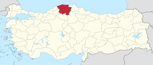
Kastamonu is a province of Turkey . Its capital is the Kastamonu of the same name .
The province borders on the provinces of Sinop in the east, Çorum in the southeast, Çankırı in the southwest and Karabük and Bartın in the west.
population
Results of the population extrapolation
The following table shows the annual population development after updating by the addressable population register (ADNKS) introduced in 2007. In addition, the population growth rate and sex ratio are ( Sex Ratio listed ie number of women per 1,000 men). The 2011 census found 360,694 inhabitants, almost 15,000 fewer than in the 2000 census.
| year | Population at the end of the year | Population growth rate (in%) |
Gender ratio (women per 1000 men) |
Rank (among 81 provinces) |
||
|---|---|---|---|---|---|---|
| total | male | Female | ||||
| 2018 | 383.373 | 191,431 | 191,942 | 2.95 | 1003 | 51 |
| 2017 | 372.373 | 184.289 | 188.084 | −1.21 | 1021 | 51 |
| 2016 | 376.945 | 188.039 | 188.906 | 1.16 | 1005 | 50 |
| 2015 | 372,633 | 184,585 | 188.048 | 1.01 | 1019 | 50 |
| 2014 | 368.907 | 183,564 | 185.343 | 0.22 | 1010 | 50 |
| 2013 | 368.093 | 183.188 | 184.905 | 2.30 | 1009 | 50 |
| 2012 | 359,808 | 177,647 | 182.161 | 0.01 | 1025 | 50 |
| 2011 | 359,759 | 177,666 | 182.093 | −0.41 | 1025 | 50 |
| 2010 | 361.222 | 178,875 | 182,347 | 0.39 | 1019 | 50 |
| 2009 | 359,823 | 177.152 | 182,671 | −0.17 | 1031 | 50 |
| 2008 | 360.424 | 176.832 | 183,592 | 0.02 | 1038 | 50 |
| 2007 | 360.366 | 176,954 | 183.412 | - | 1036 | 50 |
| 2000 | 375.476 | 181511 | 193.965 | 1069 | 51 | |
Census results
The following tables show the population of the province of Kastamonu documented in the 14 censuses .
The values in the table on the left are taken from e-books (from the original documents), the values in the table on the right come from the data query of the Turkish statistical institute TÜIK - available on this website:
| year | population | rank | |
|---|---|---|---|
| province | Turkey | ||
| 1927 | 336.501 | 13,648,270 | 8th |
| 1935 | 361.191 | 16.158.018 | 12 |
| 1940 | 369,847 | 17,820,950 | 14th |
| 1945 | 385.410 | 18,790,174 | 15th |
| 1950 | 412.016 | 20,947,188 | 17th |
| 1955 | 402,557 | 24,064,763 | 19th |
| 1960 | 433,620 | 27,754,820 | 24 |
| year | population | rank | |
|---|---|---|---|
| province | Turkey | ||
| 1965 | 441,638 | 31,391,421 | 29 |
| 1970 | 446601 | 35.605.176 | 35 |
| 1975 | 438.243 | 40,347,719 | 38 |
| 1980 | 450.946 | 44,736,957 | 40 |
| 1985 | 450.353 | 50,664,458 | 43 |
| 1990 | 423.611 | 56.473.035 | 46 |
| 2000 | 375.476 | 67,803,927 | 51 |
Number of provinces in relation to the census years:
- 1927, 1940 to 1950: 63 provinces
- 1935: 57 provinces
- 1955: 67 provinces
- 1960 to 1985: 73 provinces
- 1990: 73 provinces
- 2000: 81 provinces
Administrative division
The province is divided into 20 districts ( İlçe ):
| district | Area 1 (km²) |
Population (2018) 2 | Number of Units | Density (Ew / km²) |
urban share (in%) |
Sex ratio 3 |
Founding date 4.5 |
|||
|---|---|---|---|---|---|---|---|---|---|---|
| District ( İlçe ) | Administrative headquarters (Merkez) |
Municipalities (Belediye) |
City quarter (Mahalle) |
Villages (Köy) |
||||||
| Abana | 28 | 4,248 | 3,386 | 1 | 5 | 10 | 151.7 | 79.71 | 927 | 1968 |
| Ağlı | 225 | 3,196 | 2,248 | 1 | 10 | 13 | 14.2 | 70.34 | 1005 | 1990 |
| Araç | 1446 | 18,863 | 6,419 | 1 | 6th | 119 | 13.0 | 34.03 | 1027 | |
| Azdavay | 759 | 7,726 | 3,368 | 1 | 4th | 49 | 10.2 | 43.59 | 969 | 1946 |
| Bozkurt | 308 | 9,920 | 5,603 | 1 | 5 | 32 | 32.2 | 56.48 | 983 | 1968 |
| Cide | 652 | 23,329 | 10.096 | 1 | 16 | 75 | 35.8 | 43.28 | 968 | |
| Çatalzeytin | 272 | 7,035 | 2,717 | 1 | 2 | 41 | 25.9 | 38.62 | 984 | 1954 |
| Daday | 843 | 8,749 | 3,038 | 1 | 4th | 60 | 10.4 | 34.72 | 1043 | |
| Devrekani | 715 | 13,482 | 5,215 | 1 | 8th | 54 | 18.9 | 38.68 | 999 | 1944 |
| Doganyurt | 193 | 6,153 | 1,431 | 1 | 2 | 25th | 31.9 | 23.26 | 994 | 1990 |
| Hanonu | 417 | 4.156 | 2.132 | 1 | 3 | 20th | 10.0 | 51.30 | 981 | 1990 |
| İhsangazi | 445 | 5,469 | 2,895 | 1 | 10 | 23 | 12.3 | 52.93 | 1059 | 1987 |
| İnebolu | 417 | 21,738 | 10,721 | 1 | 14th | 77 | 52.1 | 49.32 | 983 | |
| Kastamonu Merkez | 1,847 | 148.931 | 118.282 | 1 | 20th | 177 | 80.6 | 79.42 | 995 | |
| Küre | 406 | 6.119 | 2,884 | 1 | 4th | 34 | 15.1 | 47.13 | 944 | 1926 |
| Pınarbaşı | 546 | 6,020 | 2,232 | 1 | 6th | 27 | 11.0 | 37.08 | 932 | 1987 |
| Seydiler | 233 | 4.143 | 2,643 | 1 | 10 | 15th | 17.8 | 63.79 | 999 | 1990 |
| Şenpazar | 252 | 5,002 | 1,689 | 1 | 7th | 23 | 19.8 | 33.77 | 932 | 1987 |
| Taşköprü | 1758 | 38,849 | 16,780 | 1 | 14th | 126 | 22.1 | 43.19 | 1037 | |
| Tosya | 1,302 | 40,245 | 28,891 | 1 | 23 | 54 | 30.9 | 71.79 | 1061 | |
| PROVINCE of Kastamonu | 13,064 | 383.373 | 232.670 | 20th | 173 | 1054 | 29.3 | 60.69 | 1003 | |
It is noteworthy that there is only one Belediye (municipality) in each district - namely the district town ( İlçe Merkezi ).
swell
Personalities
- Rıfat Ilgaz , Turkish writer. He is particularly popular and present in Turkey through the film adaptation of his novel Hababam Sınıfı .
Web links
Individual evidence
- ↑ Türkiye Nüfusu İl ve İlçelere Göre Nüfus Bilgileri , accessed on June 30, 2019
- ↑ Governor's portrait on the website of the Kastamonu Province
- ↑ Genel Nüfus Sayımları (census results 1965 to 2000).
- ↑ Directorate General of Mapping İl ve İlçe Yüzölçümleri (PDF; 0.25 MB).
- ↑ Türkiye Nüfusu İl İlçe Mahalle Köy Nüfusu , accessed on June 30, 2019.
- ↑ illeridaresi.gov.tr (PDF; 1.4 MB).
Adana | Adıyaman | Afyonkarahisar | Ağrı | Aksaray | Amasya | Ankara | Antalya | Ardahan | Artvin | Aydın | Balıkesir | Bartın | Batman | Bayburt | Bilecik | Bing oil | Bitlis | Bolu | Burdur | Bursa | Çanakkale | Çankırı | Çorum | Denizli | Diyarbakır | Düzce | Edirne | Elazığ | Erzincan | Erzurum | Eskişehir | Gaziantep | Giresun | Gümüşhane | Hakkâri | Hatay | Iğdır | Isparta | İstanbul | İzmir | Kahramanmaraş | Karabük | Karaman | Kars | Kastamonu | Kayseri | Kırıkkale | Kırklareli | Kırşehir | Kilis | Kocaeli | Konya | Kutahya | Malatya | Manisa | Mardin | Mersin | Muğla | Muş | Nevşehir | Niğde | Ordu | Osmaniye | Rize | Sakarya | Samsun | Siirt | Sinop | Sivas | Şanlıurfa | Şırnak | Tekirdağ | Tokat | Trabzon | Tunceli | Usak | Van | Yalova | Yozgat | Zonguldak