
Bunzlau district
The Bunzlau district was a Prussian district in Silesia . It existed from 1816 to 1945. The district office was in Bunzlau . The former district area is now in the Polish Lower Silesian Voivodeship .
Administrative history

After the conquest of most of Silesia by Prussia in 1741, the royal cabinet order of November 25, 1741 introduced the Prussian administrative structures in Lower Silesia . This included the establishment of two war and domain chambers in Breslau and Glogau as well as their subdivision into districts and the appointment of district administrators on January 1, 1742.
In the Principality of Jauer , one of the Silesian sub-principalities, the Prussian districts of Hirschberg , Jauer and Löwenberg-Bunzlau were formed from old Silesian soft images . All three districts were subordinate to the War and Domain Chamber Glogau, from which the district of Liegnitz of the province of Silesia emerged in the course of the Stein-Hardenberg reforms in 1815 .
The Löwenberg-Bunzlau district was split up by the Liegnitz government on January 26, 1816 into the two districts of Löwenberg and Bunzlau. The separation took place along the historical Weichbild boundary, so that the district of Bunzlau initially corresponded to the historical Weichbild Bunzlau. On June 1, 1816, as part of the establishment of districts in the Silesian Upper Lusatia, the "Dominion Wehrau possessed by the Count Solms heirs " with the estates Altenhan, Binitz, Ganz Siegersdorf, Heide Gersdorf, Neudorf, Neu Gersdorf, Ober- and Nieder Waldau including Eichert, Tzschirna and the royal domain estate Ullersdorf incorporated into the Bunzlau district.
During the district reform of January 1, 1820 in the Liegnitz administrative district, there were further changes to the area:
- The villages of Alt Jäschwitz, Alt Warthau, Groß Hartmannsdorf, Liebichau, Mittlau and Neu Warthau were reclassified from the Löwenberg district to the Bunzlau district.
- The villages Brockendorf, Grüßiggrund, Märzdorf, Petschendorf, Sankt Hedwigsdorf and Woitsdorf were reclassified from the Bunzlau district to the Goldberg-Haynau district .
- The village of Jakobsdorf was reclassified from the Bunzlau district to the Lüben district .
- The village of Haugsdorf was reclassified from the Bunzlau district to the Lauban district .
Since July 1, 1867, the district belonged to the North German Confederation as part of Prussia and from January 1, 1871 to the German Empire . On November 8, 1919, the province of Silesia was dissolved. The new province of Lower Silesia was formed from the administrative districts of Breslau and Liegnitz . On September 30, 1929, a territorial reform took place in the Bunzlau district as in the rest of the Free State of Prussia , in which almost all manor districts were dissolved and neighboring rural communities were assigned.
On April 1, 1938, the Prussian provinces of Lower Silesia and Upper Silesia were reunited to form the Province of Silesia. At the same time, the communities Heiligensee, Mühlbock, Schnellfurt and Tiefenfurt were reclassified from the district of Görlitz and the community Heiligensee from the district of Sprottau to the Bunzlau district. On January 1, 1939, the Bunzlau district was given the designation Landkreis in accordance with the now unified regulation . On January 18, 1941, the province of Silesia was dissolved. The new province of Lower Silesia was formed from the administrative districts of Breslau and Liegnitz.
In the spring of 1945 the district was occupied by the Red Army . In the summer of 1945, the district was placed under Polish administration by the Soviet occupying power in accordance with the Potsdam Agreement . The influx of Polish civilians began in the district area, some of whom came from the areas east of the Curzon Line that fell to the Soviet Union . In the period that followed, most of the German population was expelled from the district .
Population development
| year | Residents | source |
|---|---|---|
| 1819 | 40,074 | |
| 1846 | 56,624 | |
| 1871 | 57,499 | |
| 1885 | 59,573 | |
| 1900 | 62,937 | |
| 1910 | 64,813 | |
| 1925 | 67,609 | |
| 1939 | 72,912 |
District administrators

The (former) district office

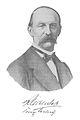
Ernst A. von Kölichen

Friedrich Graf v. Frankenberg
Karl von Reichenbach


- 1816 by Skal ( provisional )
- 1816–1840 Ernst Albrecht von Kölichen
- 1840–1849 Friedrich von Frankenberg
- 1849–1874 Karl von Reichenbach
- 1874–1880 by Lösch
- 1880 from Rittberg ( representative )
- 1880–1889 Constantin zu Stolberg-Wernigerode (1843–1905)
- 1889–1890 Viktor Eckard (1838–1907)
- 1890–1910 Conrad von Rosenstiel († 1910)
- 1910–1928 Hans von Hoffmann
- 1928–1929 Ulrich Burmann ( acting )
- 1929–1933 Wilhelm Köhne (* 1883)
- 1933–1944 Wilhelm Eckmann (1897–1945)
- 1942-1944 Siemionowski
- 1944–1945 Siegfried Kampf
Local constitution
The Bunzlau district has been divided into the cities of Bunzlau and Naumburg a. Queis , in rural communities and manor districts . With the introduction of the Prussian Municipal Constitutional Act of December 15, 1933, there was a uniform municipal constitution for all Prussian municipalities from January 1, 1934. With the introduction of the German Municipal Code of January 30, 1935, a uniform municipal constitution came into force in the German Reich on April 1, 1935, according to which the previous rural municipalities were now referred to as municipalities . These were grouped together in administrative districts . A new district constitution was no longer created; The district regulations for the provinces of East and West Prussia, Brandenburg, Pomerania, Silesia and Saxony from March 19, 1881 continued to apply.
Communities
The Bunzlau district last comprised two cities and 70 rural communities:
|
|
|
|
The forest districts of Bunzlauer Stadtforst and Klitschdorf-Wehrauer Heide also belonged to the district . The following municipalities lost their independence by 1938:
- Baudendorf, on April 1, 1938 to Altöls
- Burglehn, on May 5, 1908 in Bunzlau
- Klein Gollnisch, in Eichberg on April 1, 1938
- Königswalde, on April 1st, 1938 in Herzogswaldau
- New oils, on April 1, 1938 to waste oils
- Neu Warthau, on April 1, 1938 at Alt Warthau
- Nieder Groß Hartmannsdorf, on April 1, 1938 to Groß Hartmannsdorf
- Nieder Mittlau, on October 1, 1937 in Liebichau
- Nieschwitz, on April 1, 1938 at Alt Warthau
- Ober Groß Hartmannsdorf, on April 1, 1938 to Groß Hartmannsdorf
- Schöndorf, on April 1, 1938 in Lorenzdorf
- Ullersdorf am Bober, on April 1, 1938 in Kroischwitz
Place names
The Tschirne community was renamed Tonhain in 1937 .
Personalities
- Martin Opitz (1597–1639), baroque poet
- Otto Dienel (1839–1905), organist and composer
- Barbara Bartos-Höppner (1923–2006), writer
- Friedrich Karl von Eggeling (* 1924), forester, author and conservationist
- Dieter Hildebrandt (1927–2013), cabaret artist
- Hans-Joachim Hoffmann (1929–1994), GDR Minister of Culture
See also
literature
- Gustav Neumann : Geography of the Prussian State . 2nd edition, Vol. 2, Berlin 1874, pp. 221–222, item 9.
- Eduard Dewitz: History of the Bunzlau district . Bunzlau 1885, 702 pages ( digital copy - approx. 200 MB)
- Royal Statistical Bureau: The municipalities and manors of the Province of Silesia and their people. Based on the original materials of the general population census of December 1, 1871. Berlin 1874, pp. 210-217 ( facsimile in the Google book search).
- M. Rademacher: German administrative history from the unification of the empire in 1871 to the reunification in 1990. (online material for the dissertation, Osnabrück 2006)
Individual evidence
- ↑ Roland Gehrke: State Parliament and the Public: Provincial Parliamentarism in Silesia 1825-1845 , Böhlau Verlag: Köln 2009, p. 45, ISBN 978-3-412-20413-6 (online = partial digitization )
- ^ Monuments of the Prussian State Administration in the 18th century. Files from May 31, 1740 to the end of 1745 . Royal Academy of Sciences. Paul Parey: Berlin 1901 (= Acta Borussica 6.2) (Chapter Royal Order for the appointment of district administrators in Lower Silesia, p. 259ff) (online digital copy )
- ↑ WFC Starke: Contributions to the knowledge of the existing court system and the latest results of the administration of justice in the Prussian state, Carl Heymann: Berlin 1839, p. 290 (Chapter district division of the Prussian Duchy of Silesia in the 18th century online digitized )
- ↑ Ordinance on the division of the Prussian state according to its new boundary, 1815 (online digitized version )
- ^ Roman Kamionka: The reorganization of the district division of Silesia in the Stein-Hardenberg reform period , Breslau 1934, p. 79
- ↑ Preliminary announcement of the district division of Upper Lusatia in the administrative district of Liegnitz. In: Official Journal of the Prussian Government in Liegnitz . Liegnitz 1816, p. 1 (online digitized version )
- ^ Official gazette of the government in Liegnitz. Ordinance on the new district division of December 15, 1819 , Liegnitz 1819, No. 52, p. 470 (online = digitized version )
- ^ Statistisches Bureau zu Berlin (Ed.): Contributions to the statistics of the Prussian state . Duncker & Humblot, Berlin 1821, Silesia, p. 94 ( digitized version ).
- ↑ Royal Statistical Bureau (ed.): Mittheilungen des Statistisches Bureau's in Berlin, Volume 2 . Population of the districts. ( Digitized version ).
- ^ The municipalities and manor districts of the Prussian state and their population 1871
- ^ Community encyclopedia for the province of Silesia 1885
- ↑ a b www.gemeindeververzeichnis.de
- ^ A b c Michael Rademacher: German administrative history from the unification of the empire in 1871 to the reunification in 1990. bunzlau.html. (Online material for the dissertation, Osnabrück 2006).
- ^ Territorial changes in Germany
Web links

Sub-provinces: Lower Silesia | Upper Silesia
Administrative districts: Wroclaw | Katowice | Liegnitz | Opole | Reichenbach
Independent cities: Bytom OS | Wroclaw | Brieg | Gliwice | Glogau | Goerlitz | Grünberg i. Schles. | Hindenburg OS | Hirschberg i. Rsgb. | Katowice | Königshütte | Liegnitz | Neisse | Opole | Ratibor | Schweidnitz | Waldenburg (Schles)
Counties: Bytom | Beuthen-Tarnowitz | Bolkenhain | Wroclaw | Brieg | Bunzlau | Cosel | Falkenberg | Frankenstein | Fraustadt | Freystadt | Glatz | Glogau | Goldberg | Goldberg-Haynau | Goerlitz | Groß Strehlitz | Gross Wartenberg | Grottkau | Grünberg | Guhrau | Good day | Habelschwerdt | Hindenburg | Hirschberg | Hoyerswerda | Jauer | Katowice | Kreuzburg | State hat | Lauban | Leobschütz | Liegnitz | Löwenberg | Lüben | Lublinitz | Militsch | Münsterberg | Namslau | Neisse | Neumarkt | Neurode | Neustadt | Nimptsch | Oels | Ohlau | Opole | Pleas | Ratibor | Reichenbach | Rosenberg | Rothenburg | Rybnik | Sagan | Schönau | Schweidnitz | Sprottau | Steinau | Chasing | Striegau | Tarnowitz | Tost-Gleiwitz | Trebnitz | Waldenburg | Wohlau