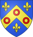
Lorges
| Lorges | ||
|---|---|---|

|
|
|
| region | Center-Val de Loire | |
| Department | Loir-et-Cher | |
| Arrondissement | Blois | |
| Canton | La Beauce | |
| Community association | Beauce Val de Loire | |
| Coordinates | 47 ° 49 ′ N , 1 ° 30 ′ E | |
| height | 115-146 m | |
| surface | 13.52 km 2 | |
| Residents | 352 (January 1, 2017) | |
| Population density | 26 inhabitants / km 2 | |
| Post Code | 41370 | |
| INSEE code | 41119 | |
| Website | http://lorges.fr/ | |
Lorges is a French municipality with 352 inhabitants (as of January 1 2017) in the department of Loir-et-Cher in the region Center-Val de Loire ; it belongs to the arrondissement of Blois and is part of the canton of La Beauce (until 2015: canton of Marchenoir ).
geography
Lorges is located about 29 kilometers north-northeast of Blois in the small Beauce . Lorges is surrounded by the neighboring communities of Villermain in the north and northeast, Cravant in the east, Josnes in the south and southeast, Concriers in the south, Roches in the southwest, Briou in the west and Saint-Laurent-des-Bois in the northwest.
Population development
| 1962 | 1968 | 1975 | 1982 | 1990 | 1999 | 2006 | 2013 | |
|---|---|---|---|---|---|---|---|---|
| 306 | 271 | 231 | 212 | 273 | 289 | 333 | 377 | |
| Sources: Cassini and INSEE | ||||||||
Attractions
- Saint-Martin church from the 15th / 16th centuries Century, since 2006 Monument historique
- Saint Thomas Chapel
- 16th century pit of the Castle of Fontenailles, monument historique since 1928
Personalities
- Guy Aldonce de Durfort, duc de Lorges (1638–1702), Marshal of France
- Victor Cosson (1915–2009), racing cyclist
Web links
Commons : Lorges - collection of images, videos and audio files
