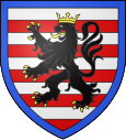
Cour-sur-Loire
| Cour-sur-Loire | ||
|---|---|---|

|
|
|
| region | Center-Val de Loire | |
| Department | Loir-et-Cher | |
| Arrondissement | Blois | |
| Canton | La Beauce | |
| Community association | Beauce Val de Loire | |
| Coordinates | 47 ° 39 ′ N , 1 ° 25 ′ E | |
| height | 67-115 m | |
| surface | 5.4 km 2 | |
| Residents | 266 (January 1, 2017) | |
| Population density | 49 inhabitants / km 2 | |
| Post Code | 41500 | |
| INSEE code | 41069 | |
Cour-sur-Loire is a French commune with a population of 266 (as at 1st January 2017) in the department of Loir-et-Cher in the region Center-Val de Loire ; it belongs to the Arrondissement of Blois and is part of the canton of La Beauce (until 2015: canton of Mer ).
geography
Cour-sur-Loire is about ten kilometers northeast of Blois . The Loire forms the southern and southeastern municipal boundaries . Cour-sur-Loire is surrounded by the neighboring communities of Suèvres in the north and east, Montlivault in the south and south-east, Menars in the south and west, Villerbon in the west and Mulsans in the north-west.
Population development
| 1962 | 1968 | 1975 | 1982 | 1990 | 1999 | 2006 | 2013 | |
|---|---|---|---|---|---|---|---|---|
| 238 | 240 | 279 | 293 | 289 | 307 | 286 | 284 | |
| Sources: Cassini and INSEE | ||||||||
Attractions
- Saint-Vincent-et-Sainte-Radegonde church from the 16th century, facade from the 12th century
- Cour-sur-Loire castle, built in 1490 for the Hurault family, renovations up to the 19th century, monument historique since 1961
Personalities
- Philippe Hurault de Cheverny (1528–1599), Chancellor of France
Web links
Commons : Cour-sur-Loire - Collection of images, videos and audio files
