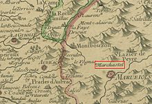
Marchastel (Lozère)
| Marchastel | ||
|---|---|---|
|
|
||
| region | Occitania | |
| Department | Lozère | |
| Arrondissement | Mende | |
| Canton | Aumont-Aubrac | |
| Community association | Hautes Terres de l'Aubrac | |
| Coordinates | 44 ° 39 ′ N , 3 ° 6 ′ E | |
| height | 1,139-1,304 m | |
| surface | 34.87 km 2 | |
| Residents | 57 (January 1, 2017) | |
| Population density | 2 inhabitants / km 2 | |
| Post Code | 48260 | |
| INSEE code | 48091 | |
| Website | Marchastel | |
 Marchastel ( Aubrac ) in winter |
||
Marchastel is a place and a municipality in the south of France with 57 inhabitants (as of January 1, 2017) in the Lozère department in the Occitanie region .
location
Marchastel is located in the far west of the Lozère department near the border with the Aveyron department at the foot of a long-extinct volcano on the Aubrac plateau at an altitude of approx. 1200 m above sea level. d. M. The river Bès forms the north-western boundary of the municipality. The municipality is one of about 2 km north of the town core lies the hamlet also ( hamlet ) Rieutort and some farmsteads. In the south of the municipality are the mountain lakes Lac de Saint-Andéol and Lac de Born, some of which are surrounded by marshy terrain .
Population development
| year | 1800 | 1851 | 1901 | 1954 | 1999 | 2013 |
| Residents | 297 | 427 | 248 | 133 | 73 | 66 |
Because of the remote location of the place and as a result of the loss of jobs due to the mechanization of agriculture , the population of Marchastel has continuously decreased since the beginning of the 20th century to the lows of the last decades.
economy
In the past, the residents lived as self-sufficient farmers from sheep and cattle breeding or from dairy products and from the yields of small barley fields and gardens protected from the wind . In the 19th century the importance of breeding Aubrac cattle , which can be kept outdoors all year round, increased more and more. In the second half of the 20th century, tourism was added as a source of income in the form of renting holiday apartments ( gîtes ).
history
A Roman military road already ran along here in ancient times; it connected the cities of Tolosa (Toulouse) and Lugdunum (Lyon). On the Pic de la Tour , the foundations of a medieval castle ( château ) of the barony of Peyre can still be seen. The part of the Way of St. James ( Via Podiensis ) starting in Le Puy also led along here.
Attractions
- The barren, almost treeless and deserted landscape of the Aubrac is extremely impressive and can be explored on hikes.
- Some houses in the village and the Église Saint-Andéol , built in 1903, are built entirely or partially from volcanic rock. The roofs usually consist of slate ( schistes ) and stone shingles ( lauzes ).
- On the outskirts there is a bakery and a claw stand ( travail ).
- About 1.5 km northwest of the village, a three-arched stone bridge leads over the river Bès.
- At the Lac de Saint-Andéol there was already an important place of worship in pre-Roman times.


