Pfyn
| Pfyn | |
|---|---|
| State : |
|
| Canton : |
|
| District : | Frauenfeld |
| BFS no. : | 4841 |
| Postal code : | 8505 |
| Coordinates : | 714 095 / 272811 |
| Height : | 411 m above sea level M. |
| Height range : | 390–557 m above sea level M. |
| Area : | 13.14 km² |
| Residents: | 2016 (December 31, 2018) |
| Population density : | 153 inhabitants per km² |
| Website: | www.pfyn.ch |
|
Pfyn |
|
| Location of the municipality | |
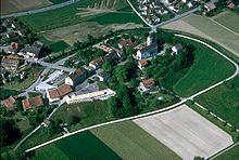
Pfyn [pfiːn] is a village on the Thur between Frauenfeld and Steckborn and a political municipality in the Frauenfeld district of the canton of Thurgau in Switzerland .
The municipal community Pfyn existed from 1803 to 1997 and included the local communities Dettighofen and Pfyn and until 1994 the local community Weiningen . The municipality of Pfyn and the local parish of Dettighofen and Pfyn have formed the political municipality of Pfyn since 1998.
history
The name goes back to the Roman Ad Fines ("on the border", meaning is between the provinces of Raetia and Gaul ). The remains of a late antique Roman fort are still visible. The place was already settled in the Neolithic . Finds from around 4000 to 3500 BC Chr. Gave this period the name Pfyner culture . Pfyn is one of the oldest settlements in Eastern Switzerland. As the Gallo- Romans, some of which had become Christian as early as the 3rd century, came together in the Roman fort , Pfyn also had one of the first churches in Thurgau.
Pre-Roman times

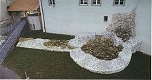
The «Städtli» Pfyn with the Bartholomäus church was built within the walls of the late Roman fort Ad Fines . The course of the non-visible image in northern fort wall coincides approximately with the late medieval houses line the town. The remains of the southern wall of the fort were removed by erosion .
The oldest so far discovered traces of settlements are located around 1.5 km west of Pfyn in the former peat bog Breitenloo, in the weak sink a lateral moraine of the Thur glacier, and date back to the Neolithic (4300 v. Chr.). The settlement was discovered at the end of the 19th century while cutting peat , but was subsequently forgotten again. In the war years 1940/41 the square was cut again during drainage work to reclaim cultivated land. Thanks to the support of a broad public, the settlement with an area of around 1000 m² was examined by interned Polish soldiers under the direction of Karl Keller-Tarnuzzer in autumn 1944 . Based on the topographical conditions and the exploratory drilling carried out in 2002, it can be assumed that around 60% of the settlement area was excavated. Using the planning documents from 1944, 17 house floor plans can be defined. The houses are oriented independently of the gable on a main street running from north to south. The buildings are almost exclusively two-aisled and have lengths of 4 to 11 meters and widths of 3.5 to 5.5 meters. It is noticeable that several houses of quite different sizes were located next to each other, which probably indicates larger residential buildings with smaller economic buildings . The house consisted of soil elaborate Unterzugskonstruktionen and overlying gap boards or beatings , mostly with clay were covered. Accumulations of finds under the floors and partial scorch marks on the underside indicate that at least individual buildings were lifted slightly from the ground by the support structures. As is customary, only a few of the walls and roofs of the houses existed, but wooden and wicker walls are covered.
Due to the relative lack of finds, Keller-Tarnuzzer has already pointed out the single-phase nature of the settlement and recognized the close relationship between the ceramic finds and the Michelsberg culture of southwest Germany. Around 1960, German research highlighted the independence of Pfyner ceramics within the Michelsberg culture. Since then, Pfyn-Breitenloo has been the eponymous station of the so-called Pfyn culture . The follow-up investigations in 2002 and 2004 led to a somewhat more differentiated picture of the settlement. Among other things, the time position could be clarified dendrochronologically . The timber used is between 3706 and 3704 BC. BC and confirm the single phase. Another Neolithic settlement must have existed around 400 meters northwest of Breitenloo. According to the few ceramics that came to light in a former peat cut, it also belongs to the Pfyn culture. The settlement has never been systematically investigated and is likely to have been largely destroyed during industrial peat extraction during World War II.
Because of Pfyn's importance as a godparent station for the Pfyn culture and as a Roman fort town , the other epochs were somewhat beyond the archaeological focus. So are about Bronze Age Beilfunde and not localizable grave finds from around Pfyn has long been known only in recent years, but hear themselves on Bronze Age settlement layers in place. Iron Age finds and findings are known to this day only a few.
Roman time
The equation of the Ad Fines mentioned in the sources with today's Pfyn is undisputed. It is also clear that the place name on the provincial border between the provinces of Rhaetia and Belgica and Germania Superior relates. The course of the Roman road from Oberwinterthur ( Vitudurum ) via Frauenfeld to Pfyn and on to Arbon (Arbor Felix) is well known. In contrast, the route of a road connection towards Eschenz ( Tasgetium ) remains uncertain . Traces of an imperial settlement are almost completely missing. In addition to references to an estate in the Heerenziegler, individual finds and parts of a large stone building from Spolia are known.
The situation is different for the late Roman period, when the fort was located in the area of the Städtlihügel. Today the hill is eroded by the Thur and the Mühlebach and has been reduced in size in the south and east, so that only parts of the north and west side of the wall have been preserved. Only with the excavations in 1976, 1980/81 and 1990–1992 was the fortress better explored. The height of the Roman walls, some of which are integrated into today's buildings, is over 3 meters in places. A total of six semicircular towers are known; At the beginning of the 21st century, however, gates and the moat are still missing. Little is known about the development of the approximately 15,000 m² interior area. They found about a Sodbrunnen and remains of wooden buildings. Fort Pfyn, which also included a smaller burial ground in the area of Hof Adelberg, gained special significance through the finds. Numerous coins and other objects indicate an occupation by the Roman military, including mounted troops, from the later 3rd century to the beginning of the 5th century. During this time, the fortress Pfyn covered the rear connecting line of the border defense along the Rhine lines between Arbon and Oberwinterthur ( Limes ). Nothing is known about the end of the Pfyn fort, but the Bartholomäuskirche indicates a continuity of settlement in the fort area.
From the Middle Ages to the present

Numerous medieval skeletal remains were found in individual graves in the church . In the Middle Ages, the landlord was the cathedral monastery of Konstanz . The bailiwick was first owned by the Ministerial von Klingenberg , from 1488 it belonged to Jakob Mötteli. In 1560 it came to Peter von Gundelfingen , 1567 to Otto Graf zu Eberstein , 1584 to Wolf Wambold von Umstadt and finally in 1614 to the city of Zurich , which appointed a bailiff until 1798. In 1476, a fire ravaged the town that had been built on the ruins of the Roman fort. The village of Pfyn was rebuilt northwest of the fire site.
St. Bartholomew's Church located in the Roman fort was the center of a large early medieval parish , at the beginning on the left Thurufer Felben , Wellhausen , Hüttlingen , Mettendorf , Harenwilen and Eschikofen , on the right Weiningen , Lanzenneunforn , Gündelhart , Hörhausen , Unterhörstetten , Dettighofen and Müllheim belonged . After the Reichenau Monastery was founded , Hüttlingen and Müllheim separated from Pfyn. In the late Middle Ages, the chaplains Felben, Gündelhart and Weiningen were established within the parish and later became independent. In 1155 the cathedral chapter of Constance was the parish collator and enfeoffed a canon who had a vicar take care of the pastoral care . In 1528 the Reformation was carried out in Pfyn . The villages belonging to the Pfyn parish, such as Gündelhart or Hörstetten, however, remained mostly Catholic. A Catholic priest was reinstated as early as 1533. The patronage remained common to both denominations and they practice the simultaneous use of the church to this day. In the 18th century a large part of the population was reformed. The collature went to the canton in 1804, and to the parishes after 1840 .
In 1414 and 1502 Pfyn received openings from the Dompropstei . The community had the Thur Bridge built from 1794 to 1795 and was allowed to levy a bridge toll for it until 1850. In Pfyn fruit growing was particularly practiced, in 1905 there were over 9100 fruit trees in the municipality. The castle dairy was established in 1822 and the village dairy in 1879. In 1858 Heinrich Bertschinger founded a cotton spinning mill, which was soon producing socking yarn from cotton and wool, so-called Vigognegarn . From 1896 it was known as Vigognespinnerei Pfyn. It employed 93 people in 1911 and 106 in 1923. In 1994 it went bankrupt as VSP Textil AG. In 2005, industry and trade accounted for half of the jobs in the municipality and agriculture for a fifth. From 1970, the former vineyard on the outskirts became a coveted location for a heterogeneous single-family housing estate.
See also
→ History section in the article Dettighofen TG
Community reform
Until the Thurgau community reform, Pfyn was a municipal community in the Steckborn district and consisted of the local communities Pfyn, Dettighofen and Weiningen (TG) . From 1803 to 1816 the local parishes of Herdern and Lanzenneunforn also belonged to the municipality of Pfyn.
Pfyn was converted into today's political municipality in two steps:
- In 1995 the local community Weiningen (TG) separated from the municipal community Pfyn and merged with Warth to form the political community of Warth-Weiningen .
- In 1998 the municipality of Pfyn merged with the local communities of Dettighofen and Pfyn to form the political municipality of Pfyn.
coat of arms
Blazon : In red three left-facing yellow arrows with white tips and fletching.
In 1941 the previously used municipal coat of arms was redrawn and the three arrows heralded to the left . After the formation of the political community, the coat of arms of the previous local community was transferred to the new community.
population
 |
| 1831 | 1850 | 1900 | 1950 | 1990 | 2000 | 2010 | 2018 | |
|---|---|---|---|---|---|---|---|---|
| Political community | 1804 | 1927 | 2010 | |||||
| Municipal parish | 1105 | 1227 | 1530 | 2068 | ||||
| Local parish | 533 | 789 | 891 | 1187 | 1578 | |||
| source | ||||||||
Of the total 2010 inhabitants of the municipality of Pfyn in 2018, 287 or 14.3% were foreign citizens. 829 (41.2%) were Protestant Reformed and 508 (25.3%) were Roman Catholic. The village of Pfyn had 1591 residents at this time.
economy
In 2016, Pfyn offered 525 jobs (converted to full-time positions). Of these, 12.8% were employed in agriculture and forestry, 30.6% in industry, trade and construction and 56.6% in the service sector.
politics
On March 11, 2007, Jacqueline Müller was elected mayor.
Attractions
- Städtli with the remains of the Roman fort still visible
- the simultaneous church of St. Bartholomew
schools
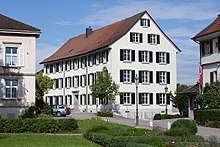
In Pfyn, teaching takes place in two school buildings on the Städtlihügel . The children can get to the school either via the Schülerweg , Mühlegasse , Bergli or Rumpelgasse . The "Schulhaus Schloss" with its large rooms offers plenty of space for lessons. In 1993 the facility was expanded to include the “Kastell schoolhouse”. Exposed walls from Roman times were preserved.
In 1996 the multi-class system was introduced. Since then, the children have been taught in the lower grades (1st – 3rd grade) and intermediate (4th – 6th grade). The gym was built in 1968. The two-story building is also used by clubs. In summer, the Frankrichli offers a spacious meadow for gymnastics lessons and leisure activities.
Pfyn belongs to the upper level district of Müllheim. The secondary school pupils can safely get to the “Oberstufenzentrum Rietwies” on a well-developed cycle path. The facility is located on the western outskirts of Müllheim, approx. 3 km from Pfyn.
The kindergarten is located in the Trotte building in the Städtli and in the fort.
In 2008 the new Obere Wiide sports field south of the VSP area was inaugurated. It can be used in summer as well as in winter, as the main square is provided with artificial turf.
Varia
- Pfyn was proclaimed the cultural capital of Switzerland for 2011/2012 .
- The lake below the town is called Frankriichli .
literature
- Albin Hasenfratz, Hansjörg Brem, Erich Trösch: Pfyn. In: Historical Lexicon of Switzerland .
The history section is largely based on the entry in the Historical Lexicon of Switzerland (HLS), which, according to the HLS's usage instructions, is under the Creative Commons license - Attribution - Share under the same conditions 4.0 International (CC BY-SA 4.0). - Alfons Raimann, Peter Erni: The art monuments of the Canton of Thurgau, Thurgau VI. The Steckborn district. Edited by the Society for Swiss Art History GSK. Bern 2001 (Art Monuments of Switzerland, Volume 98). ISBN 3-906131-02-5 .
Web links
Individual evidence
- ↑ Permanent and non-permanent resident population by year, canton, district, municipality, population type and gender (permanent resident population). In: bfs. admin.ch . Federal Statistical Office (FSO), August 31, 2019, accessed on December 22, 2019 .
- ↑ a b Thurgau in figures 2019 . On the website of the Statistical Office of the Canton of Thurgau (PDF file; 1.8 MB), accessed on April 28, 2020.
- ↑ Swiss land use statistics. Completed on July 1, 1912. Published by the Federal Statistical Bureau. ( Memento from April 12, 2016 in the Internet Archive )
- ↑ a b Localities and their resident population. Edition 2019 . On the website of the Statistical Office of the Canton of Thurgau (Excel table; 0.1 MB), accessed on April 28, 2020.
- ↑ a b c d Albin Hasenfratz, Hansjörg Brem, Erich Trösch: Pfyn. In: Historical Lexicon of Switzerland .
- ^ History. On the website of the Pfyn municipality, accessed on December 31, 2019
- ↑ Mutation No. 28f to the official Gde. Verz CH , edition 1986
- ↑ Mutation No. 42j to the official Gde. Verz CH , edition 1986
- ↑ a b municipal coat of arms . On the website of the State Archives of the Canton of Thurgau, accessed on December 8, 2019
- ↑ a b c population development of the municipalities. Canton Thurgau, 1850–2000 and resident population of the municipalities and change from the previous year. Canton of Thurgau, 1990–2018. On the website of the Statistical Office of the Canton of Thurgau (Excel tables; 0.1 MB each), accessed on April 28, 2020.
- ↑ schulepfyn.ch: Pfyn Primary School , accessed on March 4, 2011
- ↑ www.kulturhauptstadtderschweiz.ch accessed on February 7, 2012


