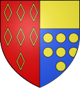
Plouha
| Plouha | ||
|---|---|---|

|
|
|
| region | Brittany | |
| Department | Cotes-d'Armor | |
| Arrondissement | Guingamp | |
| Canton | Plouha (main town) | |
| Community association | Leff Armor Community | |
| Coordinates | 48 ° 41 ′ N , 2 ° 56 ′ W | |
| height | 0-109 m | |
| surface | 39.97 km 2 | |
| Residents | 4,503 (January 1, 2017) | |
| Population density | 113 inhabitants / km 2 | |
| Post Code | 22580 | |
| INSEE code | 22222 | |
| Website | http://www.plouha.fr/ | |
 Church of St. Peter in Plouha, consecrated in 1872 |
||
Plouha is a French commune with 4503 inhabitants (as of January 1, 2017) in the Côtes-d'Armor department in Brittany and the capital of the canton of Plouha .
The place is located 27 kilometers northwest of Saint-Brieuc and about three kilometers from the Atlantic coast. There are the highest cliffs in Brittany at the Pointe de Plouha at 104 meters.
Population development
| year | 1962 | 1968 | 1975 | 1982 | 1990 | 1999 | 2009 | 2016 |
|---|---|---|---|---|---|---|---|---|
| Residents | 4227 | 4296 | 4195 | 4248 | 4197 | 4401 | 4582 | 4484 |
| Source: INSEE | ||||||||
Architectural monuments
See: List of Monuments historiques in Plouha
Parish partnership
The Irish town of Killorglin is a sister city of Plouha.
literature
- Le Patrimoine des Communes des Côtes-d'Armor. Flohic Editions, Volume 2, Paris 1998, ISBN 2-84234-017-5 , pp. 1076-1084.
Web links
Commons : Plouha - collection of images, videos and audio files

