Radosze
| Radosze | ||
|---|---|---|

|
|
|
| Basic data | ||
| State : | Poland | |
| Voivodeship : | Warmia-Masuria | |
| Powiat : | Kętrzyn | |
| Gmina : | Barciany | |
| Geographic location : | 54 ° 13 ' N , 21 ° 18' E | |
| Residents : | 201 | |
| Postal code : | 11-410 | |
| Telephone code : | (+48) 89 | |
| License plate : | NKE | |
| Economy and Transport | ||
| Street : | Ext. 590 : Barciany ↔ Drogosze - Korsze - Reszel - Biskupiec | |
| Rail route : | no rail connection | |
| Next international airport : | Danzig | |
Radosze ( German Freudenberg ) is a village in Poland in the Warmian-Masurian Voivodeship . It belongs to the rural community Barciany (Barten) in the powiat Kętrzyński ( Rastenburg district ) .
Geographical location
Radosze is about 13 kilometers south of the Polish state border with the Russian Kaliningrad Oblast , and it is 16 kilometers to the southeast to the district town of Kętrzyn ( German: Rastenburg ).
history
Local history
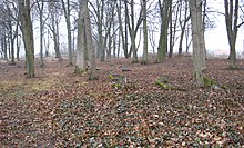
Before the settlement of today's Radosze, there was probably a Pruzzen fortress on a hill to the west . In the times of the Pruzzen, the mountain is said to have been surrounded by water.
The Freudenberg was laid out around 1370, but possibly as early as 1352 under German law. An area of 50 Włóka belonged to the village . In 1785 Freudenberg was mentioned as a “royal farming village with 36 fireplaces”. In 1874 the newly established district of Barten Domain was established in the Rastenburg district and the Königsberg district in the Prussian province of East Prussia . The Freudenbergswalde residential area ( Radoski Dwór in Polish ) belonged to the village of Freudenberg , and on March 13, 1918 the property forester's house Klingspornswalde (no longer existent today) in the Dönhofstädt estate - in the administrative district of the same name - was reclassified to the Freudenberg rural community . In 1929 the name of the administrative district of Barten domain was changed to " Taberwiese administrative district " ( Taborzek in Polish ). The district existed until 1945.
In January 1945 the Red Army marched into the area. As a result of the war, the village was part of Poland and renamed "Radosze". In 1937 the village became a Schulzenamt (Polish Sołectwo ) in the municipality of Barciany (rural municipality of Barten ). The two localities Zalewska Góra and Wargity (Wargitten) belonged to the Schulzenamt .
Due to two administrative reforms, the village was part of the Olsztyn Voivodeship between 1975 and 1998 and has been part of the Warmian-Masurian Voivodeship since 1999 .
Population development
| year | number |
|---|---|
| 1820 | 275 |
| 1885 | 492 |
| 1905 | 377 |
| 1910 | 384 |
| 1933 | 481 |
| 1939 | 462 |
| 2011 | 201 |
church
A (Catholic?) Church is said to have stood in Freudenberg. Remains of the stone baptismal font were in the garden of the school building before 1945.
Before 1945 mainly Protestant residents lived in Freudenberg. They belonged to the parish of the church Barten in the parish of Rastenburg ( Polish Kętrzyn ) in the church province of East Prussia of the Church of the Old Prussian Union .
Today the population of Radosze is almost without exception Roman Catholic . The former Protestant church in Barciany now serves as a Catholic parish church in the Deanery Kętrzyn II (north-east) of the Archdiocese of Warmia in the Catholic Church in Poland .
Protestant church members living in Radosze are now assigned to the parish in Kętrzyn , which maintains a chapel as a place of worship in Barciany and belongs to the Masurian diocese of the Evangelical-Augsburg Church in Poland .
school
In 1808 there was a school in Freudenberg that was attended by 33 school children, in 1823 there were 55.
traffic
Voivodeship Road 590 runs through Radosze . This opens about 3 kilometers east in the Voiwodschaftsstraße 591 (former German Reichsstraße 141 ) a little north of Barciany (Barten) . In a westerly direction, it leads after about 13 kilometers through Korsze (Korschen) .
The next train station is also in Korsze, or there is a train station in Kętrzyn, which is about as far away. Both places offer direct connections to Olsztyn (Allenstein) and Posen or Ełk (Lyck) and Białystok .
The nearest international airport is Kaliningrad Airport , which is located about 85 kilometers northwest on Russian territory. The nearest international airport on Polish territory is Lech Wałęsa Airport, Gdansk, about 190 kilometers to the west .
literature
- Tadeusz Swat: Dzieje Wsi . In: Aniela Bałanda and others: Kętrzyn. Z dziejów miasta i okolic . Pojezierze, Olsztyn 1978, p. 219 ( Seria monografii miast Warmii i Mazur ).
Web links
Individual evidence
- ↑ Polish Postal Code Directory 2013, p. 1069
- ^ History of Barciany - Barten at ostpreussen.net
- ↑ Dietrich Lange, Geographical Location Register East Prussia (2005): Freudenberg
- ↑ a b Freudenberg (Rastenburg district) at GenWiki
- ↑ a b c Rolf Jehke, administrative district of Barten / Taberwiese domain
- ↑ Klingspornswalde at GenWiki
- ^ Wieś Radosze w liczbach
- ↑ Photo of the baptismal font of the former church


