
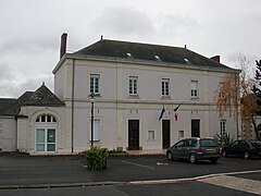
Champtocé-sur-Loire
| Champtocé-sur-Loire | ||
|---|---|---|

|
|
|
| region | Pays de la Loire | |
| Department | Maine-et-Loire | |
| Arrondissement | Angers | |
| Canton | Chalonnes-sur-Loire | |
| Community association | Loire Layon Aubance | |
| Coordinates | 47 ° 25 ′ N , 0 ° 52 ′ W | |
| height | 11-83 m | |
| surface | 36.76 km 2 | |
| Residents | 1,868 (January 1, 2017) | |
| Population density | 51 inhabitants / km 2 | |
| Post Code | 49123 | |
| INSEE code | 49068 | |
| Website | Champtocé-sur-Loire | |
 Ruins of the castle of Gilles de Rais |
||

Champtocé-sur-Loire is a commune with 1,868 inhabitants (at January 1, 2017) in the department of Maine-et-Loire in the region of Pays de la Loire .
history
Neolithic people built megalithic structures such as the Dolmen de la Romme , the Dolmen de la Boire de Champtocé or the Dolmen du Champ-du-Ruisseau .
The name Champtocé comes from the Celtic “Canthos”.
There was a castle in the 9th century. Construction of the church began in the 11th century. A castle was built in the 13th century, of which ruins are still preserved.
The church of St. Pierre was completed between the 14th and the 16th century, and Lancrau Castle was built in the 15th century. In the 15th century the medieval castle was inhabited by Gilles de Rais , who tortured and murdered young boys there.
Beauchesne Castle was built in the 18th century.
Viticulture
The place belongs to the Anjou wine region .
- Attractions

Saint-Pierre church

Dolmen du Champ-du-Ruisseau

Dolmen de la Romme
Mayorry


The place has a train station on the Tours – Saint-Nazaire railway line .
See also
literature
- Le Patrimoine des Communes de Maine-et-Loire . Flohic Editions, Volume 2, Paris 2001, ISBN 2-84234-117-1 , pp. 1079-1081.