
Mountains (Lower Saxony)
| coat of arms | Germany map | |
|---|---|---|
.png)
|
Coordinates: 52 ° 37 ' N , 7 ° 45' E |
|
| Basic data | ||
| State : | Lower Saxony | |
| County : | Osnabrück | |
| Joint municipality : | Fürstenau | |
| Height : | 44 m above sea level NHN | |
| Area : | 66.71 km 2 | |
| Residents: | 3531 (Dec. 31, 2019) | |
| Population density : | 53 inhabitants per km 2 | |
| Postal code : | 49626 | |
| Area code : | 05435 | |
| License plate : | OS , BSB, MEL, WTL | |
| Community key : | 03 4 59 009 | |
| Community structure: | 5 parts of the community | |
| Address of the municipal administration: |
Tempelstrasse 8 49626 mountains |
|
| Website : | ||
| Mayor : | Volker Brandt ( SPD ) | |
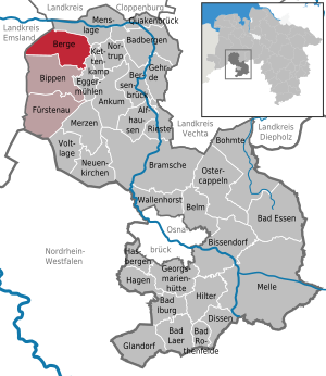
| Location of the municipality of Berge in the district of Osnabrück | ||
  |
||


Berge is a municipality within the joint municipality of Fürstenau on the north-western border of the Osnabrück district in Lower Saxony .
geography
Geographical location
The municipality of Berge is located in western Lower Saxony on the extreme northwestern edge of the Osnabrück district. Immediately to the west, the municipality borders on the district of Emsland. The closest major cities (rounded straight line distances) are Osnabrück (50 km southeast), Oldenburg (65 km northeast) and Bremen (80 km east-northeast).
In terms of nature, there are mountains in the central North German lowlands . The town is more precisely delimited in the northern edge area of the Dümmer-Geest lowland , which in turn forms part of the large landscape of the North German lowlands as a third-order natural spatial unit . The natural spatial unit of the Ems-Hunte-Geest joins just a few kilometers north. In addition, the municipal area with the Börsteler Wald is located in the northern foothills of a glacial terminal moraine landscape, the Ankumer Höhe . The elevations of the Börsteler Wald separate the center of Berge from the Grafeld district to the west of the forest area . Overall, the landscape typical of North German geest landscapes with a varied character is evident. Extensive fields and wet meadows shape the appearance of the municipality and alternate with fens and swamp forests. The Börsteler Wald terminal moraine rises like an island from the otherwise flat lowlands and is particularly noticeable to the observer from the west and north. The Berger municipality is also part of the Northern Teutoburg Forest-Wiehengebirge Nature Park . It should be mentioned, however, that the geology of the community of Berge has nothing to do with the Wiehengebirge mountains far to the southeast, nor with the Teutoburg Forest .
Neighboring communities
Berge borders in the north on Menslage , in the east on Kettenkamp and Eggermühlen , in the south on Bippen and in the west on the district of Emsland with the communities Wettrup , Dohren and Herzlake .
Community structure
Parish parts:
- Anten
- mountains
- Dalvers
- Grafeld
- Hekese
- Börstel - Stift Börstel
climate
The climate in the mountains and the surrounding area is typical of the temperate, maritime climate zone of northern Germany. There is a moderate maritime climate, which is influenced by humid north -westerly winds from the relatively close North Sea (the Dollart bay is about 70 km by air in a north-westerly direction). As is typical for these climates, the winters are mild, wet and, due to the relative proximity to the North Sea, sometimes also characterized by stormy weather conditions, but larger amounts of snow or longer permafrost are rare. The summers are generally only moderately warm and rich in precipitation; July and August generally have the highest amounts of precipitation of the year. A second maximum can be seen in December and January.
The Börsteler forest as nördlichster part of the glacial moraine of Ankum Heights might west and northwest of Berge ensure a microclimate in terms of rainfall due to its location. Since the dominant wind direction here, as in large parts of the North German Plain, is southwest to northwest and precipitation mostly comes from this direction, it can be assumed that there is a slight slipstream here . Mountains on the east side of the ridge are therefore in the lee area and will presumably have lower rainfall than, for example, villages in the neighboring Emsland , which are in turn west of the ridge and thus on the windward side. The reason for this assumption are the differences between the relatively nearby official weather stations in Lingen (Ems) and Bersenbrück . In Lingen, west of the Ankumer Höhe, the annual average rainfall is 789 mm. In Bersenbrück, just 40 km to the east, on the other side of the terminal moraine, it is only 616 mm. Since there are no mountain ranges in the vicinity apart from the Ankumer Höhe, which rises like an island from the North German Plain , it is likely that this is responsible for the uneven distribution of precipitation in the region. Because of this location east of the Börsteler Wald as the northernmost branch of the Ankumer Höhe, mountains are likely to have slightly less rainfall than neighboring villages to the west of Emsland. However, there are no specific comparative values from mountains or the surrounding area.
history
The relatively well-preserved megalithic complexes of Hekese are located in the municipality , about one kilometer south of the village. The complexes (No. 883 and 884 according to Sprockhoff) of the passage grave type are unusually large (19 and 20 meters long, respectively) and connected in a way that is unique in Germany with a 53 meter long, but no longer complete row of stones . The Megalithic Culture Route, which connects numerous large stone graves in northern Germany, also passes through these facilities. Berge is a stage on the route of megalithic culture .
On Sunday, April 8, 1945, Berge was occupied by British troops. The troops advancing from Ohrte encountered resistance, so that there were numerous fighting in and around the place.
Incorporations
The current municipality of Berge was formed on the occasion of the regional reform on July 1, 1972 from the municipalities of Anten, Berge, Dalvers, Grafeld and Hekese.
Population development
_-_population_development.svg)
The following overview shows the population of Berge in the respective territories and on December 31st.
The figures are updates by the State Office for Statistics and Communication Technology Lower Saxony based on the census of May 25, 1987 .
The data from 1961 (June 6) and 1970 (May 27) are the census results including the places that were incorporated on July 1, 1972.
|
|
|
politics
Municipal council
The parish council currently has 15 members from four parties or groups. Mayor is Volker Brandt (SPD).
The following table shows the local election results since 1996.
| Berge Municipality Council: election results and municipal councils | |||||||||||||||||||
|---|---|---|---|---|---|---|---|---|---|---|---|---|---|---|---|---|---|---|---|
| CDU | SPD | Green | FDP | UWG 1 |
Individual applicants |
Others | total | electoral participation |
|||||||||||
| Electoral term | % |
|
% |
|
% |
|
% |
|
% |
|
% |
|
% |
|
% |
|
% | ||
| 1996-2001 | 60.2 | 10 | 34.6 | 5 | 5.2 | 0 | - | - | - | - | - | - | - | - | 100 | 15th | 68.9 | ||
| 2001-2006 | 62.4 | 10 | 34.6 | 5 | 3.0 | 0 | - | - | - | - | - | - | - | - | 100 | 15th | 63.0 | ||
| 2006-2011 | 44.6 | 7th | 41.8 | 6th | 1.9 | 0 | - | - | 11.7 | 2 | - | - | - | - | 100 | 15th | 69.5 | ||
| 2011-2016 | 36.57 | 5 | 51.15 | 8th | 3.71 | 1 | - | - | 8.57 | 1 | - | - | - | - | 100 | 15th | 65.37 | ||
| 2016-2021 | 37.02 | 5 | 58.96 | 9 | 4.03 | 1 | - | - | - | - | - | - | - | - | 100 | 15th | 66.92 | ||
|
Percentages rounded. Sources: State Office for Statistics and Communication Technology Lower Saxony, District Osnabrück. In the case of different information in the sources mentioned, the data from the State Office for Statistics and Communication Technology were used, as they are generally more plausible. 1 Independent community of voters |
|||||||||||||||||||
mayor
- Since 2006 Volker Brandt (SPD)
- 1981-2006 Alfons Bertke (CDU)
coat of arms
The coat of arms was approved by the district on May 16, 1978.
Blazon : "In gold, a red-silver bar nested in two rows, overlaid with a shortened and sharpened red pole."
The shaft is supposed to remind of the Cistercian order, which had such in the coat of arms; he owned the former monastery in the municipality, now the Börstel monastery. The stake represents the red pillar in color and shape , a border post in the municipality that is linked to all sorts of stories. Both figures together make up the Christian cross.
Economy and Infrastructure
traffic

From 1904 to 1952 Berge had a railway connection through the Lingen – Berge – Quakenbrück small railway, stations were in Berge itself and in today's district of Dalvers. The Berger Bahnhof was the seat of the municipal administration until 2008, and two freight cars on the former track are a memorial to the small train.
The next connection to the network of the Reichs- or Bundesbahn was from 1879 the station of the former RhE in Bippen about 5 km away. Passenger traffic was stopped here in 1969 and freight traffic in 1978.
Today the public transport in Berge and the surrounding area is provided by the Verkehrsgemeinschaft Osnabrück with buses. Mountains are reached by four lines, of which line 640 (Fürstenau – Berge – Quakenbrück) is the most important connection.
Berge is on the Artland Route holiday route .
Established businesses
In Berge the company Segler-Förderanlagen Maschinenfabrik GmbH with 134 employees produces conveyor systems for various branches of industry.
August Bruns GmbH & Co. KG builds passive houses under the brand name EVO | Passivhaus.
education
In addition to the elementary school in Berge, there is also the Oberschule Berge with around 340 students. The next grammar school can be found in Emsland in Handrup , as well as the Artland grammar school in Quakenbrück.
Personalities
Sons and daughters of the church
- Christian Höveler († 1850s), painter
- Willi Stöve (born February 4, 1860 in Berge; † September 22, 1931), politician, member of the Reichstag
- Wilhelm Bleckwenn (1906–1989), German military, most recently major general and probably also rear admiral in World War II, service in the army and navy
People connected to the community
- Paul Freytag (* 1873 in Haspe; † 1954), painter and draftsman, lived on the Hengholt estate since 1926
- Gerhard Lucas Meyer (born May 6, 1830 in Burgerbrug-Zyde (Netherlands), † December 30, 1916 in Hanover), industrialist
literature
- Werner Dobelmann , mountains . History of a rural community. Verlag Oelkers, Quakenbrück 1981, ISBN 3-923664-00-1 .
Web links
Individual evidence
- ↑ State Office for Statistics Lower Saxony, LSN-Online regional database, Table 12411: Update of the population, as of December 31, 2019 ( help ).
- ↑ http://www.strassedermegalithkultur.de/
- ↑ 70 years ago: The British invasion of mountains. In: noz.de. Neue Osnabrücker Zeitung , April 5, 2015, accessed on April 21, 2020 .
- ↑ a b Federal Statistical Office (ed.): Historical municipality register for the Federal Republic of Germany. Name, border and key number changes in municipalities, counties and administrative districts from May 27, 1970 to December 31, 1982 . W. Kohlhammer, Stuttgart / Mainz 1983, ISBN 3-17-003263-1 , p. 254 .
- ↑ State Office for Statistics and Communication Technology Lower Saxony, population update ( page no longer available , search in web archives ) Info: The link was automatically marked as defective. Please check the link according to the instructions and then remove this notice.
- ↑ https://www.fuerstenau.de/city_info/webaccessibility/index.cfm?region_id=6&waid=489&design_id=0&modul_id=33&record_id=80973 Results of the municipal election in Berge on the website of the municipality of Fürstenau
- ↑ State Office for Statistics and Communication Technology Lower Saxony, Table 5000311
- ↑ Landkreis Osnabrück, official final results of the district election on September 9, 2001 ( Memento from May 25, 2005 in the Internet Archive ) (PDF; 528 kB)
- ^ The local elections for the district of Osnabrück on September 11, 2011 (also includes 2006 results). (PDF; 8.0 MB) Landkreis Osnabrück, p. 22 column "Municipal elections " , accessed on March 6, 2016 .
- ↑ https://www.noz.de/archiv/vermischtes/artikel/148603/berge-hat-einen-neuen-burgermeister New Mayor
- ↑ https://www.noz.de/lokales/samtgemeinde-fuerstenau/artikel/472982/bundesverdienstkreuz-fur-alfons-bertke-aus-berge#gallery&0&0&472982 Mayor Alfons Bertke
- ↑ Glider conveyor systems - overview. Segler Förderanlagen GmbH, accessed on June 21, 2017 .
- ↑ EVO | Passive House. August Bruns GmbH & Co. KG, accessed on May 2, 2010 .
- ↑ Our school - HRS mountains. Haupt- und Realschule Berge, accessed on May 2, 2010 .
Alfhausen | Ankum | Bad food | Bad Iburg | Bad Laer | Bad Rothenfelde | Badbergen | Belm | Mountains | Bersenbrück | Tapping | Bissendorf | Boiled | Bramsche | Dissen at the Teutoburg Forest | Eggermühlen | Fürstenau | Gehrde | Georgsmarienhütte | Glandorf | Hagen am Teutoburg Forest | Hasbergen | Hilter at the Teutoburg Forest | Kettenkamp | Melle | Menslage | Merzen | Neuenkirchen | Nortrup | Ostercappeln | Quakenbrück | Rieste | Voltage | Wallenhorst