
Tightness
 quarters of Zurich |
|
|---|---|
 |
|
| Coordinates | 682 570 / 246490 |
| height | 409 m |
| surface | 2.40 km² |
| Residents | 9489 (Dec. 31, 2017) |
| Population density | 3954 inhabitants / km² |
| BFS no. | 261-024 |
| Post Code | 8002 |
| Urban district | District 2 since 1893/1913 |
Die Enge is a district of the city of Zurich . The formerly independent municipality Enge was incorporated in 1893 and is today along with Wollishofen and Leimbach the circuit 2 .
Neighborhood structure
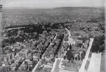

The quarter is southwest of the city center, between parks, moraine hills and Lake Zurich . Around 9,500 people live in the narrow area on around 2.4 square kilometers.
The quarter is of great economic importance mainly due to the 27,000 jobs of regional, national and international companies, including four global insurance groups. The Enge is famous for its landmark, the Enge Church , but even more for the Rietberg Museum in Rieterpark and the collection of succulents, which are well-known beyond the national borders . Architecturally significant are the former 18th and 19th century country estates Muraltengut (today serves city receptions), Liberut (today the seat of the International Ice Hockey Association ), Belvoir (today hotel management school) and Villa Wesendonck (today Rietberg Museum) including the preserved parks as well the industrialist villa Villa Sihlberg . The only vineyard on the territory of today's city of Zurich that has been planted throughout and has never been given up in the meantime is on the southern slope in front of the Bürgli , where the writer Gottfried Keller wrote his Green Heinrich . Many other villas had to make way for new buildings in the 20th century. The many streets with facades of historicism are also worth mentioning. In contrast to the quarters Hottingen is Art Nouveau little represented; the ensemble Bleicherweg 37–47 with the distinctive Chachelihuus at the Tunnelstrasse tram stop is a significant exception .
coat of arms
- Divided six times by silver and red
history
Prehistory and early history
The first evidence of settlements in the Enge area was discovered in 1961 at today's intersection of Alfred-Escher- / Breitingerstrasse . During excavations, Neolithic settlements from the time of 3300 and 3200 BC have been proven. After that, the next settlement was not to arise until about 1000 years later, which in turn was in the 9th century BC Was replaced by an early Iron Age settlement at today's General Guisan Quai . Since the lake level had probably risen, this settlement was already forced by its Celtic inhabitants around 800 BC. To be abandoned again.
Although it can be assumed that there were later small settlements in the area of today's Enge, the only find - a woman's grave on Gabler Hill, in which ankle and arm rings were found - dates from the 4th century BC. From the time of the Roman Empire , various small traces were found in the narrow area (walls, coins, mosaics, etc.) and u. a. a grave at the Tiefenhöfe . These finds were interpreted as the remains of Roman villas . After the Romans moved away, Helvetian peasants were probably left behind in the Enge , and they later mingled with the invading Alemanni . Only an Alemannic sax that was found during construction work reminds of this time .
Surname
In 1210, the name "Enge", which is derived from a field name that indicates a bottleneck, was first found in a document. It mentions newly cleared land in Engi superiori . However, it is still not clear to which point in the Enge district this name refers. According to Guntram Saladin , the narrow depression between the moraines on both sides of today's Waffenplatzstrasse is the starting point for the name. A source from 1351, in which today's Brandschenkestrasse is referred to as "Landstrasse nach Engi", also seems to indicate that the "Engi" was in the area of today's Waffenplatzstrasse. Uf Engi was also the name of a fiefdom of the Fraumünster Abbey at the foot of the Rietberg , which supports this interpretation. According to another opinion, the location in question «Engi» is said to have been located further south on today's Brunaustrasse.
It was not until the 16th century that the name Enge became established for the entire municipality. Another name was Watch to the Three Kings, which referred to an earlier chapel in the area of today's Zurich Enge train station. In 1897 this designation was taken up again as an archaic for the name of the newly founded district guild "Guild of the Three Kings".
middle Ages
After the time under Alemannic rule, the narrow area belonged to the territory of the Franconian Empire and after the Treaty of Verdun to the Duchy of Swabia . A donation from Ludwig the German , a grandson of Charlemagne , to his eldest daughter Hildegard - he gave her a small existing monastery along with a lot of land - came under the rule of the Fraumünster monastery and the Zurich imperial bailiff. With the takeover of the Reichsvogtei by the Counts of Lenzburg , the Enge came under their rule until they died out in 1173. After the Lenzburgs died out, the Imperial Bailiwick of Zurich and Enge passed to the Zähringer family . On behalf of the Zähringer (and possibly even earlier on the order of the Lenzburg) the barons of Eschenbach administered the Imperial Bailiwick of Zurich. With the death of Berthold V in 1218, however, the main line of the Zähringer died out and the Reichsvogtei Zurich fell to the Eschenbachers as an imperial fief.
See also: Zürichgau , History of the City of Zurich

Over the years, the Eschenbachers' property has been divided up again and again. However, the Imperial Bailiwick of Zurich remained in the possession of the branch of the Eschenbach family that lived on the Schnabelburg throughout the 13th century . Since the Eschenbacher Berchtold III. After his death in the battle of Göllheim he left his sons in debt, they had to sell the bailiwick of Wollishofen along with other lands. On October 6, 1304 Walter von Eschenbach sold the Vogtei Wollishofen in his and his brothers' names to Rüdiger Manesse, a son of the song collector Rüdiger Manesse . It can be assumed that he wanted to create a "small empire" with Manegg Castle as its center. The successors of Rüdiger Manesse as Vogt were his son Ulrich and his son Rüdiger, who was Rudolf Brun's successor from September 1360 mayor of the city of Zurich.
In 1392 the Manesses were also forced to turn their property into money and sold the Vogtei Wollishofen on May 4th to Rudolf Hoppeler von Winterthur and to the knight Johannes von Seon, a Zurich councilor . The bailiwick soon sold them to the Zurich citizen Johannes Ebishart , who sold them to Johannes Stucki from Zurich on November 5, 1395. In 1420 Jakob Stucki, a descendant of Johannes Stucki, sold the bailiwick to the city of Zurich. The Vogtei Wollishofen, consisting of the Wachten (military and tax districts) Enge and Wollishofen , where Leimbach belonged to Wacht Enge despite the lack of a common border, was administered by the town's upper bailiffs, two members of the Small Council, until 1789.
As a neighbor of the city of Zurich, Enge was not spared from the Old Zurich War . Although the Dreikönigskapelle in der Enge was still used as a venue for negotiations in 1440, sources report that the Confederates later also wreaked havoc in the Enge. However, it can be assumed that the population was able to flee behind the city walls of Zurich and that the Engemer did not suffer any significant losses.
reformation
In contrast to areas on the other bank of Lake Zurich, the Reformation took place in the narrowness without resistance and violence. The houses of worship were also secularized in the narrow area, including the Epiphany Chapel, first mentioned in 1361. The name of the chapel (it stood on the site of today's Enge train station ) was reflected both in the coat of arms of the former municipality of Enge and in the name of today's district guild. The chapel, later converted into a residential building, fell victim to a fire in 1887 and was demolished in 1890. The associated prayer and school house, built in 1776, was demolished in 1899.
Together with Ulrich Zwingli , a narrow contingent moved into the Second Kappel War , whereby the narrow ones Adam Welti, Junghans Sässler and Uli Baag fell.
17th century
Since the Enge was now under the spell of the city of Zurich, only craftsmen who belonged to a city guild were allowed to settle here. On the other hand, the narrow-minded people were waived the usual customs duties at the city gates. There were often disputes in which the town guilds sued against craftsmen who had settled in the narrow area. Some of these were decided by the Council in favor of and others against the plaintiffs.
When the city fortifications were expanded in the 17th century , the narrow area lost the area between the Fröschengraben (today: Bahnhofstrasse ) and the Schanzengraben to the city. The Engemer who lived there were allowed to retain their citizenship, but were no longer subordinate to the chief bailiffs, but to the city directly.
Industrialization and incorporation


At the end of the 19th century, various industrial companies and numerous wealthy entrepreneurs settled in the Enge, building villas with, in some cases, large parks. In 1841, for example, Emanuel Hess from Zurich bought the property to expand the wine trading company he founded in 1834 (today Landolt Weine AG ). In 1866 the Hürlimann brewery was relocated to the Steinernes Tisch farm, which is adjacent to the farm . In 1834 the Landolt family replaced their tower-like town house with a classicist building, the Bürgli , where the poet and politician Gottfried Keller lived from 1876 to 1882.
At the end of the 19th century, the left bank Seebahn near the lake was planned, whereby the first train station in 1875 was not built at the current location, but around 100 meters closer to the lake. The route ran through the Ulmberg tunnel to Wiedikon and corresponds to the later tunnel road. With only around 20 trains per day, the numerous level crossings with the corresponding waiting times were accepted.
Under city engineer Arnold Bürkli , the Bürkliplatz and the quay facilities with quay bridge and arboretum , today's Bürklipark , were created in the 1880s through considerable lake embankments. For the most part, Zurich was given a spectacular public promenade in the area of the still independent municipality of Enge and thus opened up to the lake for the first time.
After the community of Aussersihl was confronted on the one hand with social and on the other hand with infrastructural problems (housing and school building), its municipal council submitted a petition to the cantonal council in 1885 for unification with the city of Zurich, which also affected the other 10 sub-communities. The communities of Enge and Wollishofen rejected this request. After deliberations in the Cantonal Council, however, on May 11, 1891, the Unification Act was adopted with 169 votes to 11. This law provided for the unification of the 11 outer communities with the city of Zurich, which was required by Aussersihl. In the following cantonal referendum, the bill was accepted with 37,843 votes to 24,904. Of the communities affected, only the communities Enge (yes: 448, no: 453) and Wollishofen (yes: 124, no: 256) voted against. Wollishofen then even submitted an appeal to the Federal Supreme Court, which, however, was rejected. On January 1, 1893, the narrow was then incorporated together with the ten other outlying communities.
20th century


The Zurich Enge train station was built from Ticino granite between 1925 and 1927 according to plans by the Pfister brothers , which is why the square in front of it is called Tessinerplatz .
From 1954 to 1960, the architect built Jacques Schader on the grounds of Villa Park and Freudenberg today's Canton schools Enge and Freudenberg . The facility has been a listed building since 1987. From 1993 to 2000 it was completely renovated for the first time. Architectural features of the school building are the flooding of light - in each room the light falls from two - and the size of the rooms. These are relatively high and have large windows. Thanks to the preservation of parts of the old park, the entire building complex is surrounded by trees.
In 1964, one of the first high-rise buildings in the city of Zurich was completed in the Enge district: the 50 m high- rise zur Palme at Bleicherweg 33 by the architects Max Ernst Haefeli , Werner Max Moser and Rudolf Steiger . The building, which is strongly geared towards the automotive community, gave a lot to talk about in Zurich and also received international attention - the city of Zurich's award for good buildings, on the other hand, was denied.
The railway tunnel under the Parkring, which was closed after the route was laid in 1927 and opened to motor vehicle traffic, was expanded in the mid-1960s and reopened in 1968 as an efficient connection between Wiedikon and Enge. This capacity expansion was also due to the opening of the Sihlhochstrasse six years later , via which the A3 motorway leads traffic from the left bank of Lake Zurich and the Sihl valley into the city.
The Sanitas Spital, founded by the Dominicans , was relocated to the neighboring municipality of Kilchberg in 1975 .
In 1986 a deep borehole on the grounds of the Hürlimann brewery found a spring that was found to be extraordinarily rich in minerals. The brewery launched the first Zurich mineral water called Aqui. Small quantities of water were made available to the population free of charge at the Aqui fountain on Brandschenkestrasse. The fountain remained in operation even after the brewery was closed. From 2003, apartments and jobs in service companies and businesses were created on the site. The move of the Google headquarters for the EMEA economic area ( Europe, Middle East, Africa ) met with great media coverage .
Locations

-
Reformed Church Enge ▼ On the hill of the lateral moraine of the Linth Glacier stands the mighty Reformed Church Enge with its 60-meter-high tower and distinctive dome. It was built in the years 1892–1894 according to plans by Alfred Friedrich Bluntschli (1842–1930). The Enge church is a New Renaissance building. She owns an organ from the organ building company Th. Kuhn from 1951 with 62 sounding stops and a remote control from 1994, which is located in the dome of the church.
-
Catholic Church "Three Kings"
The Catholic Church is somewhat hidden about 300 m south-east of the Reformed Church. It was built in the years 1949–1951 by the architects Ferdinand Pfammatter and Walter Rieger and is in the tradition of the French concrete Gothic. The colorful windows of the church come from Paul Monnier (1907–1982), who achieved the luminosity of his glass windows through the unevenness of the two surfaces as well as through the thickness and luminosity of the glass. -
Hafen Enge ▼ The Hafen Enge is one of the oldest seaports in Zurich. It is protected by a granite wall that is open on both sides. The south-eastern entrance is protected by a striking, approximately 2.5 m high lion sculpture (Zurich's heraldic animal).
-
Lido Enge
The lido in the middle of Zurich offers a 330-meter-long sandy beach and a 5-meter diving platform in the lake. Many residents use it for an extended lunch break to swim and then have lunch on the beach. Every year, a lake crossing to the Tiefenbrunnen lido opposite is organized, where several thousand swimmers tackle the 1 km stretch across the lake. -
Google Europe
The headquarters of Google for the EMEA economic area was built in 2008 on the old Hürlimann site .

-
Museum Rietberg
Opened in 1952 in the Villa Wesendonck , the museum is dedicated to art from Asia, Africa, America and Oceania and is the only art museum for non-European cultures in Switzerland. -
FIFA World
Museum of FIFA about football, which opened in February 2016 in a former office building on Tessinerplatz. -
Succulents Collection Zurich .
With around 6,500 cultivated species and varieties, it is one of the most extensive and most important special collections of succulent plantsworldwideand a protective collection of the International Organization for Succulent Research (IOS).
literature
- Paul Guyer: The story of tightness. Orell Füssli Verlag, Zurich 1980, ISBN 3-280-01215-5 .
- Building Construction Department of the City of Zurich, Office for Urban Development: Enge, Wollishofen, Leimbach. Verlag Neue Zürcher Zeitung, Zurich 2006 (Baukultur in Zurich, Volume V), ISBN 3-03823-074-X .
- Hans Hürlimann: The history of the structural development of the former municipality of Enge. Report house printing house, Zurich 1964.
- Martin Illi: Enge (ZH). In: Historical Lexicon of Switzerland .
- Presidential Department of the City of Zurich, Statistics City of Zurich: Quartierspiegel Enge. Zurich 2015 ( read online ).
Web links
- Website of the neighborhood association Enge
- Website of the non-profit society Enge
- Website of the Enge neighborhood meeting place
- Rietberg Museum
- Succulents Collection
Individual evidence
- ^ Roland Böhmer: The free property in Zurich-Enge. Headquarters of the International Ice Hockey Federation IIHF. (Swiss Art Guide, No. 827, Series 83). Ed. Society for Swiss Art History GSK. Bern 2008, ISBN 978-3-85782-827-0 .
- ↑ For the two names see Paul Guyer: Die Geschichte der Enge. Orell Füssli, Zurich 1980, pp. 10-12.
- ↑ Denise Marquard, editor Zurich @ tagesanzeiger: Narrows are the real Zürichberg . In: Tages-Anzeiger, Tages-Anzeiger . September 30, 2010, ISSN 1422-9994 ( tagesanzeiger.ch [accessed on July 23, 2017]).
- ^ Schönbächler: Churches and places of worship in the city of Zurich. New Year's Gazette Industriequartier / Aussersihl. Zurich 2012, p. 47
- ^ Website of the church Enge, section disposition of the organ. Retrieved July 20, 2013.
- ^ Schönbächler: Churches and places of worship in the city of Zurich. New Year's Gazette Industriequartier / Aussersihl. Zurich 2012, p. 46
- ^ Andreas Böni: Gianni Infantino opens the Fifa Museum. In: look . February 28, 2016, accessed May 3, 2016 .
Affoltern | Albisrieden | Altstetten | City | Tightness | Escher Wyss | Fluntern | Friesenberg | Trade school | Hard | Hirslanden | Hirzenbach | Universities | Höngg | Hottingen | Langstrasse | Leimbach | Lindenhof | Mühlebach | Oberstrass | Oerlikon | Town Hall | Seeds | Schwamendingen-Mitte | Seebach | Seefeld | Sihlfeld | Undercarriage | Weinegg | Will | (Alt-) Wiedikon | Wipkingen | Witikon | Wollishofen
Former communities: Affoltern | Albisrieden | Altstetten | Aussersihl | Tightness | Fluntern | Hirslanden | Höngg | Hottingen | Leimbach | Niederurdorf | Oberstrass | Oberurdorf | Örlikon | Riesbach | Schwamendingen | Seebach | Undercarriage | Wiedikon | Wipkingen | Witikon | Wollishofen
Since 1986 in the Miles district : Zollikon
Since 1989 to the new Dietikon district : Birmensdorf | Dietikon | Geroldswil | Oberengstringen | Oetwil on the Limmat | Streaks | Uitikon | Unterengstringen | Urdorf | Weiningen
Canton of Zurich | Districts of the Canton of Zurich | Municipalities of the Canton of Zurich