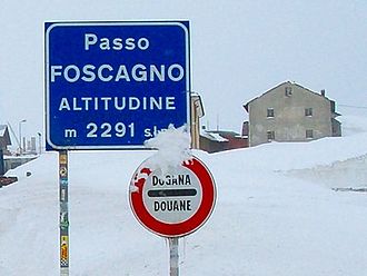
Passo di Foscagno
| Passo di Foscagno | |||
|---|---|---|---|
|
|
|||
| Compass direction | west | east | |
| Pass height | 2291 m slm | ||
| Province / Region |
|
||
| Watershed | Spöl → Inn → Danube | Adda → Po | |
| Valley locations | Madonna del Soccorso, Livigno | Valdidentro , Bormio ( Valtellina ) | |
| expansion | Strada Statale 301 del Foscagno | ||
| Winter closure | open all year | ||
| Mountains | Livigno Alps | ||
| profile | |||
| Ø pitch | 5.6% (271 m / 4.8 km) | 4.5% (1066 m / 23.9 km) | |
| Max. Incline | 12% | 12% | |
| map | |||
|
|
|||
| Coordinates | 46 ° 29 '45 " N , 10 ° 12' 29" E | ||
The Passo di Foscagno (German: Foscagnopass ) is a pass in Valtellina in Italy . The top of the pass is at 2291 m slm .
Together with the Passo d'Eira 2210 m slm on the same route, it connects Bormio with the duty-free Livigno . Livigno can only be reached all year round from Italy via this road, as the Forcola di Livigno between Poschiavo (CH) and Livigno is only free of snow in summer. Livigno can also be driven year-round from Switzerland via the toll road Munt-la-Schera tunnel .
The steepest slope is 12%.
See also
Web links
Commons : Passo di Foscagno - collection of images, videos and audio files
Individual evidence
- ^ A b Ernst Höhne: Knaurs Lexicon for Mountain Friends / The Alps between Allgäu and Lake Garda . Droemer Knaur, Munich 1986, ISBN 3-426-26224-X , p. 113 .
- ↑ The pass portal: Foscagno Pass (Passo di Foscagno). MoTourMedia eK, accessed on June 8, 2020 .

