
Altenfelden
|
market community Altenfelden
|
||
|---|---|---|
| coat of arms | Austria map | |
 |
|
|
| Basic data | ||
| Country: | Austria | |
| State : | Upper Austria | |
| Political District : | Rohrbach | |
| License plate : | RO | |
| Surface: | 26.43 km² | |
| Coordinates : | 48 ° 29 ' N , 13 ° 58' E | |
| Height : | 598 m above sea level A. | |
| Residents : | 2,250 (January 1, 2020) | |
| Population density : | 85 inhabitants per km² | |
| Postal code : | 4121 | |
| Area code : | 07282 | |
| Community code : | 4 13 04 | |
| NUTS region | AT313 | |
| Address of the municipal administration: |
Veldenstrasse 3 4121 Altenfelden |
|
| Website: | ||
| politics | ||
| Mayor : | Klaus Gattringer ( ÖVP ) | |
|
Municipal Council : (2015) (25 members) |
||
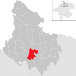
| Location of Altenfelden in the Rohrbach district | ||
  |
||
 Market square with parish church |
||
| Source: Municipal data from Statistics Austria | ||

Altenfelden is a market town in Upper Austria in the Rohrbach district in the upper Mühlviertel with 2250 inhabitants (as of January 1, 2020). The community is located in the judicial district of Rohrbach .
geography
Altenfelden lies at 598 m above sea level. A. Höhe in the upper Mühlviertel . In terms of the nature conservation spatial structure, the community area largely belongs to the Central Mühlviertel highlands , only in the area of the lower Mühltäler does the community have a share in the Danube gorge and side valleys . The extension is 7.4 km from north to south and 6.6 km from west to east. The total area is 26.43 km², making Altenfelden the tenth largest of the 40 municipalities in the district. The community area extends over a height of around 310 meters at the Kleine Mühl and over 650 meters at Mairhof and is 28.1 percent wooded (Upper Austria: 38.3 percent). A further 64.3 percent (Upper Austria: 49.3 percent) are used as agricultural land, the remaining 6.6 percent of the municipal area is accounted for by bodies of water, gardens, construction areas and other areas. Neighboring communities are Arnreit in the north, Neufelden in the southeast and east, Kleinzell in the Mühlkreis in the southeast, Kirchberg ob der Donau in the south, Niederkappel in the southwest, Lembach in the Mühlkreis in the west and Hörbich in the northwest.
Community structure
The municipality includes the following localities (population in brackets as of January 1, 2020):
- Altenfelden (1185)
- Atzesberg (40)
- Blumau (117)
- Double (14)
- Fraunschlag (58)
- Outdoor (41)
- Godersdorf (71)
- Haselbach (100)
- Hörhag (113)
- Chicken Screaming (53)
- Long necks (28)
- Mairhof (41)
- Newborn (59)
- Oberfeuchtenbach (56)
- Panwood (24)
- Starling (12)
- Starz (13)
- Steinerberg (55)
- Unteredt (43)
- Unterfeuchtenbach (60)
- Refuses (26)
- Wollmannsberg (41)
Counting districts are Altenfelden-Zentrum and Altenfelden-Umgebung, cadastral communities are Altenfelden, Haselbach and Langhalsen .
history
Prehistory and early history
Nothing has been handed down about the prehistory and early history of today's municipal area. There are also no finds from this period. However, the Upper Mühlviertel was settled as early as the Stone Age, as evidenced by finds from the younger Stone Age from Arnreit. Finds from the Bronze Age also came to light in nearby Landshaag , and Roman finds in St. Martin. In the early Middle Ages, Bavaria and Slavs settled in the Upper Mühlviertel. However, it cannot be proven whether Slavs also lived in today's municipality.
High and late Middle Ages
After the southern part of the Mühlviertel was cleared and settled between 800 and 1100 AD, a second stage followed after 1100 in a stronger clearing and settlement of the high central part of the Mühlviertel, in which the current municipality of Altenfelden is also located. The characteristic form of settlement of this time was the church village as the center of extensive individual courtyard settlements. Together with the Altenfelden parish, the farms of the farmers on the Edt, the Kleebauer, the Freilebner, the Leitenbauer, the Walchshof and the Höferhof could have been created. The first clearings could also include Feuchtenberg, Atzesberg and Steinerberg. Around 1200 settlements were increasingly laid out as row settlements, Waldhufendörfern and hamlets, with hamlets like Godersdorf, Neundling or Wollmannsberg increasingly being laid out in today's municipal area , but also row settlements such as Oberfeuchtenbach, Fraunschlag, Blumau and Haselbach.
In the 12th century, the owner of the Upper Mühlviertel was the Niedernburg convent , which was owned by the king. The Bishop of Passau obtained all rights to this area by 1220. Although the region came under Austrian sovereignty in the 14th century, it still remained a Passau imperial fief and part of the imperial duchy of the Diocese of Passau. Therefore, the jurisdiction in the district court of Velden was exercised by a Passau district judge. This situation persisted until the middle of the 18th century.
In the area around Altenfelden, the Passauian ministerial families of the Tannberger and Marsbacher were particularly active. The Tannbergs built Tannberg Castle on the Kleine Mühl in the 12th century in what is now the neighboring municipality of Hörbich , and the Tannberg rulership included numerous estates in what is now Altenfelden. The Tannbergs also became feudal lords of Pürnstein Castle in the neighboring community of Neufelden in the 14th century . Some of the farms that appeared in the Tannberg lordship's register of properties in 1397 later belonged to the Pürnstein lordship, although many of the residents of what is now the municipality were originally subjects of the Pürnstein family. The Pürnsteiners served as ministerials to the Lords of Blankenberg. After the Blankenbergers died out, rule came to the Bishop of Passau in 1241, who refused to rule. In addition to the two rulers, other rulers had properties in what is now the municipality of Altenfelden. The village of the same name as well as some goods in Altenfelden belonged to Schloss Blumau . Between the 12th and 14th centuries the Steinbergers were also active as followers of the Tannberger. They maintained a castle in Unteredt. In addition, the fortified castle stable of Andre Gruber existed in the 14th century in today's chicken shouting and from the north the rule of the Liebensteiners with the Liebenstein castle (today the municipality of Arnreit) also had an influence on the area.
Early modern age
In 1528, the regional court in Neufelden was relocated to Marsbach , and several Passau properties in the Mühlviertel were merged in 1529 and the previous nursing offices were merged to form a supervisory board in Marsbach. The nurse and church bailiff responsible for Altenfelden subsequently had his seat in Marsbach, but this did not apply to the subjects of the Pürnstein rule with the office in Blumau. In the second half of the 16th century, the influence of the Reformation increased in the Upper Mühlviertel and more and more Catholic priests were expelled from the parishes. At the same time, the high taxes paid by the farmers laid the foundation for social unrest. In 1595, the pastor of Altenfelden Steffan Heher was also expelled, whereupon the new pastor Sebastian Kugelmann had to be guarded by 20 soldiers from Neufelden in the rectory. In July, farmers from Niederwaldkirchen moved into Neufelden and drove out the market judge Abraham Öder. Together with local farmers they moved on to Altenfelden and stormed the rectory. As a result, more and more farmers moved via Pfarrkirchen to Rohrbach and brought the Haslach, Aigen and Ulrichsberg markets on their side. The actions in the Mühlviertel took place as part of the Second Upper Austrian Peasant Uprising , with the Emperor sending soldiers under Gotthard von Starhemberg to Haslach in the summer of 1597 . He urged the parishes to renounce the Reformation faith and give up their weapons, whereupon the parishes gradually gave up. The ringleaders like Thomas Baumbauer from Altenfelden and the forest farmer from Neundling were executed. However, the Catholic faith was not able to assert itself even afterwards. Kugelmann returned to the parish, but could only last a few years. Rather, a Protestant preacher worked in Altenfelden for two decades.
After Emperor Ferdinand II pledged Upper Austria to Elector Max II of Bavaria, Adam von Herberstorff was appointed governor who drove the Counter Reformation in the Mühlviertel. Between 1624 and 1625 he had all Protestant school teachers and preachers expelled, with a Catholic pastor already installed in Altenfelden in 1622. However, resistance quickly arose against the Bavarian pawnbrokers and in May 1626, after a dispute between farmers and Bavarian soldiers, there was an open uprising against the Bavarians, from which the Upper Austrian Peasants' War developed. By October 1626, however, the imperial troops were able to put down the peasant uprising. On November 3rd, imperial and Bavarian troops united in Altenfelden and moved together to Linz.
Altenfelden in the 18th and 19th centuries
Under Emperor Joseph II , conscription communities were created to facilitate the recruitment of soldiers , with Altenfelden belonging to the conscription community Langhalsen. In the course of a tax reform, Joseph II also introduced the cadastral communities and the land tax cadastre , with the cadastral communities of Altenfelden, Haselbach and Langhalsen emerging in what is now the municipality. The real estate tax cadastre also gives an insight into the economy in Altenfelden in the second half of the 18th century. In today's municipality, three-field farming was still practiced , while cattle breeding was severely underdeveloped and, due to the soil conditions, it was hardly possible to grow fruit. In agriculture, the cultivation of flax, beets, cabbage and potatoes dominated, with little clover and hemp added, while leaves were mainly used for fertilization. Small oxen and cows were mostly kept in cattle breeding, horse owners were few and pigs were only kept for their own use. Most households operated a spinning wheel for processing flax or cotton as additional income.
21st century
In May 2016, an asylum accommodation that had not yet been occupied burned down completely; the police assumed it was arson . The act was strongly condemned by all political parties in the state. Six months later the Linz public prosecutor closed the investigation without success.
population
Population structure
In 2013 there were 2,117 people in the Altenfelden community, making Altenfelden the seventh largest of the 42 communities in the district. In relation to the population density, Altenfelden had the eleventh highest population density in the district with 80 inhabitants per km². At the end of 2001, 96.4 percent of the population were Austrian citizens (Upper Austria 92.8 percent, Rohrbach district 96.9 percent), by the beginning of 2013 the value rose to 97.9 percent (Upper Austria 91.1 percent, Rohrbach district 96.9 percent) Percent). A total of only 44 foreigners were counted in the municipality in 2013, 39 percent of whom came from Turkey and 32 percent from EU countries. In 2001, 94.3 percent of the population committed to the Roman Catholic Church (Upper Austria: 79.4 percent), 2.0 percent were without confession, 3.0 percent were Islamic and 0.3 percent were Protestant.
The average age of the community population in 2001 was below the national average. 22.1 percent of the residents of Altenfelden were younger than 15 years (Upper Austria: 18.8 percent), 60.4 percent between 15 and 59 years old (Upper Austria: 61.6 percent). The proportion of residents over 59 years of age was 17.5 percent, well below the national average of 20.2 percent. The average age of the population of Altenfelden changed as a result in all segments. The proportion of people under the age of 15 fell to 14.9 percent as of January 1, 2013, while the proportion of people between the ages of 15 and 59 increased significantly to 68.4 percent. By contrast, the proportion of people over 59 years of age fell to 16.7 percent. According to their marital status, in 2001 48.4 percent of the residents of Altenfelden were single, 44.6 percent married, 5.4 percent widowed and 1.7 percent divorced.
Population development
The current municipality of Altenfelden experienced in the late 19th century between 1869 and 1900 an above-average population growth compared to the federal state of Upper Austria and the Rohrbach district, with the population increasing by 17 percent to just over 2,000 inhabitants during this period. After that, a process of shrinking set in, which lasted until 1939 and brought the number of inhabitants back to almost the original level of 1869. After that, however, there was another trend reversal and the population gradually increased again until the turn of the millennium. In 2002 the municipality recorded a peak with 2,247 inhabitants. Since then, the population has fallen by around 100 people. The population development over the last few decades has been characterized by a high birth surplus and, in some cases, strong emigration, with the birth surplus in the 1970s and 1980s being significantly higher than emigration. Since the migration balance was balanced in the 1990s , the population growth rose particularly strongly in this decade. After the turn of the millennium, however, this trend changed and emigration increased sharply while the birth surplus weakened sharply.

politics
Municipal council
The municipal council as the highest body of the municipality has 25 seats and is elected every six years in the course of Upper Austria-wide municipal council elections. The 2015 municipal council election resulted in the following:
- Austrian People's Party (ÖVP) 14 seats
- Freedom Party of Austria (FPÖ) 6 seats
- Social Democratic Party of Austria (SPÖ) 5 seats
mayor
The mayor has been determined by direct election since 1997 , with no absolute majority for a candidate in a runoff election . Karl Lauss (ÖVP) , who has been in office since 1985, won the first direct mayor election with 61.9 percent in the first ballot. In 2002 Lauss was replaced in office by Franz Trautendorfer (ÖVP). Trautendorfer was confirmed as mayor in the first ballot in 2003 with 67.3 percent, in 2009 with 64.9 percent and in 2015 with 74.5 percent.
Mayor since 1850:
| Term of office | Surname | Term of office | Surname |
|---|---|---|---|
| 1850-1860 | Georg Furtmüller | 1919-1929 | Johann Gahleitner |
| 1860-1864 | Franz Kraml | 1929-1930 | Georg Engleder |
| 1864-1870 | Michael Dorner | 1930-1938 | Johann Kneidinger |
| 1870-1873 | Josef Wöss | 1938-1938 | Franz Schnopfhagen |
| 1873-1878 | Josef Meisinger | 1938-1945 | Georg Furtmüller |
| 1878-1879 | Johann Peherstorfer | 1945-1946 | Josef Reisinger |
| 1879-1882 | Josef Wöss | 1946-1949 | Michael Meisinger |
| 1882-1885 | Matias Bichler | 1949-1954 | Heinrich List |
| 1885-1887 | Matias Engleder | 1954-1955 | Heinrich Höretzeder |
| 1887-1894 | Georg Fuchs | 1955-1964 | Johann Schneeberger |
| 1894-1900 | Josef Hackl | 1964-1973 | Heinrich Höretzeder |
| 1900-1902 | Josef Hackl | 1973–1985 | Josef Leibetseder |
| 1902-1903 | Josef Wurmhöringer | 1985-2002 | Karl Lauss |
| 1903-1914 | Josef Öttl | 2002-2014 | Franz Trautendorfer |
| 1914-1919 | Josef Thaller | 2014– | Klaus Gattringer |
Other options
As in municipal council elections, the ÖVP also dominates regional elections in the municipality, although the dominance of the People's Party has decreased somewhat. Nevertheless, the ÖVP has always been able to become the party with the strongest vote since 1973, and before 1991 it even had a two-thirds majority. The ÖVP achieved its best result in this period in 1979 with 71.2 percent, since then it has clearly lost its share of the vote, and in 1997 it achieved its lowest result to date with 50.0 percent. The second strongest party in state elections until 1985 and 2003 was the SPÖ, which won between 17.3 and 28.8 percent. The SPÖ had its best result in 2003, its worst in 1997. However, the FPÖ was also twice the second strongest party, which fluctuated between 2.5 percent and 22.8 percent between 1973 and 2009. The FPÖ recorded its best result in the 1997 election year. In the last state election in 2009, the ÖVP came first with 51.1 percent. The SPÖ only got 17.5 percent and thus had to give up more than 10 percent of its share of the vote. Therefore, the FPÖ was able to advance to second place with 19.0 percent, the Greens came in at 7.3 percent.
coat of arms
On March 17, 1978, the municipality of Altenfelden determined the design of the municipality's coat of arms and the municipality's colors (green-yellow) by resolution of the municipal council. The coat of arms was subsequently awarded by resolution of the Upper Austrian provincial government of April 24, 1978, or the municipal colors were approved. The blazon of the coat of arms reads: “ In green with a silver, wavy shield base , inside a green wave bar , a golden, upright, red-tongued ibex . “The coat of arms is derived from a tombstone on the north chapel of the parish church. The gravestone of Gertrude Steinpöck from 1355 shows a rising ibex in the "speaking" coat of arms. Furthermore, the municipal coat of arms refers to the Altenfelden Wildlife Park. The waves in the base of the shield symbolize the Kleine and Große Mühl, which represent the natural municipal boundary in the east and west of the municipality. The coat of arms was designed by Herbert Erich Baumert from Linz.
Economy and Infrastructure
Workplaces and employees
In 2001 Altenfelden housed a company with more than 100 employees and four workplaces with 20 or more employees. In total, the workplaces census carried out as part of the census showed 84 workplaces with 576 employees (excluding agriculture), 85 percent of which were employed. The number of workplaces had risen by 27 (plus 47 percent) compared to 1991, and the number of employees by as much as 229 people (plus 66 percent). The most important branch of the economy in 2001 was trade with 27 companies and 184 employees (32 percent of all employees), followed by health, veterinary and social services with seven workplaces with 123 employees (21 percent) and construction with seven workplaces and 74 employees (13 percent) . Other important branches of industry were the manufacturing of goods and the hotel and restaurant sector. 40 percent of the employees in Altenfelden were salaried employees or civil servants, 36 percent blue-collar workers and 13 percent business owners.
Of the 1,186 economically active persons living in Altenfelden in 2010, only 2.6 percent were unemployed. Of the 1,155 employed, 219 were employed in manufacturing (19 percent), 171 in trade (15 percent) and 146 in health and social services (13 percent). Other important sectors were construction with 9 percent and agriculture and forestry with 8 percent. Of the 1,122 employed people from Altenfelden (excluding residents temporarily absent from work), only 299 people were employed in Altenfelden in 2010. 823 or 73 percent had to commute to work. Of the out-commuters, 40 percent had their place of work in the Rohrbach district and 37 percent in Linz . The most important commuter communities besides Linz were Rohrbach in Upper Austria , Neufelden as well as St. Martin im Mühlkreis and Sarleinsbach . In return, 536 people commuted to Altenfelden, 92 percent of whom came from the Rohrbach district.
Agriculture and Forestry
In 2010, the statistics showed 105 agricultural and forestry operations for the municipality of Altenfelden. These included 40 full-time businesses, 61 part-time businesses and two groups of persons or businesses of legal entities. The total number of businesses had fallen by 22 businesses or 17 percent compared with 1999, with the number of part-time businesses in particular falling sharply. In 2010, the farms cultivated a total of 2,215 hectares, with 69 percent of the area being farmed by full-time farmers and 29 percent by part-time farmers. The average area of full-time farmers was 38.5 hectares, slightly higher than the Upper Austrian average.
Transport and infrastructure
Altenfelden is connected to the higher-ranking transport network by Rohrbacher Straße (B 127), which runs the municipality from east to north. The Rohrbacher Straße connects Altenfelden with Kleinzell in the Mühlkreis in the east and Arnreit in the north. Veldenstrasse (L 1518), which connects Altenfelden with Neufelden, runs eastwards from the market square in Altenfelden via Rohrbacher Strasse. North of the market, Falkenstein Landesstraße (L 584) branches off from Rohrbacher Straße to the southwest, which then runs eastwards via Hörhag and the Kleine Mühl to the neighboring community of Lembach. The Partenstein Bezirksstraße (L 1517) branches off again from the Falkenstein Landesstraße to the south and runs via Hörhag, Unteredt and Steinerberg to Untermühl (municipality of St. Martin im Mühlkreis). Tannberg Landesstraße (L 588) and Haselbacher Bezirksstraße (L 1525) branch off from Rohrbacher Straße between Markt Altenfelden and Frauenschlag. The Tannberg Landesstraße leads west via Doppl to the municipality of Lembach. The Haselbacher Bezirksstraße runs through Haselbach in a north-west direction to Hühnergeschrei. The Obermühler Landesstraße runs along the western border of the municipality of Altenfelden and starts in the district of Obermühl an der Donau (municipality of Kirchberg ob der Donau) and runs through Starz, Doppl and Hühnergeschrei to Krondorf (municipality of Hörbich).
In 2011, the municipality's own water supply supplied 90 percent of the residents and around 88 percent of the properties in the municipality, with the water supply network covering around 62 kilometers. In 2011, 73 properties had no connection to the water supply, although no major line extensions were planned at that time. Around 75 percent of the drinking water supplied by the municipal water supply came from the "Wasserverband Fernwasserversorgung Mühlviertel", the remaining 25 percent from municipal sources. The Altenfelden water supply also supplies properties in the neighboring communities of Kirchberg ob der Donau and Hörbich. With 87 percent of the houses, a very high degree of connection was already achieved in 2001 for wastewater disposal, with the construction of the wastewater disposal systems in the community being completed. To dispose of wastewater, 46 pumping stations were built in the community, which channel the wastewater into the two municipal wastewater treatment plants as well as the Neufelden and Kirchberg ob der Donau wastewater treatment plants. The sewage treatment plants in Altenfelden are located in Neundling and Doppl, with Doppl also treating wastewater from the neighboring communities of Hörbich and Arnreit. The residual waste collection and organic collection was transferred to the Rohrbach district waste association in 2004, which organizes and carries out waste collection. The district waste association operates a waste material collection center on the northern outskirts of the market.
safety
Until the beginning of the 21st century there were three volunteer fire brigades in the municipality of Altenfelden . The Altenfelden fire brigade was founded in 1883. She received her first motorized syringe in 1930, and in 1945 the entire inventory was burned. However, a four-wheel drive vehicle from army surplus was acquired in the same year and for rescue vehicles could be converted. In 1966 the rescue vehicle was replaced by an all-wheel drive vehicle with a front-mounted pump. Today the FF Altenfelden maintains a fire station in the center of the municipality behind the municipal office , which was completed in September 1999. It houses a fire engine, a tank fire engine and a command vehicle. The FF Hühnergeschrei was founded in 1925, and a horse-drawn cart with a hand pump was purchased in the same year. As a result, a fire station was built between 1927 and 1928 and a motorized sprayer was purchased in 1936. In the 1950s, the FF Hühnergeschrei received a Wehrmacht vehicle that served as a fire engine. FF Feuchtenbach was founded in 1901 and received its own motorized injection system in 1931. This was confiscated by the occupying powers in 1945 and replaced in 1946. However, the FF Feuchtenbach was dissolved in 2008 due to a lack of young talent and the equipment was divided between the two FF Altenfelden and Hühnergeschrei. Since then, FF Altenfelden has been responsible for almost the entire municipality, the mandatory area of FF Hühnergeschrei encompassed the north-western municipality. The closest police station is the Neufelden Police Station.
education
The roots of the school system in Altenfelden go back to the Middle Ages, although there was initially a parish school in town. At the beginning of the 19th century, the school building was located in the so-called Mesnerhaus, which was demolished in the late 1970s. In 1824 it housed two classes for the first time, and until 1852 all the villages of Altenfelden and Arnreit belonged to the school district. Not until 1851 was a school founded in Arnreit. In 1861, 158 children were taught in the Altenfelden school, and between 1874 and 1876 the school building was rebuilt. By 1900, 293 children in three classes were already attending the Altenfelden elementary school. Altenfelden finally reached the highest student level in the school year 1921/22 with 310 students. In the second half of the 1930s, the number of classes rose from three to five. At the end of 1944 the school building housed refugees from Transylvania, and in 1945 the building was badly damaged by American troops. The Soviet troops then used the building as a barracks, after which an emergency school was maintained in Mairhof. In 1946 the school was able to move back to Altenfelden. From the 1960s, elementary school upper level in Altenfelden was gradually discontinued, with the children attending secondary school in Neufelden from the fifth grade onwards. In 1970 the ground-breaking ceremony took place for the new school building in the southwest of Altenfelden, which was opened in 1973. Most recently, 91 pupils were taught in six classes in the 2013/14 school year. In addition to the four primary school classes, there is also a class for severely disabled children and a special class. At the Altenfelden elementary school, teaching and the integration of children with special educational needs has been a tradition since the 1970s.
There is a kindergarten in the community, which is housed in a building belonging to the Altenfelden parish and operated by the parish charity. The municipality of Altenfelden organizes and pays for the provision of accompanying persons and the transport of children by an entrepreneur from a neighboring municipality. The operation of the kindergarten is classified in a test report as extremely favorable for the community, whereby in addition to the children from Altenfelden also some children from Neufelden and a few from Arnreit visited. In September 2013, 61 children in 3 groups attended the Altenfelden Kindergarten, with two regular groups and one integration group with children under three years of age.
Capital of the municipality
|
Altenfelden ( capital of a market community ) locality ( capital of the community ) cadastral community Altenfelden |
|
|---|---|
| Basic data | |
| Pole. District , state | Rohrbach (RO), Upper Austria |
| Pole. local community | Altenfelden |
| Coordinates | 48 ° 29 ′ 7 " N , 13 ° 58 ′ 6" E |
| height | 598 m above sea level A. |
| Residents of the village | 1185 (January 1, 2020) |
| Area d. KG | 12.52 km² |
| Post Code | 4121 |
| prefix | + 43/07282 |
| Statistical identification | |
| Locality code | 10828 |
| Cadastral parish number | 47202 |
| Counting district / district | Altenfelden center and area (41304 000,001) |
| Source: STAT : index of places ; BEV : GEONAM ; DORIS | |
The main town Altenfelden has about 1000 inhabitants. The main town also includes the remote area Höferhof .
Neighborhoods:
| Godersdorf Wollmannsberg |
Live freely | Unterfeuchtenbach |
| Mairhof |
.svg)
|
Neufelden (district of Neufelden) |
| Panwood | Blumau | Höferhof |
Culture and sights
- Parish church Altenfelden : The parish church goes back to an older predecessor, the current nave was built in the 14th century at the latest. The chapels were built in the 14th and 15th centuries. At the end of the 15th century, the nave was rebuilt in late Gothic style. The choir, which was redesigned in Baroque style around 1685, houses a high altar created in 1859, which is an important, early historical example of Gothic altar architecture.
- War memorial in front of the parish church. It was created in the early 1920s.
- Pilgrimage Church Maria Pötsch : The pilgrimage church is in the Feuchtenbachtal. It was first built of wood in 1849 and was replaced by a stone chapel in the following year. The small church serves as a place of pilgrimage, especially in the summer months, and is a popular place for weddings.
- Altenfelden wildlife park : It was founded in the late 1960s in the village of Atzesberg . Today it is home to more than 200 different animal species on more than 80 hectares, with the diversity of species ranging from the small chaco sparrow to wolf, zebra and barbary macaques.
Sports
Sports issues in the community are carried out by the Altenfelden Sports Union, which was founded in 1959 as the “Austrian Gymnastics and Sports Union SV Altenfelden”. At that time the club consisted of the three sections football, athletics and table tennis, with the club colors being defined as "blue and white". In the meantime, the number of sections has increased significantly, with judo, skiing / cross-country skiing, stick shooting, tennis, gymnastics and volleyball being added. However, athletics and table tennis are no longer offered. The football section's combat team will play in 1st class north in the 2013/14 season. The "Union Reit- und Fahrverein Altenfelden - Mühltal" was founded in 1978 and organizes dressage. Jumping and driving tournaments.
Club life
ASKÖ Mühltal, gold bonnet and headscarf group Altenfelden, beekeeping association Altenfelden, hunting society Altenfelden, motorcycle regulars table Altenfelden, music association Altenfelden, nature lovers local group Altenfelden, pensioners association Altenfelden, senior citizens' association Altenfelden, sport union Altenfelden, union riding and driving association Altenfelden-Mühltal, beautification association.
literature
- Dehio-Handbuch Oberösterreich , Vol. 1 - Mühlviertel, Horn / Vienna 2003, pp. 27–34
- Mühlviertel - Between the Danube and the Bohemian Forest - The Rohrbach district . Rohrbach 2001, pp. 475-479.
- Willibald Katzinger : Altenfelden. Review - panoramic view. Altenfelden municipal office 1978
Web links
- Community website
- Map in the Digital Upper Austrian Room Information System ( DORIS )
- 41304 - Altenfelden. Community data, Statistics Austria .
- Further information about the municipality of Altenfelden can be found on the geographic information system of the federal state of Upper Austria .
Individual evidence
- ↑ Statistics Austria - Population at the beginning of 2002–2020 by municipalities (area status 01/01/2020)
- ^ Province of Upper Austria: Natural area mapping Upper Austria. Landscape survey of the municipality of Altenfelden. Final report. Kirchdorf an der Krems 2007
- ↑ Statistics Austria: Population on January 1st, 2020 by locality (area status on January 1st, 2020) , ( CSV )
- ↑ dismay after arson in asylum home , article on ORF .at from June 1, 2016
- ↑ Brand Altenfelden: Investigations stopped , article on ORF .at from November 13, 2016
- ↑ a b State of Upper Austria ( Memento from November 29, 2014 in the Internet Archive ) Population levels in Upper Austria in comparison by citizenship
- ↑ Statistics Austria: Population by religion and federal states 1951 to 2001 (accessed on October 2, 2013)
- ↑ a b c d e Statistics Austria community data of Altenfelden
- ↑ a b Province of Upper Austria ( Memento from October 29, 2013 in the Internet Archive ) Resident population in Upper Austria compared by age group
- ↑ a b Province of Upper Austria, results of the 2015 elections. Retrieved on April 24, 2019 .
- ^ Municipality of Altenfelden Mayor since 1850
- ^ State of Upper Austria State election results in Altenfelden from 1973
- ^ State of Upper Austria coat of arms of the municipality of Altenfelden
- ↑ a b Office of the Upper Austrian Provincial Government (Ed.): Audit report by the Rohrbach District Authority on the insight into the management of the market town of Altenfelden . Linz 2011
- ↑ a b Katzinger: Altenfelden. Review -Around view. Altenfelden 1978 p. 111 f.
- ^ FF Altenfelden
- ↑ fireworld.at
- ^ Katzinger: Altenfelden. Review -Around view. Altenfelden 1978 pp. 105–111
- ↑ Altenfelden primary school. Retrieved January 11, 2014 .
- ↑ Altenfelden municipality. Retrieved January 12, 2014 .
- ^ Union Altenfelden
- ↑ Altenfelden Riding and Driving Association

Aigen-Schlägl | Altenfelden | Arnreit | Atzesberg | Eggplant | Haslach an der Mühl | Helfenberg | Hofkirchen im Mühlkreis | Hörbich | Julbach | Kirchberg ob der Donau | Klaffer am Hochficht | Kleinzell im Mühlkreis | Kollerschlag | Lembach im Mühlkreis | Lichtenau im Mühlkreis | Nebelberg | Neufelden | Neustift im Mühlkreis | Niederkappel | Niederwaldkirchen | Oberkappel | Oepping | Peilstein in the Mühlviertel | Parish churches in the Mühlkreis | Putzleinsdorf | Rohrbach Mountain | St. Johann am Wimberg | St. Martin im Mühlkreis | St. Oswald near Haslach | St. Peter am Wimberg | St. Stefan-Afiesl | Ortisei in the Mühlkreis | St. Veit im Mühlkreis | Sarleinsbach | Schwarzenberg am Böhmerwald | Ulrichsberg