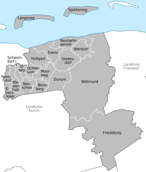
List of municipalities in the district of Wittmund
The list of municipalities in the district of Wittmund gives an overview of the 19 smallest administrative units in the district . Two of the municipalities are cities . The district town of Wittmund is a medium- sized town , Esens is a small town . The district is the second smallest district in Lower Saxony and Germany after Lüchow-Dannenberg in terms of population.
The district was created in 1885 from the offices of Wittmund and Esens and the city of Esens. As a result of the district reform carried out in 1977, the district of Wittmund was dissolved and combined with the communities of Jever , Sande , Schortens , Wangerland and Wangerooge of the former district of Friesland to form the new greater district of Friesland. Wittmund became the county seat . Due to various constitutional complaints before the Lower Saxony State Court, the reorganization of the Friesland / Wittmund area was withdrawn on January 1, 1980 and the districts of Ammerland , Friesland and Wittmund were restored in their previous form. The current church structure was completed in 1980. The year in which they joined the municipality is noted for the suburbs of the municipalities.
description
The district can be further subdivided into two municipalities :
- Integrated municipality of Esens : with the town of Esens and the municipalities of Dunum , Holtgast , Moorweg , Neuharlingersiel , Stedesdorf and Werdum ;
- Integrated municipality Holtriem : with the municipalities Westerholt , Blomberg , Eversmeer , Nenndorf , Neuschoo , Ochtersum , Schweindorf and Utarp ;
The city of Wittmund and the communities Friedeburg , Langeoog and Spiekeroog are unitary communities.
The district has a total area of 656.68 km 2 . The largest area within the district has the city of Wittmund with 210.0 km 2 and the municipality of Friedeburg with 164.0 km 2 . This is followed by the municipality of Stedesdorf with 27.95 km 2 . Another four municipalities have an area larger than 20 km 2 , including the city of Esens . Nine municipalities have an area of over 10 km 2 and three municipalities are smaller than 10 km 2 . These three smallest municipalities are Nenndorf with 6.86 km 2 , Utarp with 6.37 km 2 and Schweindorf with 5.44 km 2 .
The largest share in the population of the district of 56,926 inhabitants have the district town Wittmund with 20,313 inhabitants, the community Friedeburg with 10,154 inhabitants and the city Esens with 7,271 inhabitants. One municipality has over 2,000 inhabitants, seven have over and eight have less than 1,000 inhabitants. The three smallest municipalities in terms of population are Nenndorf with 754 inhabitants, Schweindorf with 716 and Utarp with 673 inhabitants.
The entire district of Wittmund has a population density of 87 inhabitants per km 2 . The largest population density within the district has the city of Esens with 271 inhabitants per km 2 , followed by the municipalities Westerholt with 176 and Schweindorf with 132. Another three municipalities have a population density of over 100. Of the remaining thirteen municipalities with fewer than 100 inhabitants per Two km 2 , including the city of Wittmund , have a higher population density than the district average of 87. The most sparsely populated municipalities are the island municipality of Spiekeroog with 44, as well as the municipalities of Dunum with 40 and Werdum with 40 inhabitants per km 2 .
Legend
- Municipality : Name of the municipality or city
- Subsites : Enumerated are the formerly independent municipalities of the administrative unit. The year of incorporation is also given
- Joint congregation : Shows the affiliation to one of the joint congregations
- Coat of arms : coat of arms of the municipality or city
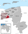
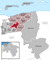
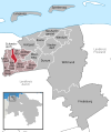
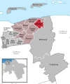
- Map : Shows the location of the municipality or city in the district
- Area : Area of the city or municipality, given in square kilometers
- Population : number of people living in the municipality or city (as of December 31, 2019)
- Population density : The population density is given, calculated on the area of the administrative unit, given in population per km 2 (as of December 31, 2019)
- Altitude : Altitude of the eponymous town or town in meters above sea level
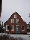
- Image : Image from the respective municipality or city
Communities
| local community | Sub-locations | Joint municipality | coat of arms | map | surface | Residents | EW density |
height | image |
|---|---|---|---|---|---|---|---|---|---|
| Wittmund district |  |
 |
656.68 | 56,926 | 87 |

|
|||
| Blomberg |
Blomberg South Moor |
Holtriem |  |
 |
12.8 | 1,859 | 145 | 7th |

|
| Dunum |
Dunum Brill |
Esens | 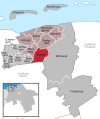 |
26.83 | 1,086 | 40 | 0 |

|
|
| Esens (city) |
Esens Bensersiel (1972) Death (1972) |
Esens |  |
 |
26.83 | 7,271 | 271 | 3 |

|
| Eversmeer | Eversmeer | Holtriem |  |
 |
11.56 | 841 | 73 | 8th |

|
| Friedeburg |
Friedeburg Abickhafe (1972) Bentstreek (1972) Dose (1972) Etzel (1972) Hesel (1972) Hoheesche (1972) Horsten (1972) Marx (1972) Reepsholt (1972) Wiesede (1972) Wiesedermeer (1972) (The municipalities of Abickhafe, Dose, Hoheesche and Reepsholt formed a community of Reepsholt a few months before incorporation into Friedeburg, which was then incorporated into Friedeburg) |
 |
 |
164.0 | 10.154 | 62 | 3 |

|
|
| Holtgast |
Holtgast Damsum (1972) Fulkum (1972) Utgast (1972) |
Esens |  |
24.0 | 1,782 | 74 | 2 |

|
|
| Langeoog | Langeoog |  |
 |
19.67 | 1,817 | 92 | 5 |
 
|
|
| Moor path |
Moorweg (merger of the districts Altgaude, Klosterschoo , Neugaude, Wagnersfehn and Westerschoo in 1972) |
Esens |  |
 |
18.65 | 858 | 46 | 2 | |
| Nenndorf | Nenndorf | Holtriem |  |
 |
6.86 | 754 | 110 | 6th | |
| Neuharlingersiel |
Neuharlingersiel Altharlingersiel (1972) Ostbense (1972) Seriem (1968) |
Esens |  |
 |
24.55 | 973 | 40 | 1 |

|
| Neuschoo | Neuschoo | Holtriem |  |
 |
14.47 | 1,171 | 81 | 6th |

|
| Ochtersum |
East Affiliate West Affiliate Barkholt |
Holtriem |  |
 |
10.82 | 882 | 82 | 5 |

|
| Schweindorf | Schweindorf | Holtriem |  |
 |
5.44 | 716 | 132 | 5 |

|
| Spiekeroog | Spiekeroog |  |
 |
18.25 | 809 | 44 | 3 |
 
|
|
| Stedesdorf |
Stedesdorf Mamburg (1972) Osteraccum (1972) Thunum (1972) |
Esens |  |
 |
27.95 | 1,639 | 59 | 0 |

|
| Utarp | Utarp | Holtriem |  |
 |
6.37 | 673 | 106 | 2 | |
| Become | Become | Esens |  |
 |
18.45 | 746 | 40 | 2 |

|
| Westerholt | Westerholt | Holtriem |  |
 |
14.63 | 2,582 | 176 | 3 |

|
| Wittmund (district town) |
Wittmund Ardorf (1972) Asel (1972) Berdum (1972) Blersum (1972) Burhafe (1972) Buttforde (1972) Carolinensiel (1972) Eggelingen (1972) Funnix (1972) Hovel (1972) Leerhafe (1972) Uttel (1972) Willen (1972) |
 |
 |
210.0 | 20,313 | 97 | 4th |
|
Former parishes
See: Former municipalities of the Wittmund district
Individual evidence
- ^ Michael Rademacher: German administrative history from the unification of the empire in 1871 to the reunification in 1990. Wittmund district. (Online material for the dissertation, Osnabrück 2006).
- ↑ State Office for Statistics Lower Saxony, LSN-Online regional database, Table 12411: Update of the population, as of December 31, 2019 ( help ).
- ↑ State Office for Statistics Lower Saxony, LSN-Online regional database, Table 12411: Update of the population, as of December 31, 2019 ( help ).
