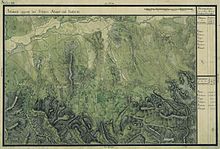
Prigor
|
Prigor Briger Nérahalmos |
||||
|
||||
| Basic data | ||||
|---|---|---|---|---|
| State : |
|
|||
| Historical region : | Banat | |||
| Circle : | Caraș-Severin | |||
| Coordinates : | 44 ° 56 ' N , 22 ° 7' E | |||
| Time zone : | EET ( UTC +2) | |||
| Area : | 301.63 km² | |||
| Residents : | 2,987 (2014) | |||
| Population density : | 10 inhabitants per km² | |||
| Postal code : | 327305 | |||
| Telephone code : | (+40) 02 55 | |||
| License plate : | CS | |||
| Structure and administration (as of 2016) | ||||
| Community type : | local community | |||
| Structure : | Prigor, Borlovenii Noi , Borlovenii Vechi , Pătaș and Putna | |||
| Mayor : | Antonică Moț ( M10 ) | |||
| Postal address : | Str. Principală, no. 323 loc. Prigor, jud. Caraș-Severin, RO-327305 |
|||
| Website : | ||||
Prigor (German: Briger , Hungarian: Nérahalmos ) is a municipality in the Caraş-Severin district , in the Banat region , in southwest Romania . The villages of Borlovenii Noi , Borlovenii Vechi , Pătaș and Putna also belong to the Prigor municipality .
Geographical location
Prigor is located in the Almăj Depression, in the Caraş-Severin County, at the foot of the Semenic Mountains in the north and the Almăj Mountains in the south.
Neighboring places
| Pătaș | Borlovenii Vechi | Șumița |
| Prilipeț |

|
Putna |
| Bănia | Eftimie Murgu | Almăj Mountains |
history
A first documentary mention comes from the year 1550. In the records of the historian Marsigli from 1690 to 1700 Prigor belongs to the Almăj district.
On the Josephine land survey of 1717 Prigor is registered with 50 houses. After the Peace of Passarowitz (1718) the village was part of the Habsburg crown domain Temescher Banat . Briger is inhabited on the Mercy map from 1723 .
After the establishment of the Banat military border from 1773, the 3rd Company of the Wallachian-Illyrian Border Regiment No. 13 had its headquarters in Prigor. In 1871 the military administration was dissolved and the Hungarian county administration was introduced. The official place name is changed to Nerahalmos .
The Treaty of Trianon on June 4, 1920 resulted in the Banat being divided into three , whereby Prigor fell to the Kingdom of Romania .
Population development
| census | Ethnicity | |||||||
|---|---|---|---|---|---|---|---|---|
| year | Residents | Romanians | Hungary | German | Other | |||
| 1880 | 4821 | 4772 | 2 | 16 | 31 | |||
| 1910 | 5232 | 5047 | 66 | 15th | 104 | |||
| 1930 | 4594 | 4369 | 14th | 12 | 199 | |||
| 1977 | 3963 | 3907 | 3 | - | 53 | |||
| 2002 | 2978 | 2899 | 2 | 1 | 76 | |||
Web links
- Dumitru Popovici: Timeline of the village of Prigor at.wordpress.com (Romanian)
- Prigor at ghidulprimariilor.ro
- Web presentation of the municipality of Prigor at home.ro
Individual evidence
- ↑ Mayoral elections 2016 in Romania ( MS Excel ; 256 kB)
- ↑ a b c almajana.wordpress.com , Prigor
- ↑ kia.hu (PDF; 858 kB), E. Varga: Statistics of the number of inhabitants by ethnicity in the Caraș-Severin district according to censuses from 1880 - 2002


