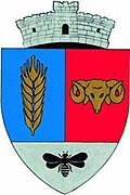
Măureni
|
Măureni Moritzfeld Móricföld |
||||
|
||||
| Basic data | ||||
|---|---|---|---|---|
| State : |
|
|||
| Historical region : | Banat | |||
| Circle : | Caraș-Severin | |||
| Coordinates : | 45 ° 24 ' N , 21 ° 30' E | |||
| Time zone : | EET ( UTC +2) | |||
| Area : | 88.30 km² | |||
| Residents : | 2,646 (October 20, 2011) | |||
| Population density : | 30 inhabitants per km² | |||
| Postal code : | 327065 | |||
| Telephone code : | (+40) 02 55 | |||
| License plate : | CS | |||
| Structure and administration (as of 2016) | ||||
| Community type : | local community | |||
| Structure : | Măureni, Șoșdea | |||
| Mayor : | Filimon Brian ( PNL ) | |||
| Postal address : | Str. Principală, no. 371 loc. Măureni, jud. Caraș-Severin, RO-327265 |
|||
| Website : | ||||
Măureni (formerly Morițfeld , German Moritzfeld , Hungarian Móricföld , until 1894 Moritzfeld ) is a Romanian municipality. It is located in the Caraș-Severin district in the historical Banat region .
The community consists of the two villages Măureni ( Moritzfeld ) and Șoșdea ( Waldau ).
Geographical location
Măureni is located in the northeast of the Caraș-Severin County, close to the border with the Timiș County .
Neighboring places
| Gătaia | Șoșdea | Gherteniș |
| Sângeorge |

|
Berzovia |
| Șemlacu Mare | Ferendia | Tyrol |
history
The place had already existed as a small settlement for some time when significant development occurred in 1784. At that time, 200 new houses were built for a group of German settlers who settled here by order of the Austrian government. In the same year the first 30 families arrived in Moritzfeld and in the following years a total of 172 more German families settled there.
In 1786 the municipality achieved its administrative independence for the first time; in the same year the construction of the catholic church, which was consecrated in 1819, began.
Another important step took place in 1872/1873 when the Voiteg - Gătaia -Măureni- Reșița railway was built as a result of an agreement with the affected communities .
However, the development of the village suffered a severe setback when 100 houses were destroyed in a fire on June 12, 1875.
After the Austro-Hungarian Compromise (1867), the Banat was annexed to the Kingdom of Hungary within the dual monarchy of Austria-Hungary .
At the beginning of the 20th century the law for the Magyarization of place names (Ga. 4/1898) was implemented. The official place name was Móricföld . The Hungarian place names remained valid in the Kingdom of Romania until the administrative reform of 1923 when the Romanian place names were introduced.
The Treaty of Trianon on June 4, 1920 resulted in the triple division of the Banat , whereby Măureni fell to the Kingdom of Romania .
Măureni has remained a small community with a purely rural economy to this day. However, both a food and a textile factory have set up there in recent years, the latter being supported by Italian entrepreneurs.
Demographics
| census | Ethnicity | |||||||
|---|---|---|---|---|---|---|---|---|
| year | Residents | Romanians | Hungary | German | Other | |||
| 1880 | 3222 | 901 | 121 | 2102 | 98 | |||
| 1910 | 4260 | 1173 | 461 | 2608 | 18th | |||
| 1930 | 3800 | 1410 | 89 | 2273 | 28 | |||
| 1977 | 3087 | 2017 | 63 | 979 | 28 | |||
| 2002 | 2647 | 2521 | 41 | 66 | 19th | |||
Sons and daughters
- Augustin Pacha (1870–1954), former Roman Catholic bishop of the Timișoara diocese
- Stefan Pacha (1859-1924), Abbot Pastor of Timișoara - Fabric
literature
- Elke Hoffmann, Peter-Dietmar Leber and Walter Wolf : The Banat and the Banat Swabians. Volume 5. Cities and Villages , Media Group Universal Grafische Betriebe München GmbH, Munich, 2011, 670 pages, ISBN 3-922979-63-7 .
Web links
Individual evidence
- ↑ 2011 census in Romania ( MS Excel ; 1.3 MB)
- ↑ Mayoral elections 2016 in Romania ( MS Excel ; 256 kB)
- ^ Website of the community, accessed on September 2, 2009 ( Memento of March 28, 2010 in the Internet Archive )
- ^ Gerhard Seewann : History of the Germans in Hungary , Volume 2 1860 to 2006, Herder Institute, Marburg 2012
- ↑ kia.hu (PDF; 858 kB), E. Varga: Statistics of the number of inhabitants by ethnicity in the Caraș-Severin district according to censuses from 1880 - 2002


