
L'Aquila Province
| L'Aquila Province | |
|---|---|

|
 .svg) |
| State : | Italy |
| Region : | Abruzzo |
| Capital: | L'Aquila |
| Area : | 5,034.46 km² ( 11. ) |
| Residents : | 296,491 (Dec. 31, 2019) |
| Population density : | 58.9 inhabitants / km² |
| Number of municipalities: | 108 |
| License plate : | AQ |
| ISO-3166-2 identification : | IT-AQ |
| Website: | L'Aquila Province |
 |
|


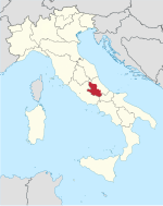
The province of L'Aquila ( Italian Provincia dell'Aquila ) is a province of the Italian region of Abruzzo . The capital of the province is L'Aquila , which is also the capital of the region. The province is the only one in Abruzzo that has no direct access to the sea.
Until the founding of the Kingdom of Italy in 1861, the province belonged to the Kingdom of Naples and is therefore still part of southern Italy today . In 1927 the western part of the province was given up to the newly founded province of Rieti .
geography
The province is determined by the high mountains of Abruzzo , which culminate in the Gran Sasso , whose highest point, the Corno Grande , is already in the province of Teramo . At 2914 m, the Corno Grande is the highest point in the Italian Apennines . The most important river is the Aterno . In the south lies the fertile plateau of the drained Fuciner See .
Besides L'Aquila, the main cities are Avezzano and Sulmona .
About three quarters of the Abruzzo, Latium and Molise National Park are in the province. The province also has a large share in the Gran Sasso and Monti della Laga National Park and the Majella National Park . This makes the province of L'Aquila the province with the highest proportion of protected areas in Italy. The Gran Sasso National Park (150,000 hectares) consists of two mountain ranges, the rugged Gran Sasso massif and the gentler Monti della Laga. The Gran Sasso, the "Great Rock of Italy" consists of a wild landscape, characterized by jagged peaks, ridges and vertically sloping walls. While the many peaks on the eastern side and the spectacular limestone walls rising steeply from the hills give the massif a high alpine aspect, the western side with the high plateau Campo Imperatore (approx. 1600 m altitude) is more reminiscent of the landscapes of Inner Mongolia , one for European eyes unusual impression of space and grandeur.
From this high plateau you can reach the eternal snow of the Calderone , the southernmost glacier in Europe. There is still a relatively large population of wolves and bears in the national parks .
geology
The area of the Italian Apennines is traversed by two plate boundaries. The province of L'Aquila was therefore frequently hit by earthquakes. The first recorded quake occurred on December 3, 1315. On February 2, 1703 , a quake claimed 2,400 victims. On July 31, 1786, the worst earthquake claimed over 6,000 deaths and completely destroyed the city. The city was also affected by earthquakes on January 13, 1915 and June 24, 1958. In the earthquake on April 6, 2009 , 295 people were killed. The provincial capital L'Aquila and the villages to the east of it were particularly affected.
Largest communities
(Population figures as of December 31, 2019)
| local community | Residents |
|---|---|
| L'Aquila | 69,710 |
| Avezzano | 42,276 |
| Sulmona | 23,326 |
| Celano | 10,764 |
| Pratola Peligna | 7425 |
| Tagliacozzo | 6607 |
| Castel di Sangro | 6707 |
| Trasacco | 6072 |
| Luco dei Marsi | 6102 |
| Carsoli | 5245 |
| Capistrello | 5038 |
Source: ISTAT
The list of municipalities in Abruzzo includes all municipalities in the province with population figures.
Web links
- www.lupus-italicus.de - Information about L'Aquila and the province.
- L'Aquila abruzzen-online.de ( Memento from December 21, 2011 in the Internet Archive ) - Page about the province of L'Aquila
Individual evidence
- ↑ Statistiche demografiche ISTAT. Monthly population statistics of the Istituto Nazionale di Statistica , as of December 31 of 2019.
Acciano | Aielli | Alfedena | Anversa degli Abruzzi | Ateleta | Avezzano | Balsorano | Beret | Barisciano | Barrea | Bisegna | Bugnara | Cagnano Amiterno | Calascio | Campo di Giove | Campotosto | Canistro | Cansano | Capestrano | Capistrello | Capitignano | Caporciano | Cappadocia | Carapelle Calvisio | Carsoli | Castel del Monte | Castel di Ieri | Castel di Sangro | Castellafiume | Castelvecchio Calvisio | Castelvecchio Subequo | Celano | Cerchio | Civita d'Antino | Civitella Alfedena | Civitella Roveto | Cocullo | Collarmele | Collelongo | Collepietro | Corfinio | Fagnano Alto | Fontecchio | Fossa | Gagliano Aterno | Gioia dei Marsi | Goriano Sicoli | Introdacqua | L'Aquila | Lecce nei Marsi | Luco dei Marsi | Lucoli | Magliano de 'Marsi | Massa d'Albe | Molina Aterno | Montereale | Morino | Navelli | Ocre | Ofena | Grandpa | Oricola | Ortona dei Marsi | Ortucchio | Ovindoli | Pacentro | Pereto | Pescasseroli | Pescina | Pescocostanzo | Pettorano sul Gizio | Pizzoli | Poggio Picenze | Prata d'Ansidonia | Pratola Peligna | Prezza | Raiano | Rivisondoli | Rocca Pia | Rocca di Botte | Rocca di Cambio | Rocca di Mezzo | Roccacasale | Roccaraso | San Benedetto dei Marsi | San Benedetto in Perillis | San Demetrio ne 'Vestini | San Pio delle Camere | San Vincenzo Valle Roveto | Sant'Eusanio Forconese | Sante Marie | Santo Stefano di Sessanio | Scanno | Scontrone | Scoppito | Scurcola Marsicana | Secinaro | Sulmona | Tagliacozzo | Tione degli Abruzzi | Tornimparte | Trasacco | Villa Sant'Angelo | Villa Santa Lucia degli Abruzzi | Villalago | Villavallelonga | Villetta Barrea | Vittorito