
Rajshahi (Division)
|
রাজশাহী বিভাগ Rajshahi
|
|
|---|---|
  |
|
| Basic data | |
| Country | Bangladesh |
| Capital | Rajshahi |
| surface | 18,194 km² |
| Residents | 20,412,000 (2016) |
| density | 1122 inhabitants per km² |
| ISO 3166-2 | BD-E |
| Website | rajshahidiv.gov.bd (Bengali) |
Coordinates: 25 ° 0 ' N , 89 ° 0' E
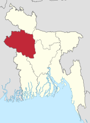
The Rajshahi division ( Bengali : রাজশাহী বিভাগ , Rājśāhī bibhāg ) is one of eight administrative units in Bangladesh , which are superordinate to the districts and are named after their largest city. The area covers 18,194 km². It is located in the northwest of the country. The division's population is around 20 million. The administrative capital is Rajshahi .
The Rajshahi division borders the national administrative unit Rangpur to the north, Dhaka and Maimansingh to the east, Khulna to the south and the Indian state of West Bengal to the west .

The administrative unit consists of 8 districts: Bogra , Jaipurhat , Lalmonirhat , Naogaon , Natore , Nawabganj , Pabna , Rajshahi and Sirajganj .
Until January 25, 2010, the districts of Dinajpur , Gaibandha , Kurigram , Nilphamari , Panchagarh , Rangpur and Thakurgaon also belonged to the Rajshahi division. These then formed the newly created Rangpur Division .
Population development
| year | population |
|---|---|
| 1991 census | 14.212.065 |
| 2001 census | 16,354,723 |
| 2011 census | 18,484,858 |
| 2016 estimate | 20,412,000 |
Web links
| Barishal |
Barguna • Barishal • Bhola • Jhalokathi • Patuakhali • Pirojpur |
|
| Chittagong |
Bandarban • Brahmanbaria • Chandpur • Chittagong • Cox's Bazaar • Feni • Khagrachhari • Kumilla • Lakshmipur • Noakhali • Rangamati |
|
| Dhaka |
Dhaka • Faridpur • Gazipur • Gopalganj • Kishoreganj • Madaripur • Manikganj • Munsiganj • Narayanganj • Narsingdi • Rajbari • Shariatpur • Tangail |
|
| Khulna |
Bagerhat • Chuadanga • Jessore • Jhinaidah • Khulna • Kushtia • Magura • Meherpur • Narail • Satkhira |
|
| Maimansingh |
Jamalpur • Maimansingh • Netrakona • Sherpur |
|
| Rajshahi |
Bogra • Jaipurhat • Naogaon • Natore • Nawabganj • Pabna • Rajshahi • Sirajganj |
|
| Rangpur |
Dinajpur • Gaibandha • Kurigram • Lalmonirhat • Nilphamari • Panchagarh • Rangpur • Thakurgaon |
|
| Sylhet |
Habiganj • Moulvibazar • Sunamganj • Sylhet |