Sembadel
| Sembadel | ||
|---|---|---|
|
|
||
| region | Auvergne-Rhône-Alpes | |
| Department | Haute Loire | |
| Arrondissement | Brioude | |
| Canton | Plateau du Haut-Velay granitique | |
| Community association | Puy-en-Velay | |
| Coordinates | 45 ° 17 ′ N , 3 ° 41 ′ E | |
| height | 849-1,128 m | |
| surface | 18.59 km 2 | |
| Residents | 229 (January 1, 2017) | |
| Population density | 12 inhabitants / km 2 | |
| Post Code | 43160 | |
| INSEE code | 43237 | |
Sembadel is a commune with 229 inhabitants (as of January 1 2017) in the department of Haute-Loire in the region Auvergne Rhône-Alpes (before 2016 Auvergne ). It belongs to the Arrondissement of Brioude and the canton of Plateau du Haut-Velay granitique ( La Chaise-Dieu until 2015 ). The inhabitants are called Sembadelois .
geography
Sembadel is located about 36 kilometers north-northwest of Le Puy-en-Velay in the natural landscape of Emblavès (also spelled Emblavez ). The neighboring communities of Sembadel are La Chaise-Dieu in the north, Bonneval in the northeast, Félines in the east, Monlet in the south and southeast, Saint-Pal-de-Senouire in the west and southwest and Connangles in the west and northwest.
Population development
| year | 1962 | 1968 | 1975 | 1982 | 1990 | 1999 | 2006 | 2011 | 2016 |
| Residents | 524 | 422 | 328 | 263 | 238 | 250 | 250 | 244 | 230 |
| Source: Cassini and INSEE | |||||||||
Attractions
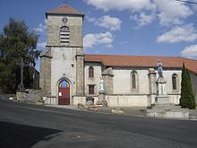
- church
- Notre-Dame-de-la-Forêt chapel
- Rotunda at the Sembadel train station
Personalities
- Yves Ramousse (* 1928), former Apostolic Vicar of Phnom-Penh
Web links
Commons : Sembadel - collection of images, videos and audio files

