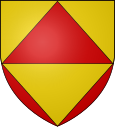
Soula
| Soula | ||
|---|---|---|

|
|
|
| region | Occitania | |
| Department | Ariège | |
| Arrondissement | Foix | |
| Canton | Pays d'Olmes | |
| Community association | Communauté d'agglomération Pays Foix-Varilhes | |
| Coordinates | 42 ° 47 ' N , 1 ° 42' E | |
| height | 480-1,014 m | |
| surface | 11.16 km 2 | |
| Residents | 177 (January 1, 2017) | |
| Population density | 16 inhabitants / km 2 | |
| Post Code | 09000 | |
| INSEE code | 09300 | |
 The Pyrenean village of Soula |
||
Soula is a French commune with 177 inhabitants (as of January 1, 2017) in the Ariège department in the Occitanie region . It belongs to the canton of Pays d'Olmes and the Arrondissement Foix .
location
The highest point in the municipality is the peak of the Pic de l'Aspre at 1014 meters above sea level. Neighboring communities are Pradières in the north-west, L'Herm in the north, Leychert in the east, Celles in the south, Saint-Paul-de-Jarrat in the south-west and Montgaillard in the west.
Population development
| year | 1962 | 1968 | 1975 | 1982 | 1990 | 1999 | 2008 | 2015 |
|---|---|---|---|---|---|---|---|---|
| Residents | 122 | 100 | 96 | 100 | 153 | 159 | 210 | 189 |
| Sources: Cassini and INSEE | ||||||||
Web links
Commons : Soula - collection of images, videos and audio files

