Montoulieu (Ariège)
| Montoulieu | ||
|---|---|---|
|
|
||
| region | Occitania | |
| Department | Ariège | |
| Arrondissement | Foix | |
| Canton | Sabartès | |
| Community association | Communauté d'agglomération Pays Foix-Varilhes | |
| Coordinates | 42 ° 55 ' N , 1 ° 38' E | |
| height | 428-1,488 m | |
| surface | 14.12 km 2 | |
| Residents | 410 (January 1, 2017) | |
| Population density | 29 inhabitants / km 2 | |
| Post Code | 09000 | |
| INSEE code | 09210 | |
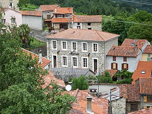
 The Mairie of Montoulieu |
||
Montoulieu is a French commune with 410 inhabitants (as of January 1, 2017) in the Ariège department in the Occitanie region . It belongs to the canton of Sabarthès and the Arrondissement Foix .
It borders in the north on Prayols , in the north-east on Montgaillard (point of contact) and Saint-Paul-de-Jarrat , in the south-east on Mercus-Garrabet , in the south on Arignac , in the south-west on Bédeilhac-et-Aynat , in the west on Saurat and in Northwest at Ganac .
Population development
| year | 1962 | 1968 | 1975 | 1982 | 1990 | 1999 | 2008 | 2016 |
|---|---|---|---|---|---|---|---|---|
| Residents | 239 | 398 | 202 | 220 | 278 | 305 | 364 | 409 |
| Sources: Cassini and INSEE | ||||||||
The Pyrenees village of Montoulieu
Pont du Diable, Monument historique
Web links
Commons : Montoulieu - collection of images, videos and audio files


