
Çorum (Province)
| Çorum | |
|---|---|
| Province number: | 19th |
  |
|
| Counties | |
 |
|
| Basic data | |
| Coordinates: | 40 ° 34 ′ N , 34 ° 40 ′ E |
| Provincial capital: | Çorum |
| Region: | Black Sea Region |
| Surface: | 12,428 km² |
| Population: | 536,483 (2018) |
| Population density: | 43 inhabitants / km² |
| Political | |
| Governor: | Mustafa Çİftçİ |
| Seats in Parliament: | 4th |
| Structural | |
| Telephone code: | 0364 |
| Features : | 19th |
| Website | |
| www.corum.gov.tr (Turkish) | |
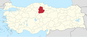
Çorum is a province of Turkey . Its capital is the Çorum of the same name . It borders - starting in the north in a clockwise direction - on the following provinces: Sinop , Samsun , Amasya , Yozgat , Kırıkkale , Çankırı and Kastamonu . The province is in 20th place in order of area (2014: 1.6% of the country's area) and in 41st place in order of population (2018: 0.65% of the country's population)
population
Results of the population extrapolation
The following table shows the annual population development at the end of the year after updating by the addressable population register (ADNKS) introduced in 2007. In addition, the population growth rate and the sex ratio (ie number of women per 1000 men) are listed. The 2011 census found 534,825 inhabitants, over 62,000 fewer than in the 2000 census.
| year | Population at the end of the year | Population growth rate (in%) |
Gender ratio (women per 1000 men) |
Rank (among 81 provinces) |
||
|---|---|---|---|---|---|---|
| total | male | Female | ||||
| 2018 | 536.483 | 265,678 | 270,805 | 1.53 | 1019 | 41 |
| 2017 | 528.422 | 261,605 | 266.817 | 0.11 | 1020 | 41 |
| 2016 | 527.863 | 261,606 | 266.257 | 0.51 | 1018 | 40 |
| 2015 | 525.180 | 259.993 | 265.187 | −0.39 | 1020 | 40 |
| 2014 | 527.220 | 261.187 | 266.033 | −0.91 | 1019 | 40 |
| 2013 | 532.080 | 263.906 | 268.174 | 0.40 | 1016 | 40 |
| 2012 | 529.975 | 262.155 | 267,820 | −0.86 | 1022 | 40 |
| 2011 | 534.578 | 265.163 | 269,415 | −0.15 | 1016 | 39 |
| 2010 | 535.405 | 264,759 | 270,646 | -0.98 | 1022 | 39 |
| 2009 | 540.704 | 268.501 | 272.203 | −0.87 | 1014 | 38 |
| 2008 | 545,444 | 270.107 | 275,337 | −0.80 | 1019 | 38 |
| 2007 | 549,828 | 271,942 | 277.886 | −7.91 | 1022 | 37 |
| 2000 1 | 597.065 | 311,897 | 285.168 | - | 914 | 38 |
1 2000 census
Administrative division
The province of Çorum is divided into fourteen districts :
| district | Area 1 (km²) |
Population (2018) 2 | Number of Units | Density (Ew / km²) |
urban share (in%) |
Gender ratio 3 |
Founding date 4.5 |
|||
|---|---|---|---|---|---|---|---|---|---|---|
| district | Administrative headquarters (Merkez) |
Municipalities (Belediye) |
District (Mahalle) |
Villages (Köy) |
||||||
| Alaca | 1,296 | 31,460 | 19,549 | 1 | 7th | 101 | 24.27 | 62.14 | 1008 | |
| Bayat | 717 | 16,525 | 6,021 | 1 | 5 | 39 | 23.05 | 36.44 | 1083 | 04/01/1958 |
| Boğazkale | 264 | 4.175 | 1,687 | 1 | 3 | 14th | 15.81 | 40.41 | 995 | 07/04/1987 |
| Dodurga | 229 | 6,368 | 2,701 | 1 | 6th | 12 | 27.81 | 42.42 | 1059 | May 20, 1990 |
| İskilip | 1,170 | 32,546 | 18,010 | 1 | 14th | 64 | 27.82 | 55.34 | 1026 | |
| Kargı | 1,174 | 15,684 | 5,355 | 1 | 6th | 58 | 13.36 | 34.14 | 1071 | 06/15/1936 |
| Laçin | 196 | 4,770 | 1,361 | 1 | 3 | 14th | 24.34 | 28.53 | 964 | May 20, 1990 |
| Mecitözü | 825 | 15,655 | 4,285 | 1 | 8th | 54 | 18.98 | 27.37 | 997 | |
| Merkez | 2,436 | 294,807 | 263,895 | 2 | 23 | 198 | 121.02 | 90.08 | 1015 | |
| Oğuzlar | 121 | 5,483 | 2,956 | 1 | 7th | 6th | 45.31 | 53.91 | 1061 | May 20, 1990 |
| Ortakoy | 300 | 8,696 | 2,984 | 2 | 5 | 14th | 28.99 | 63.20 | 988 | 04/01/1959 |
| Osmancık | 1,273 | 42,980 | 28,216 | 1 | 18th | 55 | 33.76 | 65.65 | 1025 | |
| Sungurlu | 1999 | 49,082 | 31,149 | 1 | 16 | 109 | 24.55 | 63.46 | 1029 | |
| Uğurludağ | 428 | 8,252 | 3,835 | 1 | 5 | 20th | 19.28 | 46.47 | 952 | 07/04/1987 |
| PROVINCE Çorum | 12,428 | 536.483 | 16 | 126 | 758 | 43.17 | 73.85 | 1019 | ||
swell
Population of the counties
The values up to 1960 are taken from e-books (from the original documents), the values from 1965 onwards come from the data query of the Turkish statistical institute TÜIK - available on this website:
| Census results | ||||||||||||||||||
|---|---|---|---|---|---|---|---|---|---|---|---|---|---|---|---|---|---|---|
| Counties | 1927 | 1935 | 1940 | 1945 | 1950 | 1955 | 1960 | 1965 | 1970 | 1975 | 1980 | 1985 | 1990 | 2000 | ||||
| Corum | 60,869 | 67,639 | 72,035 | 73,403 | 88.056 | 103,749 | 118,536 | 130,513 | 144,569 | 156,592 | 168.985 | 187,462 | 186.377 | 221,699 | ||||
| Alaca | 26,926 | 35,435 | 37,592 | 40.001 | 46,444 | 51,534 | 54,315 | 58,089 | 56,657 | 55,926 | 56,724 | 57,544 | 54,814 | 53,193 | ||||
| Bayat | - | - | - | - | - | - | 22,836 | 25,258 | 27,078 | 28,932 | 31,957 | 31,916 | 35,010 | 30,574 | ||||
| Boğazkale | - | - | - | - | - | - | - | - | - | - | - | - | 10,425 | 8,190 | ||||
| Dodurga | - | - | - | - | - | - | - | - | - | - | - | - | 13,550 | 10,439 | ||||
| Iskilip | 53,763 | 63.004 | 65,780 | 66,145 | 66,611 | 71,478 | 55,618 | 60,031 | 67,434 | 72.173 | 72,569 | 76,344 | 51,877 | 45,327 | ||||
| Kargı | 28,241 | 31,564 | 32,816 | 32,261 | 31,554 | 31,247 | 29,689 | 26,762 | 20,388 | |||||||||
| Laçin | - | - | - | - | - | - | - | - | - | - | - | - | 12,584 | 9,425 | ||||
| Mecitözü | 36,691 | 39,426 | 43,196 | 45,844 | 44,319 | 40,572 | 34,598 | 36,999 | 35,496 | 35,423 | 34,911 | 35,309 | 32,059 | 26,064 | ||||
| Oğuzlar | - | - | - | - | - | - | - | - | - | - | - | - | 11,846 | 9,083 | ||||
| Ortakoy | - | - | - | - | - | - | 9,580 | 9,908 | 11,016 | 11,836 | 12,420 | 12,852 | 13,073 | 11,820 | ||||
| Osmancik | 29,199 | 32,644 | 33,129 | 34,628 | 33,494 | 37,748 | 42,960 | 48,915 | 53,849 | 59,576 | 63,018 | 64,937 | 52,490 | 53,758 | ||||
| Sungurlu | 40,478 | 48,603 | 51.013 | 52,702 | 62,429 | 68,225 | 76,382 | 83,038 | 90.006 | 95,568 | 100,000 | 103.151 | 81,665 | 80,840 | ||||
| Uğurludağ | - | - | - | - | - | - | - | - | - | - | - | - | 27,331 | 16,265 | ||||
| Total province | 247.926 | 286.751 | 302.745 | 312,723 | 341.353 | 401,547 | 446.389 | 485,567 | 518.366 | 547.580 | 571.831 | 599.204 | 609,863 | 597.065 | ||||
The population figures are only shown from the date on which the district ( İlçe ) became independent.
history

- 5000-3000 BC Chr .: The first human settlements in the area of Çorum were founded about 7000 years ago. After excavations in Alacahöyük , Balımsultan, Büyük Güllücek, Boğazkale, Eskiyapar , Hüseyindede and Kuşsaray, this region was technically and culturally well developed due to the nearby raw material deposits.
- 3000-1000 BC Chr .: During the Bronze Age, Çorum was the scene of many cities being founded. Around 2000 BC Çorum belonged to a principality of the Hattier .
- 1950-1850 BC At this time there were trade colonies ( Karum ) of the Assyrians in this area , from which the first written reports come.
- before 1500–1200 BC Chr .: The Hittites have the center of their empire in Hattuša , near the present day Boğazkale .
- After the sea peoples storm and the indirectly related fall of the Hittite empire, the area belongs to the empires of the Phrygians and later the Medes , only to merge into the Persian empire and then the empire of Alexander .
- After the battles of the Diadochs , the area becomes part of the Kingdom of Cappadocia , which later becomes part of the Roman and then the Byzantine Empire.
- 1075: Conquest by the Oghusian Turks and incorporation into the principality of the Danischmenden (Danişmend Beyliği).
- 1276: Victory over the Mongols under the leadership of Emir Celalettin.
- 14th century: incorporation into the Ottoman Empire .
- 1923: Çorum becomes a province of the Republic of Turkey.
- 1980: Turkish right-wing extremists kill around 57 members of the Alevi minority in the Çorum pogrom .
Attractions
Attractions in the province include:
The Boğazköy-Alacahöyük National Park , the thermal baths of Figanı (Beke), the barrows of Balımsultan, Büyük Güllicek, Kuşsaray, Güzelcedere, Pazarlı (the village of Çikhasan), Eskiyapar and Kalınkaya, the castles of Çorum , Kalaleğ, the castles of Çorum , Kalaleet Iskilip and Osmancık (Kundıber), the settlement ruins of Melik Gazi, Kalehisar and Gerdekkaya, the rock tombs of Iskilip Bayat and Kızılcapelit, the Great Mosque (Ulu Cami) of Çorum, the mosques of Hamid, Han, Şeyhiddin, Tab Yavsi, Şeyhiddin-i Mihri Hatun, Oğuzköy and Koca Mehmed Pasha (Imaret), the Great Mosque, the Sinan Pasha Complex, the Medresses of Alaca Hüseyin Gazi and Akşemseddin, the Koyun Baba Bridge, the bathhouses of Güpür Pasha, Ali Pashauro, Koca Mehmunged Pascha , the museums of Çorum, Alacahöyük and Boğazkale (Boğazköy).
Ruin sites
The most important and earliest settlement sites include Alacahöyük and the capital of the Hethither Hattuša , today Boğazkale (formerly Boğazköy) with the rock sanctuary of Yazılıkaya . There are impressive ruins and a small museum at both locations. The Hittite city of Šapinuwa near Ortaköy is also worth seeing .
Important days
Folk festivals
- The Kargı Folk Festival between October 31st and November 6th
Festival
- The International Hittite Festival in the city of Çorum on July 15th
- Osmancık rice festival in Osmancık between November 1st and 10th
- Mecitözü sunflower festival in Mecitözü in the last week of September
Celebrations
- The Hıdrellez celebration in Osmancık between May 6th and 8th
- The traditional autumn wrestling matches and music celebration in İskilip in the first week of September
- Wrestling match and celebration in Sungurlu in autumn
- Wrestling match in the village of Berk in Dodurga County in October
Personalities
- Matthaios Kofidis , Ottoman MP of Pontus Greek origin
- İbrahim Kaypakkaya , revolutionary, founder of TKP / ML
- İsmail Beşikçi , Turkish sociologist and writer
- Aşık Gülabi , Turkish singer
Web links
- Yerelnet Çorum
- Çorum City Council website
- Website of the newspaper Çorum Haber
- Web portal of the city of Çorum
Individual evidence
- ↑ Türkiye Nüfusu İl ve İlçelere Göre Nüfus Bilgileri , accessed on June 1, 2019
- ^ Website of the province of Çorum
- ↑ Directorate General of Mapping Area 2014 (PDF file) 0.25 MB
- ↑ Türkiye'nin En Kalabalık İlleri 2018 , accessed on June 1, 2018
- ↑ Directorate General of Mapping İl ve İlçe Yüzölçümleri (PDF; 0.25 MB).
- ↑ Türkiye Nüfusu İl İlçe Mahalle Köy Nüfusu , accessed on June 1, 2019.
- ↑ illeridaresi.gov.tr (PDF; 1.4 MB).
- ↑ Genel Nüfus Sayımları (census results 1965 to 2000).
Adana | Adıyaman | Afyonkarahisar | Ağrı | Aksaray | Amasya | Ankara | Antalya | Ardahan | Artvin | Aydın | Balıkesir | Bartın | Batman | Bayburt | Bilecik | Bing oil | Bitlis | Bolu | Burdur | Bursa | Çanakkale | Çankırı | Çorum | Denizli | Diyarbakır | Düzce | Edirne | Elazığ | Erzincan | Erzurum | Eskişehir | Gaziantep | Giresun | Gümüşhane | Hakkâri | Hatay | Iğdır | Isparta | İstanbul | İzmir | Kahramanmaraş | Karabük | Karaman | Kars | Kastamonu | Kayseri | Kırıkkale | Kırklareli | Kırşehir | Kilis | Kocaeli | Konya | Kutahya | Malatya | Manisa | Mardin | Mersin | Muğla | Muş | Nevşehir | Niğde | Ordu | Osmaniye | Rize | Sakarya | Samsun | Siirt | Sinop | Sivas | Şanlıurfa | Şırnak | Tekirdağ | Tokat | Trabzon | Tunceli | Usak | Van | Yalova | Yozgat | Zonguldak