
Aumont-en-Halatte
| Aumont-en-Halatte | ||
|---|---|---|
|
||
| region | Hauts-de-France | |
| Department | Oise | |
| Arrondissement | Senlis | |
| Canton | Senlis | |
| Community association | Senlis Sud Oise | |
| Coordinates | 49 ° 14 ' N , 2 ° 33' E | |
| height | 65-143 m | |
| surface | 6.83 km 2 | |
| Residents | 476 (January 1, 2017) | |
| Population density | 70 inhabitants / km 2 | |
| Post Code | 60300 | |
| INSEE code | 60028 | |
| Website | http://www.aumont-en-halatte.fr/ | |
,_mairie_et_calvaire,_1_rue_Henri-Dupriez.jpg) Town hall (Mairie) of Aumont-en-Halatte |
||

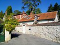
Aumont-en-Halatte is a French municipality with 476 inhabitants (as of January 1 2017) in the department of Oise in the region of Hauts-de-France . Aumont-en-Halatte belongs to the Arrondissement of Senlis and the Canton of Senlis . The inhabitants are called Aumontois .
geography
Aumont-en-Halatte is a small suburb northwest of Senlis in the Halatte forest. Aumont-en-Halatte is surrounded by the neighboring communities Verneuil-en-Halatte in the north and north-west, Senlis in the south and east, Courteuil in the south and south-west and Apremont in the west.
Population development
| 1962 | 1968 | 1975 | 1982 | 1990 | 1999 | 2006 | 2013 |
|---|---|---|---|---|---|---|---|
| 270 | 310 | 353 | 422 | 544 | 482 | 548 | 548 |
| Source: Cassini and INSEE | |||||||
Attractions
- Saint-Gervais-Saint-Protais church, today's building from the 15th / 16th centuries Century (see also: List of Monuments historiques in Aumont-en-Halatte )
- Villa Béatrice
- Museum Henri Barbusse, so-called Villa Sylvie
- Arthus Castle and Domain

Saint-Gervais-Saint-Protais church

Villa Béatrice
Henri Barbusse Museum (Villa Sylvie)

Arthus Castle
,_%C3%A9glise_Saint-Gervais-et-Protais,_depuis_le_sud-ouest.jpg)
,_villa_B%C3%A9atrice,_rue_Henri-Dupriez.jpg)
,_mus%C3%A9e_Henri-Barbusse_-_villa_Sylvie,_4_chemin_de_la_Gruerie.jpg)
,_ch%C3%A2teau_Arthus.jpg)
Personalities
- Henri Barbusse (1873–1935), writer (lived here for a long time)
Web links
Commons : Aumont-en-Halatte - collection of images, videos and audio files