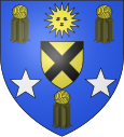
Neuilly-en-Thelle
| Neuilly-en-Thelle | ||
|---|---|---|

|
|
|
| region | Hauts-de-France | |
| Department | Oise | |
| Arrondissement | Senlis | |
| Canton | Méru | |
| Community association | Thelloise | |
| Coordinates | 49 ° 13 ′ N , 2 ° 17 ′ E | |
| height | 89-170 m | |
| surface | 15.73 km 2 | |
| Residents | 3,655 (January 1, 2017) | |
| Population density | 232 inhabitants / km 2 | |
| Post Code | 60530 | |
| INSEE code | 60450 | |
| Website | http://www.neuillyenthelle.fr/ | |
 Town hall of Neuilly-en-Thelle |
||
Neuilly-en-Thelle is a French municipality with 3655 inhabitants (as of January 1 2017) in the department of Oise in the region of Hauts-de-France . It belongs to the Arrondissement of Senlis and the canton of Méru . Neuilly-en-Thelle is a member of the Communauté de communes Thelloise .
geography
Neuilly-en-Thelle lies in the Thelle region . Neuilly-en-Thelle is surrounded by the neighboring communities Ully-Saint-Georges in the north, Cirres-lès-Mello and Ercuis in the north-east, Coury-en-Thelle in the east and south-east, Morangles in the south, Fresnoy-en-Thelle in the south and South-west, Puiseux-le-Hauberger in the west and south-west and Dieudonné in the west.
Population development
| 1962 | 1968 | 1975 | 1982 | 1990 | 1999 | 2006 | 2011 |
|---|---|---|---|---|---|---|---|
| 1,882 | 1,942 | 1,898 | 2,397 | 2,683 | 3,064 | 3,097 | 3,082 |
Attractions
See also: List of the Monuments historiques in Neuilly-en-Thelle
- Saint-Denis church from the 14th century ( Monument historique )
- Remains of the castle
Personalities
- Denise Scharley (1917-2011), mezzo-soprano
Web links
Commons : Neuilly-en-Thelle - Collection of images, videos and audio files


